
Rights-of-Way
A right of way authorizes specific use of parcels of public land for a specified period of time that is appropriate for the life of the project. The BLM has discretion to grant a ROW when doing so is in the public interest.
You need a ROW whenever you wish to build on public land or conduct any activity that would involve appreciable disturbance, alteration or damage to public lands.
The ROW grant sets rental fees that reflect the value of the authorized use(s).
Individuals and businesses may apply to obtain a right-of-way grant (ROW) to use specific pieces of public land for projects such as electric power or fiber optic lines, wind or solar energy generation, communications tower sites, roads or trails, canals, pipelines or reservoirs.
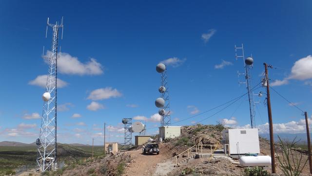
Linear ROW
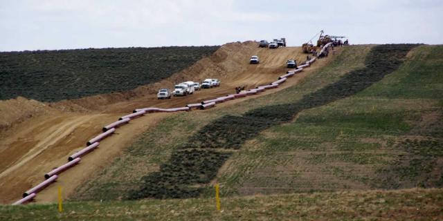
Pipelines and powerlines of all sizes are authorized in linear ROWs, some of which are designated corridors.
Rights-of-Way (ROW) Screening Tool
- Generate a comprehensive report based on a selected point, line, or polygon representing a proposed right‑of‑way (ROW) location. The tool applies a user‑defined distance buffer and returns key information such as existing BLM rights‑of‑way, infrastructure, power availability, and land suitability within the specified area.
- Customize the basemap to align with user preferences.
- Enhance the mapping experience by adding external data from ArcGIS Online, web services, or local files, including supported formats such as CSV, KML, zipped Shapefiles, File Geodatabases (FGDB), GPX, and GeoJSON.
- Query and filter available map layers to refine results.
- Perform elevation measurements and obtain terrain statistics.
- Conduct linear and area measurements directly within the map interface.
- Export and print PDF maps from the web application.
- Access additional information on the process for submitting a ROW application.
- Enables users to select map layers and view detailed pop‑up information describing each layer’s characteristics and its relevance to the Rights‑of‑Way process.