
Brownsville, Minnesota
This week's GLO Record travels to Brownsville Minnesota, the first town established in the Minnesota Territory and named after brothers Job and Charles Brown. As the first seat of Houston County, Brownsville became platted in 1854. Read more on ArcGIS Story Maps.
The GLO website provides live access to Federal land conveyance records for the Public Land States, including image access to more than 12 million federal land title records issued between 1788 and the present.
The site also hosts images of survey plats and field notes, land status records, and control document index records, and is one of the most visited websites in the Department of the Interior. Visit glorecords.blm.gov for more information.
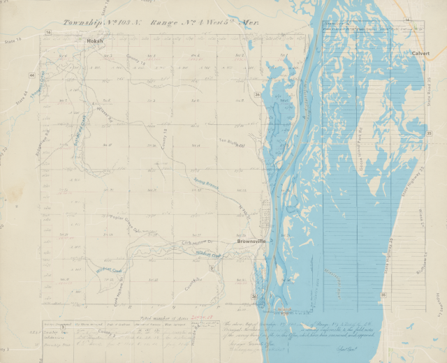
Original Survey Plat of Township 103 North Range 4 West
Related Stories
- BLM Northeastern States District Staff Connect Youth with Public Lands at Midwest Outdoor Heritage Education Expo
- Freedom and Liberty Bring the Spirit of the West to Northern Virginia
- BLM Launches a Modernized General Land Office Records System
- Framed for Freedom: Bureau of Land Management Eastern States and the Legacy of National Historic Trails
- Safety Week 2026: Building Skills, Confidence, and a Stronger Safety Culture
Office
5275 Leesburg Pike
Falls Church, VA 22041
United States