
Biscayne National Park
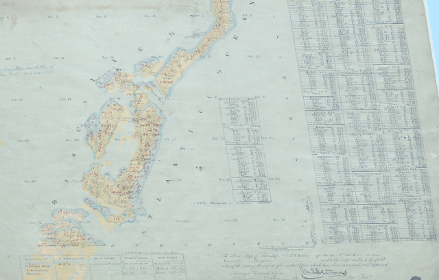
This week's interesting General Land Office record features a survey of an island plat that displays the Biscayne National Park area. The beautiful, clear, shallow water was home to indigenous people dating back at least 10,000 years and is currently a hot attraction to foreign and domestic tourism. Read more on ArcGIS Story Maps.
The GLO website provides live access to Federal land conveyance records for the Public Land States, including image access to more than 12 million federal land title records issued between 1788 and the present.
The site also hosts images of survey plats and field notes, land status records, and control document index records, and is one of the most visited websites in the Department of the Interior. Visit glorecords.blm.gov for more information.
Related Stories
- Planting for the Future: BLM Staff and Volunteers Rebuild the Jupiter Inlet Lighthouse Shoreline
- BLM Northeastern States District Staff Connect Youth with Public Lands at Midwest Outdoor Heritage Education Expo
- Freedom and Liberty Bring the Spirit of the West to Northern Virginia
- BLM Launches a Modernized General Land Office Records System
- Framed for Freedom: Bureau of Land Management Eastern States and the Legacy of National Historic Trails
Office
5275 Leesburg Pike
Falls Church, VA 22041
United States