
North Menan Butte Trail | Idaho
The Menan Buttes are extinct volcanoes formed by violent eruptions 10,000 years ago. These are unusual formations because they erupted through the cold waters of the Snake River which flowed where the Buttes stand today. When molten magma met the cold river water it cooled so quickly crystals were unable to form, and the lava solidified into glass called tachylite. The heat of the magma flashed the river water to steam, shattering the glass into tiny fragments that welded together as the hot ash settled to the ground. The Menan Buttes are unique because these are the only volcanic eruptions that occurred in freshwater in the United States, which is why North Menan Butte is designated a National Natural Landmark.
Facilities: Vault toilet, interpretive signs
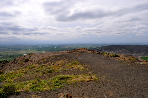
Length: 3.1 mile trail from parking area to the top, around the rim and back down (0.6 miles cutting through the bowl of the butte)
There are no day-use fees associated with this site.
Know before you go:
North Menan Butte is open to non-motorized recreation activities only. Help protect important vegetation and prevent erosion by minimizing impact to the area. Motorized vehicles have traveled up the butte in the past, creating scars that can be seen from the parking area. These scars will take a long time to rehabilitate naturally.
• Leave what you find so that others may share your sense of discovery.
• Be courteous and do not disturb wildlife.
• Trash? Pack it in. Pack it out.
• Before setting off on your journey, please consider the following safety concerns:
• Take plenty of water. This environment is hot and dry at certain times of the year.
• Watch your footing. Slippery and rocky surfaces are common in this area.
• Watch out for rattlesnakes.
Contact Us

