
Cedar Canyon Petroglyphs Interpretive Site | Wyoming
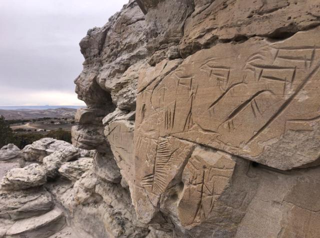
The Cedar Canyon Petroglyphs are dated back more than 200 years, with some of the petroglyphs unique to this location, including several panels that include depictions of plants and markings referred to as calendars. The surrounding landscape is known as the Red Desert, and is the traditional homeland of many Indigenous Nations who are known today as the Shoshone, Arapaho, Ute, Shoshone Bannock, Lakota, Cheyenne, and Crow tribes.
Visit with respect and DO NOT climb on, touch, chalk, or otherwise alter the petroglyph panels in any way.
Cedar Canyon is south of Fifteen-mile Knoll and southwest of Pine Canyon. Cedar Canyon has an elevation of 6,542 feet. The panels are a short uphill walk from the parking area. This is a fee-free site. Access is by remote routes and use of a high clearance, 4-wheel drive vehicle is recommended. Access road is not maintained and includes patches of loose sand. There is spotty cell service at the site.
BLM WYOMING KNOW BEFORE YOU GO
CEDAR CANYON PETROGLYPHS PHOTOS

Contact Us

Activities


Addresses
Geographic Coordinates
Directions
Take State Highway 191 north to mile marker 10. Go East on to County 4-17 16 miles to Cedar Canyon Access route and then east 5.2 miles to an unnamed route, 2.4 miles to an unnamed route. North 3 miles to the site. Call or visit the Rock Springs Field office for a map. Access is by remote routes and a high-clearance vehicle is recommended.
Fees
No Fee.