MILL CREEK CANYON WILDERNESS STUDY AREA
Values
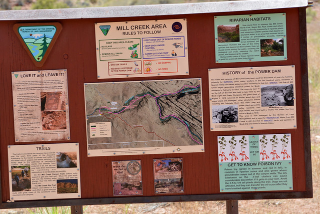
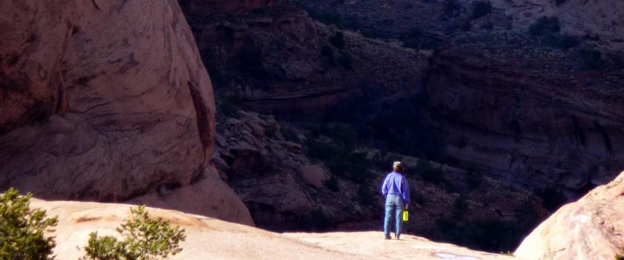
Major canyons within the WSA include the North Fork of Mill Creek, Rill Creek, and Burkholder Draw. Riparian vegetation follows the streams within the canyons. Above these canyons are pinyon-juniper/blackbrush vegetation and large expanses of Navajo sandstone domes and fins. The Mill Creek Canyon WSA is best know for its perennial streams, sheer canyon walls, large Navajo sandstone “fins” and wonderful hiking opportunities.
Visitation Information
Located just east of Moab, Utah. From Moab, the mouth of Mill Creek Canyon is accessible via Powerhouse Lane from the parking area adjacent to the remains of an old dam. The Sand Flats Road provides access to the upper portion of the WSA. The Steelbender 4WD trail starts near the Moab Golf Course and borders the the WSA for several miles.
Visitor Advisory
Visitors should come prepared for backcountry conditions and adequately prepare for their trip. Knowledge of weather, terrain, and physical conditions can help ensure safety.
Flickr Album