
Deep Creek Mountains WSA
Values
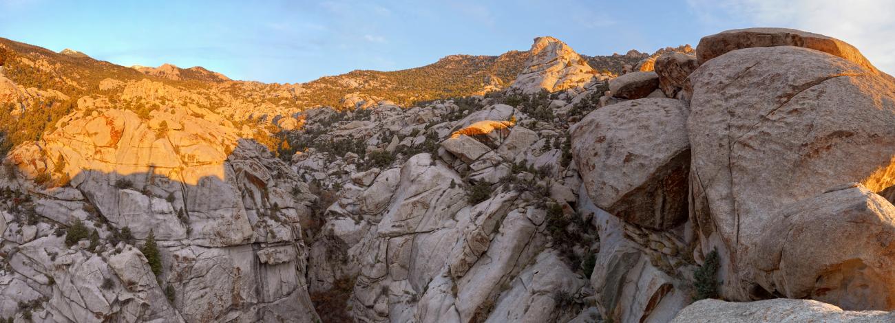
The fourth highest range in the Great Basin, the Deep Creek Mountains stand prominently in western Utah. Two 12,000 foot peaks rise 7,800 feet above the desert floor transitioning through sagebrush-grassland benches, pinyon-juniper forest, evergreen and aspen forests, and alpine meadows. The northern part of the range is sedimentary rock, the southern is sedimentary/metamorphic rock, and the middle is granite which is uncommon in mountain ranges in this region. The immense prominence of the range over the surrounding land captures moisture passing over, resulting in nine small perennial streams that twist through narrow canyons.
Alpine meadows, aspen groves, and stands of conifers are found at higher elevations. White fir, Douglass fir, Rocky Mountain juniper, birch, and cottonwood grow along streams in the canyons. Bristlecone pine grows at the highest elevations. Common animals include mule deer, elk, bighorn sheep, coyote, mountain lions and bobcat, along with a variety of birds of prey including golden eagles, turkey vultures, prairie falcons, great-horned owls, and long-eared owls. The Bonneville cutthroat trout (Utah’s state fish) inhabit two of the streams. Recreational opportunities include hiking, backpacking, mountain climbing, horseback riding, hunting, nature study, and photography. The Deep Creek Mountains and Scott’s Basin WSAs are contiguous and only separately named because they became WSAs at different times.
Visitation Information
From the Callao CCC camp, drive south on the Snake Valley Road south approximately 10 miles to the Granite Creek Canyon Road. Turn east and drive 4.3 miles to a gate (closed from December 1 to May 31). Climbing Ibapah Peak is accessed from here. The Callao CCC camp is remote. To access the Callao CCC camp, drive south from Wendover, UT on Alternate Highway 93 approximately 26 miles and turn east onto Ibapah Road; travel approximately 27 miles to the Lower Gold Hill Road and turn east (from here are only gravel roads); in approximately 6 miles, turn south onto the Pony Express-Overland Stage Road and drive approximately 10 miles to a T intersection; turn south and in approximately 4 miles, turn south onto the Snake Valley Road. Drive the Snake Valley Road approximately 4 miles to the Callao CCC camp.
Visitor Advisory
Access to the Deep Creek WSA is by way of gravel roads over long distances that are remote and without services of any kind. Access to the boundary of the WSA often requires 4WD vehicles. Many access routes are suitable for full-size vehicles but some are only suitable for ATVs, motorcycles, or side-by-sides. Roads in this area may be impassible during inclement weather. Check conditions with the Salt Lake or Fillmore BLM offices.
Flickr Album
