
Lower Salmon Falls Creek
Values
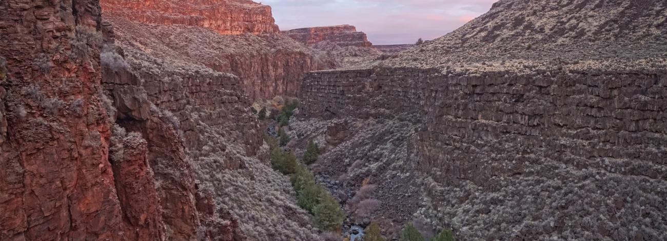
The Lower Salmon Falls Creek Wilderness Study Area is a vertical-walled, meandering canyon which dissects the Antelope Pocket lava plain. In otherwise flat terrain, Salmon Falls Creek has cut the scenic canyon between 300 and 600 feet deep. The canyon sides are dominated by sagebrush and the creek is lined by juniper and willows. Opportunities for primitive recreation consist of upland and waterfowl hunting, fishing, camping, backpacking, hiking, sightseeing and nature photography.
Visitation
From Rogerson, ID on Highway 93, take Road 1520 N west approximately 8 miles crossing over Salmon Dam to a dirt road on the right just up the hill past the dam and immediately west of a pullout. Drive or hike the dirt road 1 ½ miles to a turn around parking loop on the boundary of the WSA. A one mile trail leads north to a scenic overlook.
Visitor Advisory
The dirt road requires a suitable vehicle with high clearance. If you do not have a suitable vehicle, park at the pullout off the paved road and walk the 1 ½ mile dirt road to the WSA boundary.