
Hells Half Acre Wilderness Study Area
Values
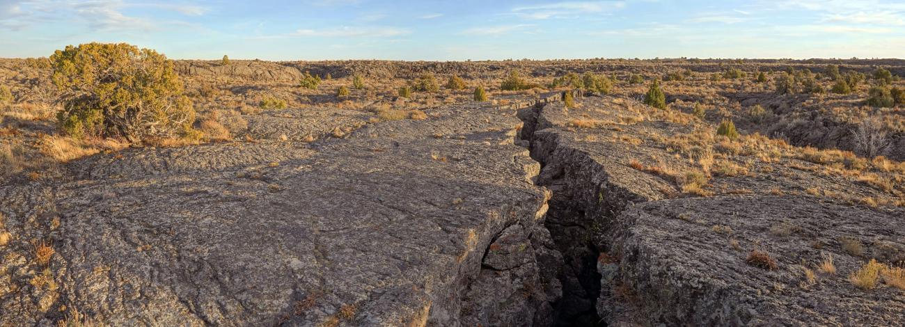
Hell’s Half Acre lava flow erupted about 4,100 years ago. As stretching of the earth’s crust occurred, a lava flow 2,000 degrees Fahrenheit, and with the consistency of molasses, traveled at speeds up to 30 mph. Hell’s Half Acre is a contorted landscape created from multiple lava flows. The northwest portion of the lava flow is also designated as a National Natural Landmark.
In the spring and early summer, numerous wildflowers, such as evening primrose, Indian paintbrush, wild onions, penstemon, geraniums, and prickly pear cactus color the landscape. Bright, green ferns grow in deep cracks. Plants from tiny mosses to juniper trees hundreds of years old grow here. Other native species include sagebrush, rabbitbrush, bitterbrush, blue bunch wheatgrass, and needle-and-thread grass. Wildlife roaming the lava flow includes mule deer, antelope, rabbits, bobcats, coyotes, foxes, and rattlesnakes. Soaring above the flows are red-tailed hawks, prairie falcons, and golden eagles.
Visitation Information
Travel west from Idaho Falls approximately 20 miles on Highway 20 to mile marker 287. Continue about ¼ mile to a sign noting “Lava Trail.” Turn south (left) onto the gravel road and continue about ¼ mile to the Twentymile Rock Trailhead. There are two trails here. Beginning at the trailhead parking is a ½ mile loop trail marked with blue top poles. About midway on the loop trail, a trail marked with red top poles departs and leads 4 ½ miles across the lava flow to the main source vent of the lava flow. This is a unique hiking experience. Primarily located on bedrock, neither trail has much of a trail tread, you must look for the next pole and walk to it stepping around or over cracks, rocks, and shrubs. The trails provide the opportunity to explore interesting volcanic features, and the further out you go, scenic solitude.
Visitor Advisory
There is precarious, rocky, uneven surfaces with cracks and sharp rocks. Hiking off trail is even more difficult. Unstable rock, fragmented crevices, open cracks, and uneven surfaces create fall and abrasion hazards. If not following the poles, visitors must possess knowledge and skill in cross country hiking and navigation on the lava flow. Navigation, whether on the trail or cross country, becomes very difficult at night, even with a light. It is hot in summer with little to no shade, and in winter cold and can be icy. There is no water. Be prepared with water, proper footwear, sun protection, and layered clothing as the conditions warrant.