
Gooding City of Rocks East Wilderness Study Area
Values
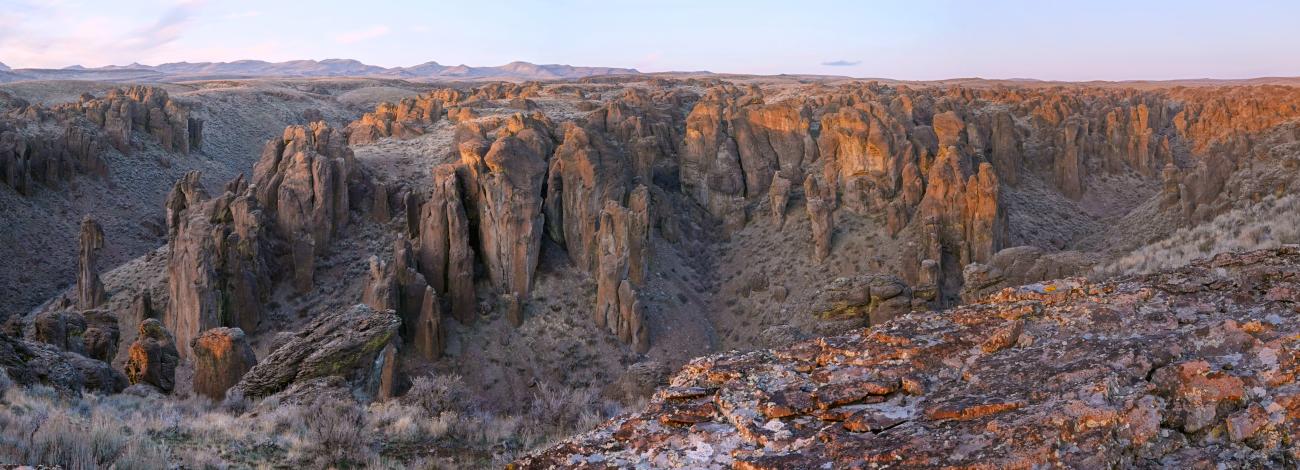
The Gooding City of Rocks East WSA is located in the Mount Bennett Hills, a rolling belt of foothills between the Sawtooth Mountains to the north and the Snake River Plain to the south. Within the WSA canyons have eroded over time and exposed rhyolite bedrock which has weathered into unusual rock formations called hoodoos. These hoodoos appear like rows of buildings and give the area its name. The hoodoos include pillars, some as much as 100 feet tall, monoliths, arches, fins and columns. These unusual rock formations, with their structural anomalies, are picturesque and interesting to explore. Opportunities exist within the WSA for photography, hiking, camping, wildlife observation, nature study, horseback riding, hunting and other activities.
Visitation Information
From Gooding, Idaho, drive Highway 46 north about 18 ½ miles to City of Rocks Road. Turn left and drive about 5 miles to a BLM sign for Gooding City of Rocks. Turn left and drive about 3 ¾ miles to a parking area at a white sign on one of the rocks indicating City of Rocks. To view the largest hoodoos, hike into one of the drainages.
Visitor Advisory
The road to the Gooding City of Rocks is a minimum maintenance dirt road. Visitors should exercise caution driving to the parking area and be familiar with navigation while hiking off-trail.