
Eighteenmile Wilderness Study Area
Values
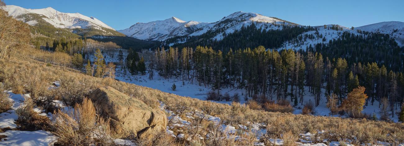
The Eighteenmile Wilderness Study Area (WSA) in north-central Idaho is remote, rugged and mountainous - moving from foothills to grassy meadows to the steep scenic cliffs along the Continental Divide, which forms a significant portion of the eastern boundary of the WSA. The vegetation varies from sagebrush-grass communities at lower elevations to forests of Douglas fir, lodgepole pine, and whitebark pine, and to alpine tundra at the highest elevations. The WSA is a popular area for non-motorized big game hunting in the fall. Visitors also enjoy excellent opportunities for solitude and for hiking, backpacking, rockhounding and wildlife viewing. The Continental Divide National Scenic Trail follows a portion of the eastern border of the WSA between the Pass Creek and Chamberlain Creek drainages.
Visitation Information
The 24,922 acre Eighteenmile WSA is southeast of Leadore, Idaho. From Leadore, drive approximately 8 miles south on Highway 28. Turn east on Eighteen Mile Rd driving 1.9 miles. Turn right, and drive 4.7 miles to an intersection. Turn right and drive 3.3 miles to and intersection. Turn left and drive 6.4 miles to the McGinty Trailhead. This trailhead provides access to routes which can be hiked.
Visitor Advisory
Access roads to McGinty Trailhead are mostly gravel but include dirt sections. This may require suitable clearance and may be impassable when muddy conditions exist. Conditions of roads can change at any time due to weather. Drivers should avoid dirt roads during rain or snow. Drivers should be cautious following rain or snowmelt. In most of the WSA, visitors must possess knowledge and skill in cross country hiking and navigation.