Douglas Point Special Recreation Management Area
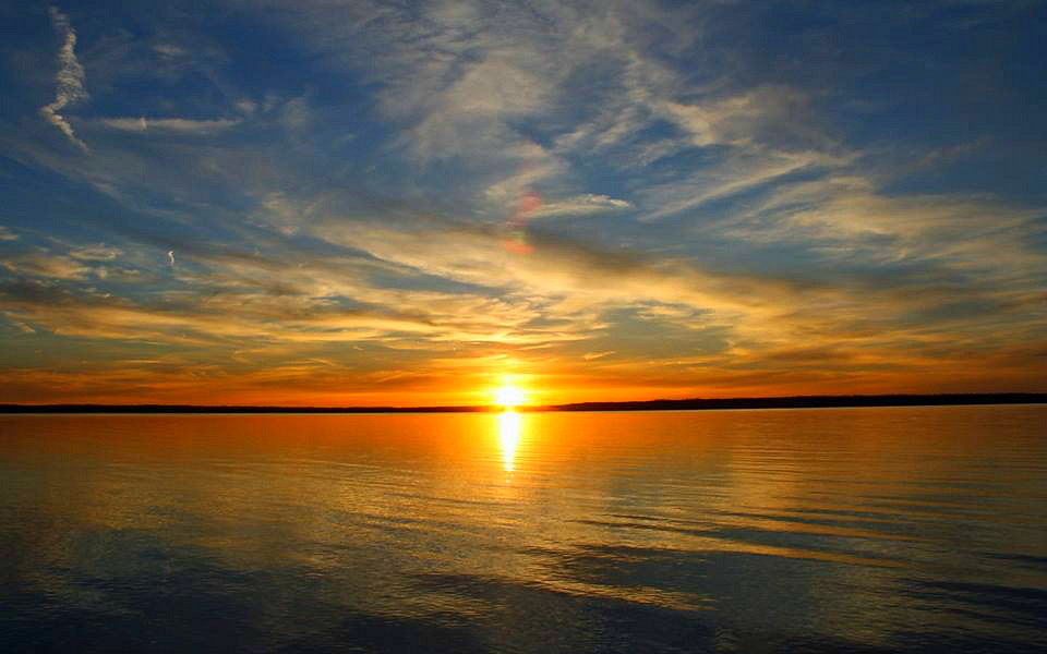
The Douglas Point Special Recreation Management Area (SRMA) in Charles County, Maryland, offers fantastic opportunities for hiking, horseback riding, hunting, fossil collecting, and relaxing along the shore. Located near fast-paced Washington, D.C., it is one of the last remaining undeveloped tracts along the Potomac River. Douglas Point encompasses 548 acres of hardwood forest and marshes, picnic area overlook, river shoreline, an accessible historical walk, and hunting blinds.
- About Douglas Point
Douglas Point lies in a lightly populated area of southern Maryland in western Charles County. The remaining portions of this once agricultural and rural peninsula county are experiencing rapid growth due to expanding economic opportunities created by increased military and contractor presence and urban sprawl.
On December 21, 2001, BLM and the State of Maryland jointly acquired approximately 1,270 acres of land known as Douglas Point, lying on the east side of the Potomac River. Douglas Point is part of the Nanjemoy Natural Resource Management Area (NRMA) which is jointly managed by the BLM and the Maryland Department of Natural Resources (MDNR). This area, one of the last remaining undeveloped tracts along the Potomac River, offers outstanding potential for recreation, wildlife habitat, and cultural resources. The management of this property offers a unique opportunity for federal, state, and local agencies to work together in a seamless effort with the public to both protect the quality resources in this area and to allow compatible passive recreational use of these public lands.
The Douglas Point tract contains magnificent hardwood forests, historic houses, and an overlook of the Potomac River. Douglas Point is one of the most ecologically and culturally significant landscapes in the state of Maryland. The area’s outstanding natural attributes are equally matched by its archaeological resources and history, including early American Indian sites, remnants from the Civil War, ruins of the colonial-era Chiles Homesite, as well as dozens of World War I-era sunken ships, which now lie in Mallows Bay.
- Hours
The hours of operation for the Douglas Point trails and natural areas are from dawn to dusk daily.
- Where to Park (Directions and Access)
Douglas Point has two parking lots - North and South Trailhead. The two parking lots are about 1 mile apart and are connected by the Cal Posey Trail. There are no restrooms on site.
South Trailhead/Chiles Homesite: 9699 Riverside Road, Nanjemoy, MD 20662
North Trailhead: 9275 Riverside Road, Nanjemoy, MD 20662
From Interstate Highway 95/495 in Maryland: Take Exit 3 for Hwy 210 South to Hwy 225, connecting with Hwy 224. Take 224 for about 14 miles. You should see signs for Nanjemoy and the Purse State Park. The parking lot is on the right side.
From US-301 N: Turn left onto MD-6 (Port Tabacco Rd). Take MD-6 for about 15 miles. Turn right onto Greenleek Hill Rd and in .2 miles keep right to continue on Greenleek Hill/ Jacksontown Rd for 2.3 miles. At the end of the road take a right onto Liverpool Point Rd and at the stop sign (400 feet ahead) take a left on MD-224 S. The parking lot will be on the right in 1 mile.
- Visit the Trails (Directions and Access)
Douglas Point is visited annually by hundreds of people from the local community. While at Douglas Point, visitors can enjoy approximately 2 miles of trails and water access to the Potomac River. Trail users should follow Leave No Trace principles and trail etiquettes while at Douglas Point. Please share the trail and respect the other users. For directions to the trails, see the Where to Park section. For more information about the trails, download the Douglas Point Brochure.
Hiking Trails: Hikers can park at either parking lot to access trails. Hikers can explore the Blue Banks Beach, Cal Posey, and Chiles Homesite trails. Please note that pets are allowed at Douglas Point but must be on a leash no longer than 6 feet at all times.
Mountain Biking Trails: Non-motorized bikes are allowed on all the trails and can access the trails at either parking lot. All motorized vehicles including e-bikes are currently not allowed at Douglas Point. Bikers can ride on the following trails: Blue Banks Beach, Cal Posey, and Chiles Homesite trails.
Equestrian Trails: Equestrians can park at either parking lot to access the trails. Horses are allowed on Cal Posey Trail and Chiles Homesite Trail. Horses are prohibited on Blue Banks Beach Trail.
Universally Accessible Trails: Users can park at the South parking lot to access the universally accessible trails. The Chiles Homesite is the only universally accessible trail at Douglas Point at this time.
National Scenic and Historic Trails: Hikers and water users can access the National Trails at either parking lot. These include two water trails: Captain John Smith Chesapeake National Historic Trail and the Star-Spangled Banner National Historic Trail, and one hiking trail: Potomac Heritage National Scenic Trail.
- Environmental Education and Interpretation
Douglas Point offers environmental education programs for homeschoolers, public and private schools, local 4-H groups, and community youth agencies. Programs consist of bird identification, fishing, fossil identification, habitat hikes, tree identification, Urban Leave No Trace, tracking, archaeological digs, invasive weed removal, and many other outdoor environmental education activities.
At Douglas Point, the BLM has developed natural and cultural resources including the stages of ecological succession; tree identification; native nonwoody plant species characteristics; identification of exotic plants; forest soil development; the benefits of snags and coarse woody debris; topics as the lifeways of the Chiles family; and Revolutionary and Civil War activity.
- Historic and Cultural Resources
Douglas Point has unique resources in the general vicinity including archaeological sites at the Chiles Homesite, and the evolving ecosystems of the shipwrecks at Mallow Bay. Historic and cultural resources at Douglas Point are protected under the Antiquities Act (16 U.S.C. 431-433) and the Archaeological Resources Protection Act of 1979 (16 USC 470aa-470mm). Therefore, metal detecting and artifact hunting is prohibited.
Chiles Homesite
The Chiles Homesite, with only its historic chimneys left, invites a little imagination to fuel a wonderfully, true story about the mid-19th century people who lived in this area. The BLM has interpreted the historic Chiles Homesite in an area of colonial settlement that began in the 1650s. In addition to the Reverend William J. Chiles family, historical accounts describe evidence of native populations who settled in Douglas Point centuries prior to the 1600s. The site later became home to Maryland governor, John Hoskins Stone, whose signature was among those on the Declaration of Independence.Fast forward to the 21st century, the BLM worked together with the National Park Service’s Historic Preservation Training Center and began the Chiles Homesite Chimney Restoration project in early September 2013. For more information about Chiles Homesite, visit: https://www.wm.edu/sites/wmcar/research/chiles/index.php.
Fossil Collecting
Fossil collecting in Charles County and at Douglas Point goes as far back as colonial days. The first comprehensive paleontological research studies of Maryland were completed in the 1830s. This work included identifying and naming new species of invertebrate fossils from Clifton Beach, south of Douglas Point and Purse State Park.Historic Trails
Trace history along scenic roads, hiking and biking trails, and meandering waterways. Explore historic sites and rich landscapes. To highlight the drama of early American history and promote the region’s natural beauty that endures today, three national trails run through Douglas Point:Potomac Heritage National Scenic Trail
Crossing lands once explored by George Washington, this evolving network of trails provides opportunities to travel a portion of five geographic regions between the Atlantic Coastal Plains and the Allegheny Highlights.Captain John Smith Chesapeake National Historic Trail
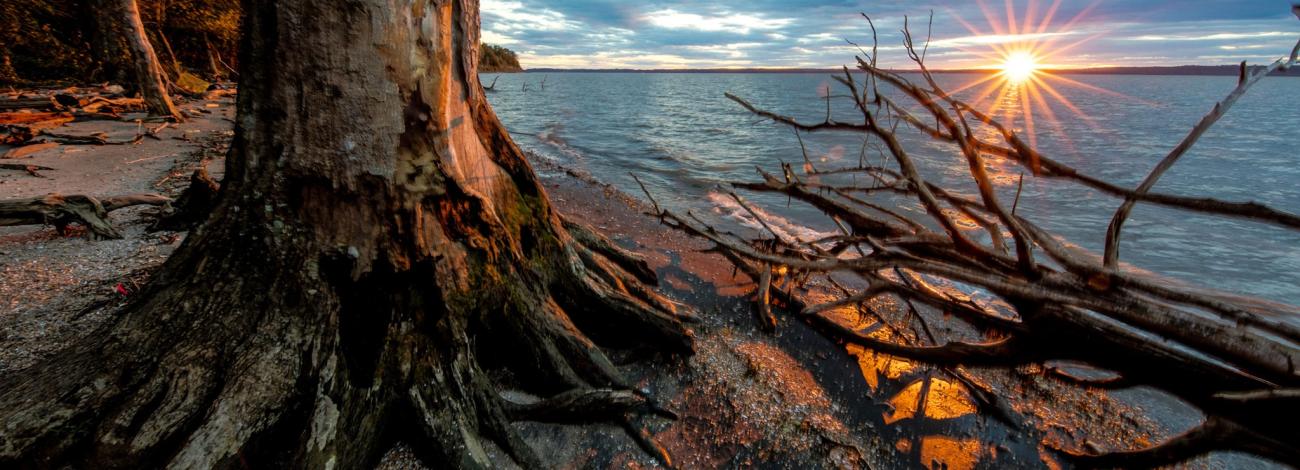
This extensive water trail traces 3,000 miles of the Chesapeake Bay and area rivers. The trail highlights the explorations of John Smith, whose detailed maps and descriptions of the region encouraged the first European settlement here. By water or land, visitors can follow Smith’s journeys and glimpse into the 17th century Chesapeake with its lush landscape, abundant wildlife, and diverse native cultures. To access this trail, visitors can hike to the Blues Bank Trail where they can visit the Potomac River overlook and a small beach that provides canoeists and kayakers water access.Star-Spangled Banner National Historic Trail
Commemorating the event of the War of 1812, which inspired the penning of America’s national anthem, this 560-mile land and water route traces the Potomac River and other tributaries that feed into the Chesapeake Bay. During the 3-year War, the British blocked shipping routes, captured and forced American soldiers into naval services, and launched raids on towns throughout Maryland and Virginia. The water trail can be accessed at Douglas Point near the north end of the area where a spur trail leads to a Potomac River overlook and a small beach that provides canoeists and kayakers water access.- Natural Resources
Douglas Point contains upland communities of hardwood, mixed hardwood pine, pine forest, open fields, tidal wetlands, and freshwater wetlands with access to the sandy shoreline of the Potomac River. Flora and fauna abound throughout hardwood forests and a diversity of wildflowers. The woods contain the rare angular-fruited milkvine, which seems to thrive in the more neutral soils that gain calcium from underlying fossil shell material. Forested seepage wetlands, fed by groundwater and saturated year-round, and freshwater marshes support the threatened Sely's sunfly and rare gray petaltail. The rare Carolina flits along grassy forest trails, stopping to sip juices from rotting fruit, animal scat, or tree sap. Soil types at Douglas Point are sand, silt or clay, or a combination. The soil types present affect drainage, vegetation, and stability.
- Invasive Species
The BLM has identified the following invasive species: barberry, barnyard grass, bush honeysuckle, Chinese lespedeza, Chinese privet, garlic mustard, Japanese knotweed, mile-a-minute, Mimosa, Multiflora rose, Nandina, Japanese stilt grass, Japanese honeysuckle, tree-of-heaven, Paulownia, Phragmites australis, Oriental bittersweet, Russian olive, Johnson grass (state-listed noxious weed), and wisteria. For more information about BLM’s invasive species management program, visit https://www.blm.gov/programs/natural-resources/weeds-and-invasives.
Location/Contact
Address: 9699 Riverside Road
Nanjemoy, MD 20662
Telephone: 703-339-8009
Email: [email protected]
Flickr Album