



Signs of Collaboration: Protecting Tortoises on Arizona Public Lands
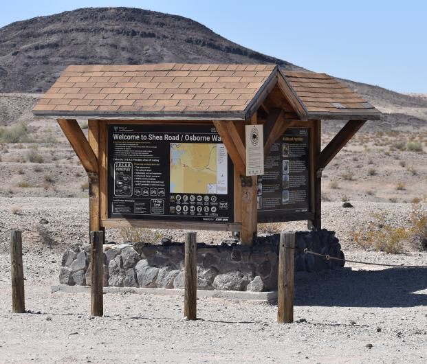
A “Watch for Tortoises, Drive with Care” sign at an off-highway vehicle (OHV) staging area carries a simple message. Deciding where that message can do the most good is considerably more complicated.
The Bureau of Land Management (BLM), Arizona Game and Fish Department, U.S. Fish and Wildlife Service, and Arizona State Parks and Trails worked together to bring this project to completion. Using wildlife science, geographic information system (GIS) data and field experience to identify locations where new signs can help protect Sonoran desert tortoises while supporting responsible, motorized recreation.
The Arizona Game and Fish Department fabricated the signs for installation on BLM-managed public lands. The goal is to place them where they can remind OHV users to watch for tortoises and reduce the risk of vehicle strikes.
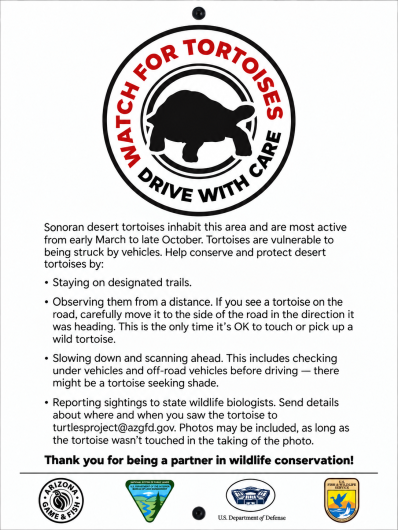
The project began with a practical question: Where do popular BLM recreation areas overlap with Sonoran desert tortoise habitat?
Tiffany Shepard, BLM Arizona’s state wildlife lead at the time, helped initiate and coordinate the effort. In December, Shepard asked BLM GIS specialist Rachel Luu to examine that question in preparation for discussions with the Arizona Game and Fish Department and Arizona State Parks and Trails about potential funding and sign placement, with Irina Ford, BLM Arizona’s lead for threatened and endangered species, later continuing management of the program after Shepard moved to another position and helping carry the project from planning into implementation.

Luu brought together several sources of geographic information, including BLM-designated OHV areas, recreation staging areas and routes, BLM desert tortoise habitat data and the U.S. Fish and Wildlife Service’s desert tortoise habitat suitability data.
She also examined BLM Arizona’s existing inventory of OHV-related signs to see where recreation messaging was already present in or near tortoise habitat.
Taken together, the information allowed planners to see where recreation and tortoise habitat intersect and to prioritize locations where a limited number of signs could potentially reach the greatest number of visitors.
The maps were developed as planning tools, not as substitutes for local knowledge. GIS can show where habitat and recreation overlap on a map, but employees working on the landscape understand how visitors actually use those areas.
That is where Harry “Ford” Mauney, a wildlife biologist with the BLM Lake Havasu Field Office, entered the process.
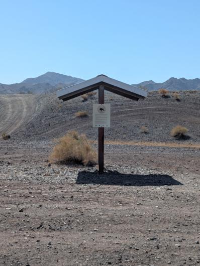
Using his knowledge of recreation patterns in the field office, Mauney identified Standard Wash, the Parker race area, and kiosks near the Central Arizona Project canal as potential locations for signs. He estimates those locations could put the tortoise message in front of roughly 90% of the field office’s OHV users.
The combination illustrates what the project was designed to do: Use statewide data to narrow the possibilities, then use local experience to determine where a sign is most likely to be seen.
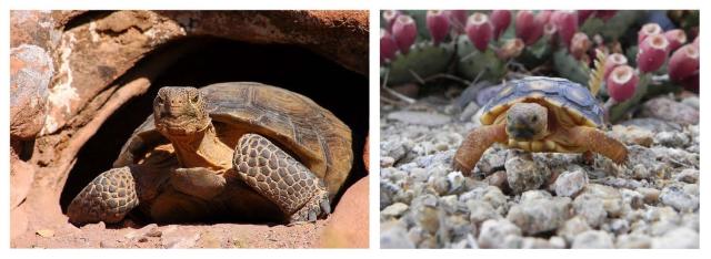
Understanding where the Sonoran desert tortoise lives is only part of the equation. The next step is reaching recreationists in the places where they are most likely to encounter the species.
For recreation managers, the signs offer an opportunity to educate visitors without restricting access. A sign at a staging area or other high-use location can reach riders before they head onto the trail and remind them that recreation takes place in habitat shared with wildlife.
For tortoises, that moment of awareness matters.
The signs may be aimed primarily at OHV users, but their message applies to everyone traveling through Arizona’s desert. Sonoran desert tortoises can cross trails and roads and can be difficult to see against the landscape. Slowing down, staying alert and watching for wildlife gives every driver a chance to help protect the animals that share these public lands.
The project brought together several kinds of expertise. Shepard identified the need and coordinated the initial effort; the Arizona Game and Fish Department developed and fabricated the signs; the U.S. Fish and Wildlife Service provided habitat data; and Arizona State Parks and Trails joined discussions about potential funding. Luu turned wildlife and recreation datasets into decision-making tools, Ford continued the wildlife program after Shepard’s departure, and Mauney applied the work on the ground by identifying locations where recreation use is highest.
The result visitors see may be just one sign beside a trail or staging area.
Behind that sign is a much larger effort to put good information in the right place, giving recreationists a chance to help protect the wildlife that shares Arizona’s public lands with them.
Related Content
Related Stories
- National Public Lands Day Paddles, Plants and Caves: BLM Connects Milwaukee Youth with the Outdoors
- Using Beavers as Partners in Riparian Habitat Restoration in Las Cienegas National Conservation Area
- K2-Play Completes Final Phase of North Fruita Desert Trails Master Plan
- Celebrating 30 Years of California Condor Recovery at Vermilion Cliffs National Monument
- BLM Fishing Derby brings Americans Outside for recreation and stewardship in Imperial Valley, California
Office
1785 Kiowa Ave.
Lake Havasu City, AZ 86403
United States