
A Point That Put Idaho on the Map: Celebrating the Boise Meridian Initial Point
In May 2026, the Bureau of Land Management and a broad coalition of partners gathered at a lonely volcanic butte south of Boise to celebrate a point that literally put Idaho on the map—the Boise Meridian Initial Point. The two-day event, part of America’s 250th anniversary commemorations, honored the 19th-century surveyors whose work still shapes every acre of land in the state.
The event marked America’s 250th anniversary by honoring the cadastral surveyors whose work has shaped the landscape—and the very structure—of the nation for generations. This blog is part of an ongoing series recognizing those professionals and their enduring legacy.
Where It All Began
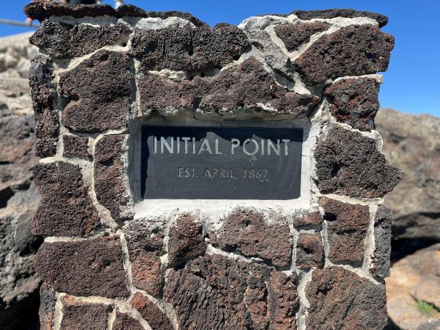
Long before Idaho officially became a state in 1890, Lafayette Cartee and his survey crew set forth to create a grid from which to measure land ownership. Their first goal was to create an “initial point,” a specific spot on the ground that marks ground zero for all following cadastral surveys. It establishes a geographic coordinate system that is defined by the intersection of a principal meridian and a base line.
Some 20 miles south of Boise City, the 1867 survey crew found a lone volcanic butte rising 170 feet above the surrounding plain. This site was isolated and far enough west that the meridian would extend northward through the narrow panhandle of the territory all the way to the Canadian border. From this single monument, the Public Land Survey System expanded across nearly 54 million acres of Idaho. The familiar grid of townships, ranges, and sections that still defines land ownership, agriculture, infrastructure, and public lands today all trace back to this exact spot.
What began as a technical exercise quickly became something much more: a framework for growth, clarity, and shared understanding across a rapidly developing landscape.
A Legacy Written on the Land
Initial Point offers a powerful connection to both Idaho’s history and the broader story of the United States. It marks the moment when vast, unmapped lands began to be organized into something legible and lasting.
Surveyors with the General Land Office—predecessor to the BLM—traversed rugged terrain to establish this system. Their work enabled settlement, supported commerce, and helped communities take root across the West.
That legacy continues today.
Every modern cadastral survey builds on the same principles established in 1867. Every land use decision—whether for grazing, recreation, energy development, or conservation—depends on the accuracy and integrity of that original framework.
The Initial Point is not just a historical artifact; it is the foundation of how land in Idaho is still understood and managed.
Reflecting on a Broader History
While the event celebrates surveying and its contributions, it also recognizes a more complex history.
Long before survey lines were drawn, tribal nations lived on and stewarded these lands. The expansion of federal land policies and treaties had profound and lasting impacts on those communities. The Boise Meridian Initial Point serves as a place to reflect on that full history—one that includes both the promise of development and the consequences of change.
Day One: Gathering at the Butte
The first day of the celebration brought attendees directly to the Initial Point site. Thanks to recent improvements by the Ada County Highway District, access to the butte was significantly safer and easier, allowing more people to experience this historic location firsthand.
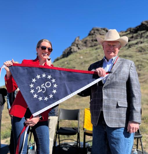
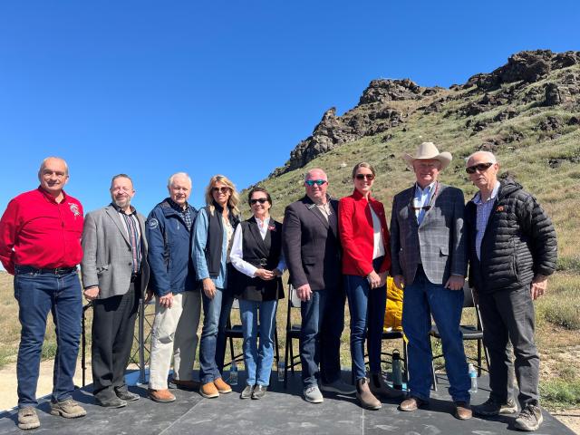
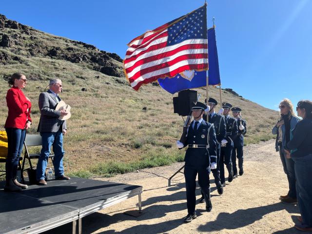
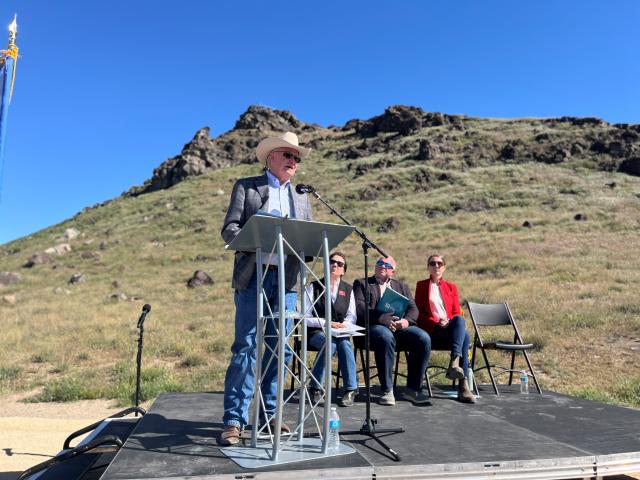
Under bright May sunshine and refreshing spring breezes, visitors hiked the uneven volcanic terrain to stand exactly where Idaho’s story of organized settlement began. An honor guard presented the colors, a military jet flyover roared overhead, and speakers including Governor Brad Little and Acting BLM Idaho State Director Meagan Conry reminded everyone: “This is the place that put Idaho on the map.”
In a highlight moment, Brad Little issued a formal proclamation designating May 1 as Boise Meridian Initial Point Celebration Day in Idaho.
Speakers emphasized a shared message: this is the place that quite literally put Idaho on the map.
Day Two: Bringing Surveying to Life
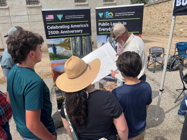
The second day of the celebration shifted to the historic Old Idaho Penitentiary. Built shortly after the Initial Point’s establishment, this rugged sandstone-walled relic in Boise opened in 1872 to hold gold rush outlaws. Today, it is one of only four American territorial prisons open to the public. During its 101 years of operation, its notoriously harsh conditions changed little while Boise itself transitioned from the “wild west” to a mid-20th century capital city.
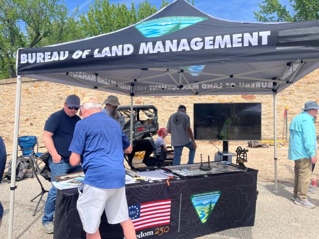
This historic venue welcomed the Initial Point celebration of modern-day surveyors and partner organizations hosted interactive exhibits and demonstrations. Visitors experienced live surveying in action, attended educational talks, and engaged with experts from across the field. Booths from partner organizations highlighted the role of surveying in transportation, education, natural resource management, and emerging technologies. Food vendors and community engagement added to the atmosphere, making the event both informative and accessible.
Looking Ahead
As the nation approaches its 250th anniversary, the Boise Meridian Initial Point offers a tangible way to connect national ideals to the physical landscape.
The work that began here reflects a uniquely American effort: to bring structure to opportunity and to create systems that support growth, stability, and shared understanding.
Today’s surveyors carry that work forward, using modern tools to refine and maintain the system while staying grounded in its original purpose.
More Than a Marker
Today this mound dubbed as the Boise Meridian Initial Point, reachable via a rough dirt road and topped with a viewing platform, serves as more than just a monument.
It represents the intersection of history, science, and public service. It reminds us that land management is not only technical—it shapes how people live, work, and connect to the world around them.
As we look to the future, the responsibility remains clear: to steward public lands thoughtfully, to honor the systems that brought us here, and to ensure they continue to serve generations to come.
Because in many ways, it all still begins at this one point.
Recap of event:
- Recap: Boise Meridian Initial Point Celebration: Surveying the Past, Mapping the Future (YouTube)
- Boise Meridian Initial Point Celebration, May 1, 2026 (Facebook)
- Recap: Acting BLM Idaho State Director Meagan Conry's comments (abbreviated) May 1, 2026 (Facebook)
- Old Idaho Penitentiary Initial Point Event, May 2, 2026 (Facebook)
Related Stories
- Freedom and Liberty Bring the Spirit of the West to Northern Virginia
- Sharing the Spirit of America: A Celebration on the Snake River Canyon Rim
- BLM Launches a Modernized General Land Office Records System
- Birding Aravaipa Canyon: A morning of songs, color, and creekside adventure
- BLM Celebrates America’s 250th Anniversary in Oregon
Office
1387 S. Vinnell Way
Boise, ID 83709
United States