
Marble Monument
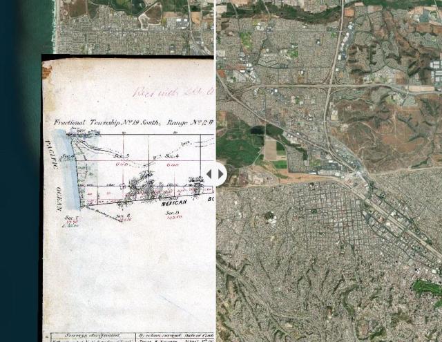
This week's General Land Office record is a survey plat that shows the "marble boundary monument" between the United States and Mexico. The marble monument is officially known as Monument No. 258 , and it serves as the initial point of boundary between the United States and Mexico. This initial point was established in 1849 with the signing of the Treaty of Guadalupe Hidalgo that brought an end to the Mexican-American War (1846-1849). To this day, the marble monument marks the southwestern corner of the contiguous United States. Read more on ArcGIS Story Maps.
The GLO website provides live access to Federal land conveyance records for the Public Land States, including image access to more than 12 million federal land title records issued between 1788 and the present.
The site also hosts images of survey plats and field notes, land status records, and control document index records, and is one of the most visited websites in the Department of the Interior. Visit glorecords.blm.gov for more information.
Related Stories
- BLM Launches a Modernized General Land Office Records System
- Framed for Freedom: Bureau of Land Management Eastern States and the Legacy of National Historic Trails
- Safety Week 2026: Building Skills, Confidence, and a Stronger Safety Culture
- Strengthening Partnerships: BLM Connects with Industry at Key Oil and Gas Meetings in Ohio and Pennsylvania
- Successful Wild Horse & Burro Placement Event Draws National Interest in Liberty, Kentucky
Office
5275 Leesburg Pike
Falls Church, VA 22041
United States