
Turkeytown, Alabama
This week's story map brings us to Turkeytown, Alabama, and features a survey plat approved April 20, 1840. This town was named not for the bird, but for its founder, the first Principal Chief of the Cherokee Nation: Little Turkey. Read more on ArcGIS Story Maps.
The GLO website provides live access to Federal land conveyance records for the Public Land States, including image access to more than 12 million federal land title records issued between 1788 and the present.
The site also hosts images of survey plats and field notes, land status records, and control document index records, and is the most visited website in the Department of the Interior. Visit glorecords.blm.gov for more information.
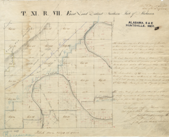
Original Survey Plat of Township 11 South Range 7 East of Huntsville Principal Meridian
Related Stories
- Freedom and Liberty Bring the Spirit of the West to Northern Virginia
- BLM Launches a Modernized General Land Office Records System
- Framed for Freedom: Bureau of Land Management Eastern States and the Legacy of National Historic Trails
- Safety Week 2026: Building Skills, Confidence, and a Stronger Safety Culture
- Strengthening Partnerships: BLM Connects with Industry at Key Oil and Gas Meetings in Ohio and Pennsylvania
Office
5275 Leesburg Pike
Falls Church, VA 22041
United States