
Sheep Mountain WSA
Values
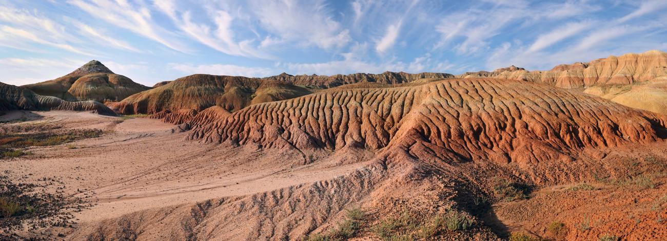
The Sheep Mountain WSA contains bare, rugged, and scenic badlands with horizontal grey and red striations. These clay badlands are formed by the erosive action of wind and water on the shales and sandstones of the Willwood Formation. The area is carved into low peaks, ridges, and mounds by irregular, sharply cut drainages radiating from Sheep Mountain in the central portion of the WSA. Some of the mounds and slopes create interesting forms which have a lot of scenic appeal. The area contains geologic and paleontological resources. Elk Creek, Dorsey Creek and Dry Creek are the main drainages in the area, though they are often dry.
Visitation Information
From Burlington, WY, drive Highway 30 south about 1 ½ miles and continue straight onto County Road R8 for 2 ½ miles. The paved road turns left onto L42 (1 ¼ miles), then right onto R9 (½ miles), then left onto L42 1/2 and in another ¼ mile turn right onto BLM Rd 1103 (Dorsey Creek Road). Drive 1103 for 2.4 miles to the boundary of the WSA. From this point the WSA is on the right side of the road (west) for approximately 6 miles.
Visitor Advisory
Access to wild lands requires good navigational skills and the road described above may require four-wheel drive or high-clearance. Visitors should be prepared for adverse weather and road conditions.