
White Mountains National Recreation Area | Alaska
When planning your visit go to the trail updates webpage for access information, current events and notices about temporary closures or restrictions.
Located about an hour's drive from Fairbanks, Alaska, off the Steese and Elliott Highways, the one-million-acre White Mountains National Recreation Area offers stunning scenery, peaceful solitude, and outstanding opportunities for recreation.
The White Mountains has three campgrounds, 13 public use cabins and two trail shelters providing various opportunities to enjoy the area throughout the year.
Winter Recreation October 15 - April 30
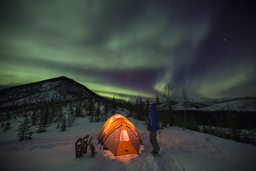
Reaching the heart of the White Mountains becomes much easier in the winter, when creeks, rivers, and bogs are frozen. In winter, visitors travel by ski, snowshoe, fatbike dog team and snowmobile to enjoy the 13 public-use cabins and 250 miles of groomed trails that make the White Mountains one of Interior Alaska's premier winter destinations.
Most of White Mountains winter trails are open to both snowmobiles and nonmotorized users, except for the non-motorized Ski Loop Trail and Summit Trail.
Summer Recreation May 1 – October 14
During the short summers, visitors hike, float, hunt, fish, pan for gold and camp under Alaska's 'midnight sun.'
Nome Creek valley is one of the prime access points for summer recreation with access to two campgrounds, trails, a gold-panning area and a departure point for float trips on Beaver Creek Wild and Scenic River. It can be reached via the US Creek Road, Steese Highway Milepost 57. These gravel roads can be bumpy but are suitable for use by highway vehicles.
To protect sensitive resources, vehicles must remain on BLM routes designated for their use unless traveling in an area designated open to cross-country motorized travel. The entire area is open to all forms of non-motorized use, so feel free to explore off trail.
The most popular places to ride OHV’s is in the Nome Creek tailings and the Quartz Creek Trail.
Most of the cabins become difficult to reach in the summer, but a few are regularly used such as Fred Blixt Cabin and Lee’s Cabin.
Camping
Cabin reservations can be made 45 days in advance through recreation.gov. The two trail shelters are available first come-first served. Three campgrounds are open from late-May until the snow flies in October: Cripple Creek Campground, Mount Prindle Campground, and Ophir Creek Campground. There’s no permit needed to camp outside the developed areas, just keep in mind that dispersed camping is limited to 10 days and is prohibited in the area’s three Research Natural Areas to protect resources.
Flickr Album
Contact Us

Activities


Addresses
Directions
Most summer hiking occurs along the Summit Trail at mile 28, Elliott Highway. Other hiking trails, along with campgrounds and gold-panning areas, may be found at Nome Creek, accessible from the U.S. Creek Rd., mile 57, Steese Highway. Winter access is at mile 28 and mile 57, Elliott Highway, and at McKay Creek, mile 42, Steese Highway. BLM has also developed a new winter access point at U.S. Creek, mile 57, Steese Highway.