
Sonoran Desert National Monument | Arizona
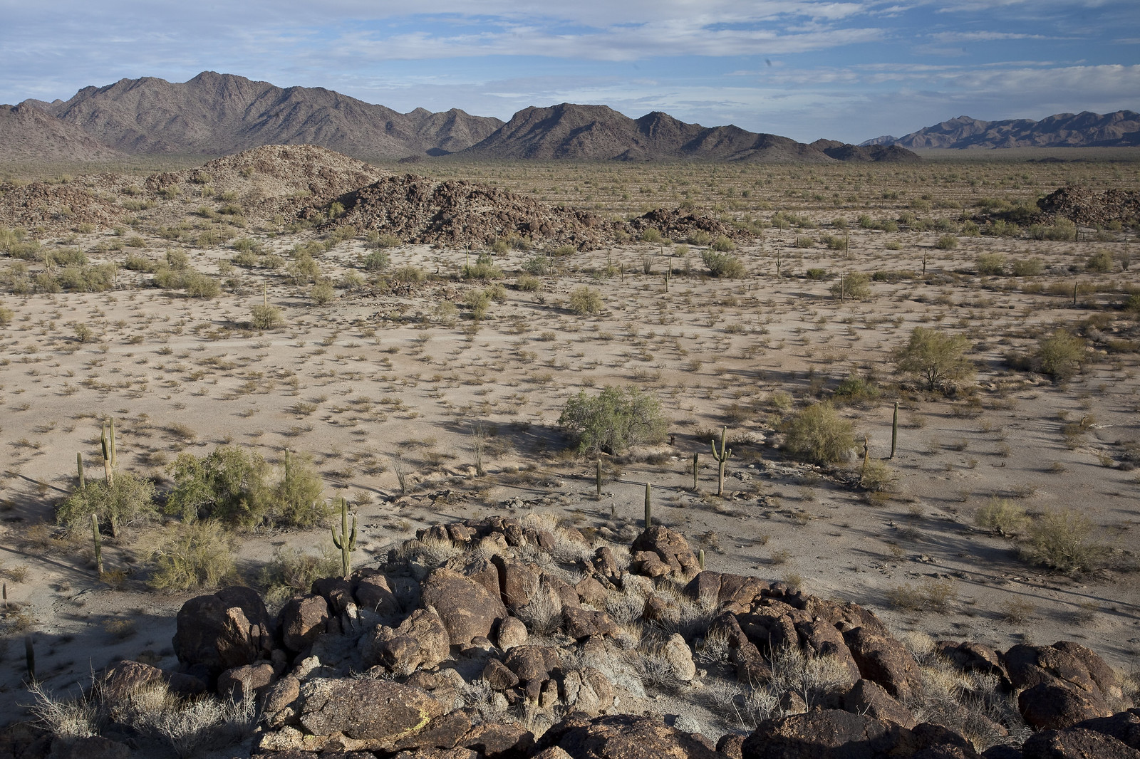
The Sonoran Desert National Monument contains magnificent examples of untrammeled Sonoran Desert landscape. The monument sits in the most biologically diverse of the North American deserts and captures a significant portion of that diversity. The most striking aspect of the plant community in the monument is the extensive saguaro cactus forest. The monument contains three distinct mountain ranges, the Maricopa, Sand Tank and Table Top mountains, as well as the Booth and White hills, all separated by wide valleys. The monument also contains three congressionally designated wilderness areas, archaeological and historic sites, and remnants of several important historic trails.
Hours and Seasons
The monument is open 24 hours a day, year-round. It's best to enjoy the monument from late October to mid-April to avoid summer heat.
Places to Go
Getting Around
Interstate 8 and State Route 238 cross the monument. Most other roads are unpaved, primitive, and not maintained. High-clearance or four-wheel-drive vehicles are recommended in some areas. More than 460 miles of posted roads are available for back country, off-highway vehicle driving and mountain biking; however, by law, vehicles and bicycles are prohibited in wilderness.
Camping
Dispersed Camping
- Dispersed camping and picnicking is allowed throughout the monument, unless otherwise posted. Desert camping allows visitors to take short scenic hikes, survey unique vegetation, and relax with friends under a blanket of stars.
Campgrounds
- Two small campgrounds at Margies Cove West and Table Top trailheads offer a toilet and three small campsites with a picnic table and barbecue grill. Four small campsites are also available at Estrella Wayside Recreation Area. No water or hookups are available. Sites are first-come, first-served.
- The BLM’s Painted Rock Campground is located about 26 miles west of Gila Bend.
Your Safety
This is a remote area and access roads are not maintained. Cell phones do not work in many areas of the monument.
Heat and Sun
The monument's elevation ranges from 1,000 to 4,400 feet, so summer is rough on visitors. It's best to enjoy the monument from late October to mid-April. If you are visiting in summer, take extra precautions to drink plenty of water, as temperatures may exceed 110°F. We recommend sunscreen, sunglasses and a hat. Weather forecast
Water
Bring all the water you will need. There is no drinking water available on the monument. Plan on drinking one gallon (4 liters) per person per day—more if you're engaged in strenuous activities.
Your vehicle
Make sure your gasoline tank is full, carry additional water and full-size spare tires in your vehicle, and make sure your vehicle is in good working condition. Winter is the most popular time to visit.
Wildlife
The desert sun stirs up rattlesnakes and other reptiles as early as February.
Flash floods
Flash floods caused by sudden storms can be dangerous in washes, so it is best to have a survival plan to prevent emergency situations. Have good maps with you and know how to use them.
Border Concerns
The southern part of the monument is a corridor for drug and human smugglers. Be alert for illegal activities and law enforcement operations.
Respect and Protect
The area is home to many species of wildlife. Please remember to practice outdoor ethics and recreate responsibly. Help us protect this unique environment by leaving no trace during your visit.
Check for fire restrictions before your visit. Using exploding targets, fireworks, sky lanterns, tracer ammunition and other incendiary devices is prohibited on BLM-managed public land in Arizona.
Report resource crimes including vandalism, dumping and suspicious activity at 1-800-637-9152.
Accessibility Description (ABA/ADA)
Toilets are accessible. There are no other accessible facilities in the monument.
Services
Toilets
Vault toilets are located at Margies Cove West, Margies Cove East, Gap Well, and Table Top trailhead. Toilets are accessible.
Lodging
There is no lodging in the monument. Nearby lodging is available west of the monument in Gila Bend, and east of the monument in Maricopa and Casa Grande.
Food and Supplies
There are no services on the national monument. Stores and gas stations are available west of the monument in Gila Bend, and east of the monument in Maricopa and Casa Grande.
First Aid
There is no first aid station on-site. The nearest hospitals are east of the monument in Casa Grande and Maricopa.
Things to Do
Hiking and Horseback Riding
You may hike or ride horseback almost anywhere in the Sonoran Desert National Monument.
Four designated wilderness trails totaling 26 miles offer a unique opportunity to explore the backcountry, including Margies Cove, Brittlebush, Lava Flow and Table Top trails.
Wildlife Viewing
Watchable Wildlife: The monument is home to a variety of wildlife, including desert bighorn sheep, mountain lions, mule deer and javelina. Many small birds and reptiles thrive year-round, including bats, owls, rattlesnakes, and the Sonoran Desert tortoise.
Archaeology and History
Explore the rich archaeological and historical legacy of Arizona. Early Native Americans, Spanish explorers, homesteaders and miners crossed the monument’s central corridor. The Juan Bautista de Anza National Historic Trail, the Buterfield Overland National Historic Trail, and the Mormon Battalion trail all pass through the monument.
Regulations, Permits, and Fees
Visits to the Sand Tank Mountains, located south of Interstate 8, require a free Barry M. Goldwater Range permit. Permits are only available online and not at the local BLM office.
Competitive events and organized activities with 25 or more participants require a permit. Contact the monument office for more information.
Motorized and mechanized vehicles, including bicycles must remain on existing routes.
Collecting, removing, or damaging natural and cultural resources, including artifacts, plants (live or dead), and rocks, is prohibited.
Flickr Album
Contact Us

Activities


Addresses
Directions
The Sonoran Desert National Monument is in south central Arizona, 60 miles from Phoenix. Do not rely on your vehicle's navigation system in the monument. Cell signals can be spotty. Download a map.
You can get to the western side of the monument via State Route 85 north of Gila Bend. State Route 238 is paved and crosses the monument between Gila Bend and Maricopa.
You can reach the eastern side of the monument from Maricopa.
You can get to the southern part of the monument via Interstate 8 east of Gila Bend. Interstate 8 provides some access at the Vekol interchange (Exit 144) and the Freeman Interchange (Exit 140).
For information about other access routes, contact us.
External Map
Fees
Commercial, competitive, and large organized group events require a special recreation permit. Contact the monument office for more information.
Visits to the Sand Tank Mountains, located south of Interstate 8, require a Barry M. Goldwater Range permit. These permits are only available online and not at the local Bureau of Land Management office.
Recreational activities on any nearby state trust land require a permit from the State of Arizona.
Quicklinks
Camping
Trails
- Brittlebrush Trail
- Margies Cove East Trailhead
- Margies Cove West Trailhead
- Lava Flow Trail
- Table Top Trail
Wilderness Areas