
Sonoran Desert National Monument
The saguaro cactus is the iconic symbol of the Sonoran Desert and the monument is a place to see extensive forests of the classic cactus. But the monument has more to offer, including distinctive mountains rising from the desert floor. It has three distinct mountain ranges: the Maricopa, Sand Tank, and Table Top mountains, as well as the Booth and White hills, all separated by wide valleys. You can hike or ride horseback almost everywhere in the monument. Four designated trails in three congressionally designated wilderness areas total 26 miles. Many miles of roads are available for mountain biking and motorized vehicle tours. The monument has significant archaeological and historic sites, and remnants of several important historic trails, including the Juan Bautista de Anza and Butterfield Overland national historic trails. These congressionally designated trails parallel the Mormon Battalion Trail, and the Gila Trail.
The southern part of the monument is a corridor for drug and human smugglers. Be alert for illegal activities and law enforcement operations.
Special Features
The monument offers many opportunities to explore and discover the secrets of the Sonoran Desert and includes three wilderness areas: the North Maricopa Mountains Wilderness, the South Maricopa Mountains Wilderness, and the Table Top Wilderness. These wilderness areas offer excellent opportunities for solitude and unconfined recreation.
The North Maricopa Mountains Wilderness has two hiking and equestrian trails, the nine-mile Margie’s Cove Trail and the six-mile Brittlebush Trail. The Table Top Wilderness also has two hiking and equestrian trails, the seven-mile Lava Flow Trail and the three-mile Table Top Trail. Sections of the Juan Bautista de Anza and Butterfield Overland national historic trails cross the national monument. A four-wheel-drive route follows the trail corridor for approximately 10 miles through the national monument.
Directions
Do not rely on your vehicle's navigation system in the monument. Cell signals can be spotty. Download a map.
From Phoenix to the western side of the national monument, take Interstate 10 west about 31 miles to Exit 112/State Route 85, then south about 35 miles to the eastern edge of Gila Bend. Turn left on State Route 238 and proceed east about four miles to the national monument. In Gila Bend information can be obtained at the Town Museum on 644 W. Pima Street.
From Phoenix to the eastern national monument boundary, take Interstate 10 east and south about 16 miles to Exit 164/Queen Creek Road, turn right and continue on State Route 347 about 15 miles to Maricopa. Turn right onto State Route 238 and continue west about 16 miles to the national monument.
From Phoenix to the southern part of the national monument, take Interstate 10 south to Interstate 8. Proceed west on I-8 to Exit 144/Vekol Road and turn south. For information about other access routes, contact us.
Things to do
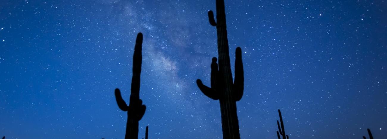
Hiking, backpacking, stargazing, camping, hunting, motor touring, sightseeing, photography, and horseback riding.
Hiking and Horseback Riding
You may hike or ride horseback almost anywhere in the Sonoran Desert National Monument.
Four designated wilderness trails totaling 26 miles offer a unique opportunity to explore the backcountry, including Margies Cove, Brittlebush, Lava Flow and Table Top trails.
Camping
Dispersed Camping
- Dispersed camping and picnicking is allowed throughout the monument, unless otherwise posted. Desert camping allows visitors to take short scenic hikes, survey unique vegetation, and relax with friends under a blanket of stars.
Campgrounds
- Two small campgrounds at Margies Cove West and Table Top trailheads offer a restroom and three small campsites with a picnic table and BBQ grill. No water or hookups are available. Sites are first-come, first-served.
- BLM’s Painted Rock Campground is located approximately 26 miles west of Gila Bend.
Vehicles and Mountain Bikes
More than 460 miles of posted roads are available for back country, off-highway vehicle driving and mountain biking; however, by law, vehicles and bicycles are prohibited in wilderness.
Wildlife Viewing
Watchable Wildlife: The monument is home to a variety of wildlife, including desert bighorn sheep, mountain lions, mule deer and javelina. Many small birds and reptiles thrive year-round, including bats, owls, rattlesnakes, and the Sonoran Desert tortoise.
Archaeology and History
Explore the rich archaeological and historical legacy of Arizona. Early Native Americans, Spanish explorers, homesteaders and miners crossed the monument’s central corridor. The Juan Bautista de Anza National Historic Trail, the Buterfield Overland National Historic Trail, and the Mormon Battalion trail all pass through the monument.
Regulations, Permits, and Fees
Visits to the Sand Tank Mountains, located south of Interstate 8, require a Barry M. Goldwater Range permit. The permit is free but requires the recipient to watch a 13-minute safety video. Permits are valid for 365 days form the date of purchase. Permits are only available online and NOT at the local BLM office. Online Permit site: Barry M. Goldwater Range permit
Competitive events and organized activities with 25 or more participants require a permit. Contact the monument office for more information.
Motorized and mechanized vehicles, including bicycles, must remain on existing routes.
Collecting, removing, or damaging natural and cultural resources, including artifacts, plants (live or dead), and rocks, is prohibited.
Your Safety
Check with the monument office for current conditions. Know before you go. This is a remote area, recreational opportunities are primitive, and access roads are not maintained. No water or trash collection is provided. Cellular phones do not work in many areas of the national monument.
Heat and Sun
The monument's elevation ranges from 1,000 to 4,400 feet, so summer is rough on visitors. It's best to enjoy the monument from late October to mid-April. If you are visiting in summer, you must take extra precautions to drink plenty of water, as temperatures may exceed 110 degrees Fahrenheit. We recommend sunscreen, sunglasses and a large, brimmed hat.
Water
You should bring all the water you will need. There is no drinking water available on the monument. Plan on drinking one gallon (4 L) per person per day—more if you're engaged in strenuous activities.
Your vehicle
Make sure your gasoline tank is full, carry additional water and full-size spare tires in your vehicle, and make sure your vehicle is in good working condition. Winter is the most popular time to visit.
Wildlife
The desert sun stirs up rattlesnakes and other reptiles as early as February.
Flash floods
Flash floods caused by sudden storms can be dangerous in washes, so it is best to have a survival plan to prevent emergency situations. Have good maps with you and know how to use them.
Border Concerns
The southern part of the monument is a corridor for drug and human smugglers. Be alert for illegal activities and law enforcement operations.
Services
Accessibility
Restrooms are wheelchair accessible. There are no other accessible facilities at the monument.
Lodging
Lodging is available in Casa Grande and Gila Bend, approximately 25 miles west of the Vekol Road interchange on Interstate 8.
Food and Supplies
There are no services on the national monument. Stores and gas stations are available in nearby Gila Bend, approximately 25 miles west of the Vekol Road interchange on Interstate 8.
First Aid
There is no first aid station on-site. The nearest hospital is located in Casa Grande, approximately 30 miles east of the Vekol Road interchange on Interstate 8.