
Confusion HMA
Overview
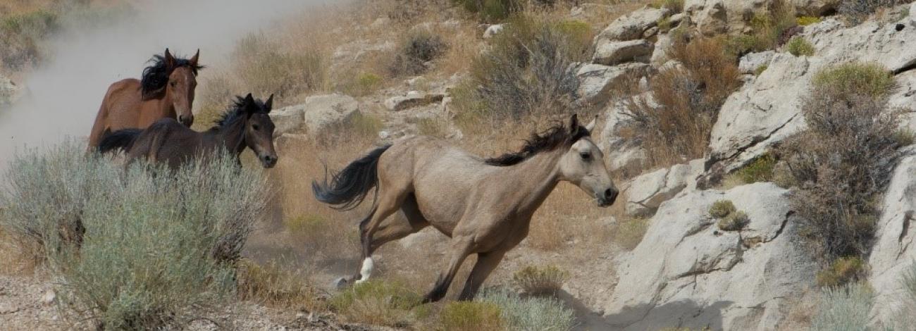
The original source of the animals in this herd is unknown, but it has been augmented through historic times and most likely up until the late 1960s, with domestic horses from local ranches.
The herd has many bays, browns, blacks, and sorrels, with some other colors mixed in through the population. These horses tend to be taller and heavier than other BLM wild horses in western Utah. It is hypothesized that this may be due to the proximity of the herd management area (HMA) to ranches located near the towns of Gandy, Partoun, and Trout Creek, and the probability that domestic stock were introduced into the herd prior to 1970.
Location
The Confusion HMA is located in Millard and Juab Counties, Utah, approximately 90 miles northwest of Delta in the Confusion Mountains. The HMA is bounded by Cowboy Pass on the south and the Weiss Highway on the north.
Size
The HMA is comprised of approximately 235,005 acres of public and other lands. The Appropriate Management Level for this HMA ranges from 70-115.
Topography/Vegetation
The HMA includes the Confusion Range, Granite and Middle Mountains, and the Coyote Knolls topographic features. These ranges are made up of long, narrow, steep ridges with large flat areas around Coyote Knolls. Elevation varies from 7200 feet to 4420 feet. Precipitation averages from four to six inches at lower elevations to six to eight inches at the highest elevations. Temperatures also vary from 0 and -10 degrees Fahrenheit in winter to between 100 and 105 degrees Fahrenheit in the summer.
Vegetation in the area is made up of three main types - Saltbush-grass type, black sage-grass type, and rabbit brush-grass type. Key species include indian ricegrass, bottlebrush squirreltail, galletta, needle and thread, sand dropseed, and winterfat. In addition, some juniper trees occur on the tops of the low mountain ridges.
Permanent waters are located along the west side of the HMA along the drainage bottom of Snake Valley. These waters originate as springs in what is known locally as the “Salt Marsh.” Horses also water at Coyote Springs on the east side of the HMA in Tule Valley. There is a distance of 24 miles between the two permanent water sources. Water is also occasionally available at the Hole-in-the-Wall Reservoir located near the north boundary of the HMA. During the winter months, the horses use snow as a water source on the Middle and Granite Mountains.
Wildlife
The HMA represents year-round habitat for limited numbers of mule deer and pronghorn antelope. A few of the nesting species in the area include Ferruginous Hawk, Swainson’s Hawk, Red-tailed Hawk, Prairie Falcon, Golden Eagle, Bale Eagle, and Great-Horned Owl. Various non-game species including, but not limited to kangaroo rats, coyotes, red fox, badgers, snakes, lizards, and toads, also inhabit the area.
Viewing Opportunities
Travel west from Delta on Highway 50 & 6 approximately 90 miles to the Utah/Nevada border. Turn north at the intersection and road sign to the town of Gandy. Travel north approximately 12 miles to the intersection with old Highway 50 & 6 (Cowboy Pass) at Robinson's Ranch. Turn east at the sign (through the ranch) and travel approximately six miles to Knoll Springs. Horses may be viewed early or late in the day at the springs or in the foothills of the Conger Mountains to the southeast. Continue east up old Highway 50 & 6 approximately five more miles to the intersection of the Gandy/Foote's Ranch Road and then turn north toward the Gandy Salt Marsh complex. These horses are often very skittish and can be seen running at a distance of one to two miles away. Horses are often seen along the benches and riparian areas between the road and the Confusion Mountains. Horses can be found anywhere throughout this HMA.
Special Travel Conditions
Most of the roads may need to be accessed by off-highway vehicles and four-wheel drive vehicles throughout the year due to the typically dry and remote conditions of the HMA. Some of the roads in the HMA are well maintained by county road departments and are accessible by car; however, conditions can deteriorate at any time due to changing environmental conditions.
