
Woodhawk Wilderness Study Area
Values
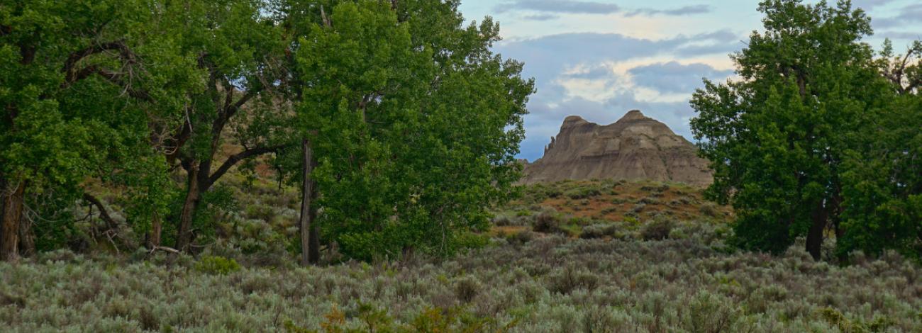
The Woodhawk WSA is on the south side of the Missouri River in a very rugged portion of the Missouri Breaks. South facing slopes consist of bare, banded clay and soil layers supporting a shortgrass prairie. Juniper and ponderosa pine also are present. Exposed colorful rock in the breaks topography is sedimentary shales and sandstones. The Missouri River cut deeply into the soft sedimentary rock forming numerous steep hills and deep coulees. River floaters camp in the area.
Visitation
From Winifred, MT, take the Stafford Ferry Road east (where pavement turns 90 deg west, turn east on a gravel road - sign says to Stafford Ferry, 16 mi). Just short of 2 miles, turn right at an intersection that identifies distance to the numerous ranches in the area. This road is signed as a BLM Backcountry Byway. In 3 more miles, turn right on the road named “DY Trail” (the road is signed with a small white sign on the left). In about 22 more miles, following the DY trail through many 90 degree turns, turn left on the road to the Woodhawk Bottom Rec Area. The WSA is on the left side of this road for four miles (the road ends at a small campground and boat launch).
Visitor Advisory
The DY Trail is gravel, but the road to Woodhawk Bottom Rec Area is not. This road could be impassible when muddy.