
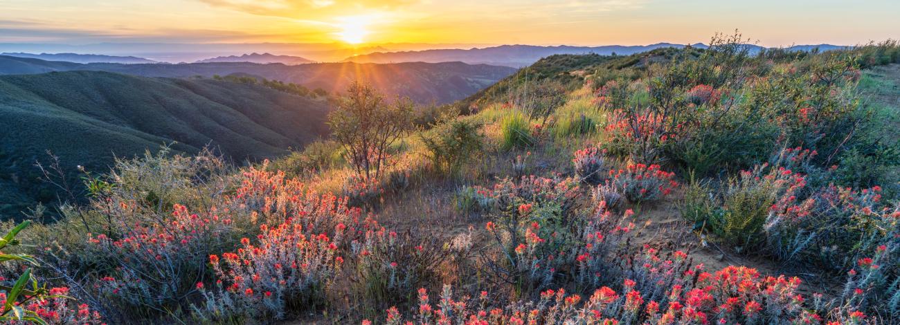
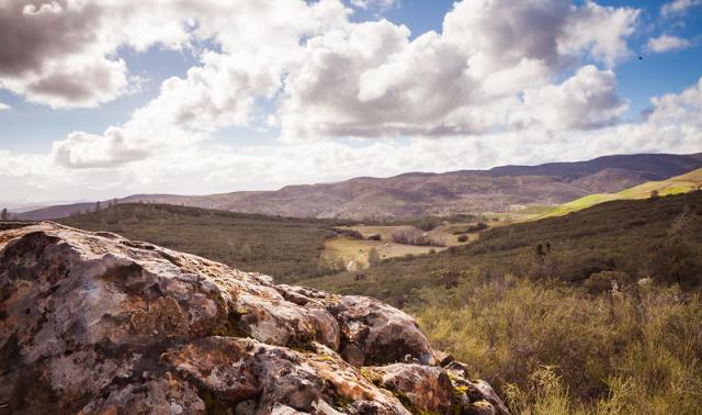
Berryessa Snow Mountain National Monument
Public lands managed by the Bureau of Land Management and Forest Service in the Berryessa Snow Mountain National Monument are some of the most scenic and biologically diverse landscapes in northern California. They range from rolling, oak-studded hillsides to steep creek canyons and ridgelines with expansive views.
Surrounding the farms, ranches and orchards in a region stretching from Napa County to the mountains of the Mendocino National Forest north of Clear Lake, these lands provide valuable wildlife habitat, lands critical for scientific study and recreational opportunities for residents of the region and beyond.
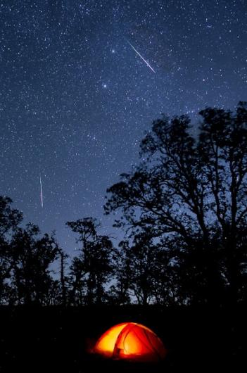
The monument is within easy driving distance for residents of the San Francisco Bay Area, the Sacramento Metropolitan region and expanding communities of the North Bay Area including Santa Rosa.
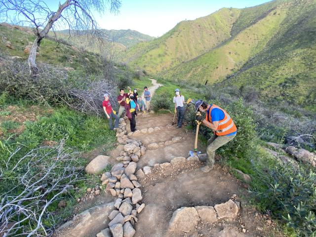
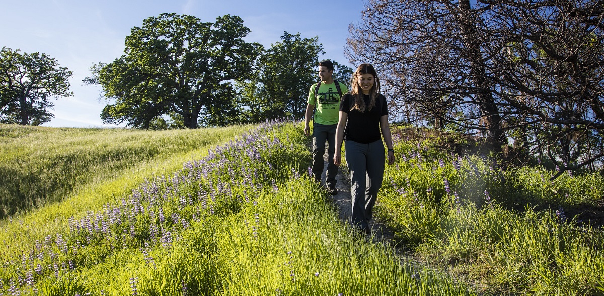
On BLM-managed lands, area residents and visitors can explore monument lands by hiking on trails in the Cache Creek Wilderness, rafting the white water of Cache Creek, boating in to the secluded Cedar Roughs Wilderness, or traveling the rugged terrain of the Knoxville Recreation Area in their four-wheel-drive vehicles, motorcycles or all-terrain vehicles.
A closer look at these public lands will reveal an intricate world of plants, animals and insects that have adapted to thrive in harsh and rocky serpentine soils. These greenish-gray-colored soils lack essential nutrients needed by most plants. To survive these soils, plants must tolerate drought, exposure to heavy metals and full sun. For years, scientists have studied conditions on BLM-managed lands within the Berryessa Snow Mountain National Monument to improve their understanding of these habitats and the specially adapted plants.
-
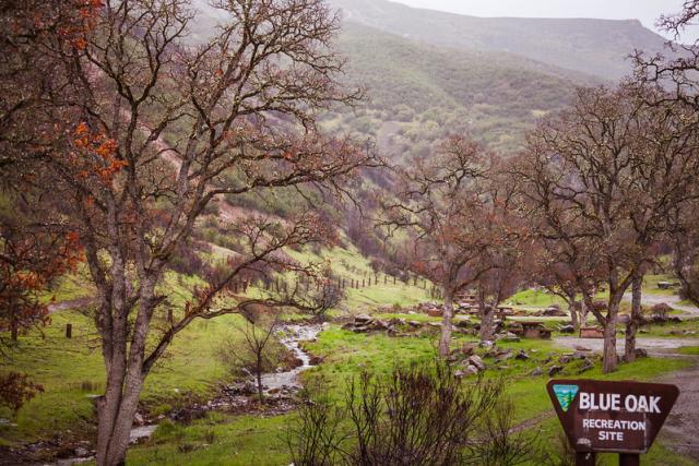
Deer Valley, Penny Pines & Middle Creek
-
Sites within Deer Valley, Penny Pines & Middle Creek are managed by the U.S. Forest Service’s Mendocino National Forest office.
Name
Facilities
Camping, OHV, hiking
Camping
Camping
Camping
Camping
Camping
Trailhead
Day-use area
Camping, OHV
Camping, OHV
Day-use area, OHV
Fuller Grove
Boating, boat launch
Pillsbury Pines
Boating, boat launch
-
Letts Lake & Stony Creek
-
Sites within Letts Lake & Stony Creek are managed by the U.S. Forest Service’s Mendocino National Forest office.
Name
Facilities
Cedar Camp
OHV
Camping
Black Oak
Camping
Green Flat
Camping
Wilson Camp
Camping
Pacific Ridge
Camping
Day-use area, OHV
Camping, OHV
Camping
OHV
Camping, OHV
Davis Flat
OHV
Fouts
OHV
Mill Creek
OHV
Boating, Fishing
North Fuller
OHV
South Fuller
OHV
Day-use area
Camping
Camping, OHV
Camping, OHV
-
Snow Mountain Wilderness
-
Sites within Snow Mountain Wilderness are managed by the U.S. Forest Service’s Mendocino National Forest office.
Name
Facilities
Camping, trail
Trailhead, camping
Camping
Trailhead
Camping, trailhead
Trailhead
Trailhead, camping
Trailhead
Copper Butte Trailhead
Trailhead
Skeleton Glade Trailhead
Trailhead
Bloody Rock Trailhead
Trailhead
Trailhead
Trailhead
Waterfall Loop
Trail
Overlook Trail
Trail
East Peak Trail
Trail
Milk Ranch Loop
Trail
East Peak Access
Trail
West Peak Access
Trail
-
Indian Valley Management Area
-
Sites within Indian Valley Management Area are managed by the Bureau of Land Management Ukiah Field Office.
Name
Facilities
Blue Oaks Campground
Camping
Kowalski Camp
Camping (boat/foot access)
Wintun Camp
Camping
Indian Creek Bridge
Trail (foot/equestrian access)
-
Cache Creek Natural Area & Cache Creek Wilderness
-
Sites within Cache Creek Natural Area & Cache Creek Wilderness are managed by the Bureau of Land Management Ukiah Field Office.
Name
Facilities
Redbud Trailhead
Trailhead (CDFW Cache Creek Unit)
Redbud Trail
Trail
Judge Davis Trailhead
Trailhead, trail (CDFW Harley Gulch Unit access)
Perkins Creek Ridge Trailhead
Trailhead, trail
Blue Ridge Trail
Trail
Fisk Creek Trail
Trail
Frog Pond Trail
Trail
Brushy Skyhigh Trail
Trail
Cache Creek Ridge Trail
Trail, spur trails #1 - #4
Buck Island
Trailhead
Roadkill Café Loop Trail
Trail
Lynch Canyon Trailhead
Trailhead
Old Wagon Road
Trail
Thompson Canyon
Trail, spur trail
High Bridge Trailhead
Trailhead
Hidden Pond Trail
Trail
Dunfield Springs Trail
Trail
Cowboy Camp
Trailhead, camping
-
Knoxville Management Area
-
Sites within Knoxville Management Area are managed by the Bureau of Land Management Ukiah Field Office.
Name
Facilities
Northern Staging Area
OHV staging area
Hunting Creek Road
OHV
Hunting Creek Campground
Camping
Hunting Creek Trail (Trail #30)
OHV
Cement Creek Campground
Camping
Trails #1 - #29 and #31- #34
OHV
Round Mountain Road
OHV
Old Mine Road (Trail #35)
OHV
Pocock Creek Loop (Trail #36)
OHV
Adams Ridge
OHV (open to all vehicles for deer season)
Cedar Creek Road
OHV
Devilhead Road
OHV
Dunnigan Hill Road
OHV
Painted Rocks Trail
Trail
-
Berryessa Peak & Stebbins Cold Canyon
-
Sites within Berryessa Peak & Stebbins Cold Canyon are managed by the Bureau of Land Management Ukiah Field Office.
Name
Facilities
Trail (CDFW Putah Creek Wildlife Area and University of California at Davis access)
Trail (CDFW Putah Creek Wildlife Area and University of California at Davis access)
Trail (CDFW Putah Creek Wildlife Area and Tuleyome access)
Trail (CDFW Knoxville Wildlife Area access)
-
Cedar Roughs Wilderness
-
Sites within Cedar Roughs Wilderness are managed by the Bureau of Land Management Ukiah Field Office.
The Cedar Roughs Wilderness has no developed recreational facilities.
Quick Facts
Proclamation
Created: July 10, 2015
Expanded: May 2, 2024 by Proclamation 10745 (Notice and Map)
Size: 344,476 acres of public land Bureau of Land Management acres: 147,262 U.S. Forest Service acres: 197,214
Fire Restrictions and Weather Closures
For updates, a complete list of restrictions, including an interactive map, please visit:
Quick Links
Plan Your Visit
- Download a Map and Recreation Guide
- National Monument Map
- Interactive BLM Recreation Map
- Interactive U.S. Forest Service Map
- Mendocino National Forest Maps
- Activities for Youth
Planning
- BLM ePlanning
- Mendocino National Forest Monument Planning
- U.S. Forest Service Schedule of Proposed Actions (SOPA)
Partners
- Mendocino National Forest
- Cache Creek Wildlife Area
- Knoxville Wildlife Area
- Bureau of Reclamation
- UC Davis Natural Reserves
- Putah Creek Wildlife Area
- Lake County
- Yolo County Parks
- California State Parks
Managers Reports
Get Involved
- Propose a new project or event at the monument.
- Berryessa Snow Mountain National Monument Stakeholders Guide
Flickr Album
