
Knoxville Management Area | California
Effective Friday, June 5, 2026, the BLM Ukiah Field Office issued an updated Fire Prevention Order due to increased wildland fire danger. Target shooting is prohibited. For specific questions, please contact the Ukiah Field Office at (707) 468-4000. Fire Prevention Order
For a full list of restrictions, please visit the BLM California fire restrictions page.
State of California campfire permits are available for free at all BLM, USFS and CAL FIRE offices or at https://www.readyforwildfire.org/prevent-wildfire/campfire-safety/.
The California State Parks OHV Preliminary Grant Applications, submitted by the BLM Ukiah Field Office, will be open for public review from March 3, 2026, to May 4, 2026. To provide your comments, visit the CA State Parks website and for the Agency field click on "BLM-Ukiah Field Office
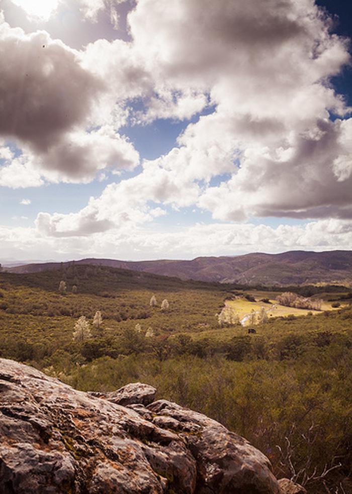
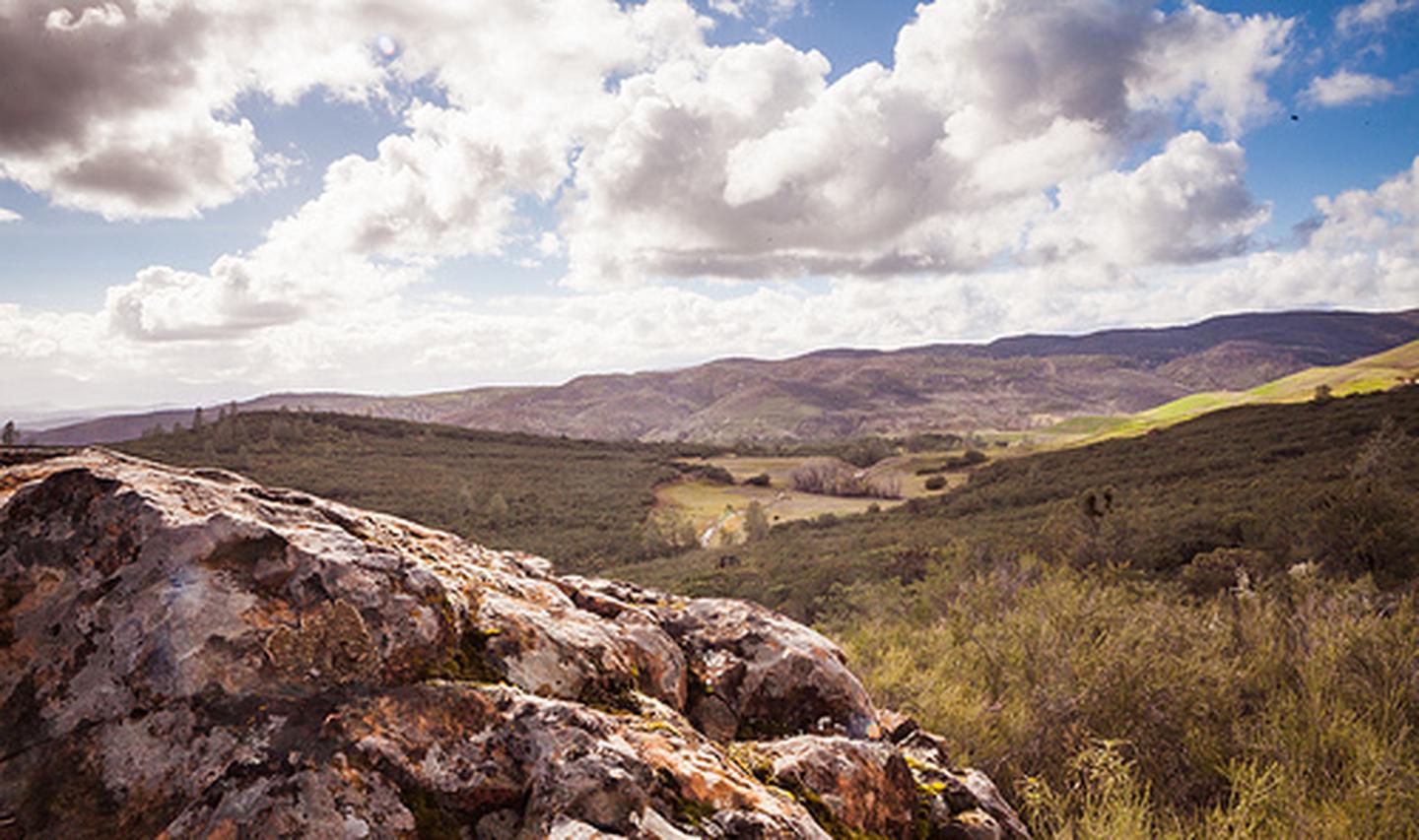
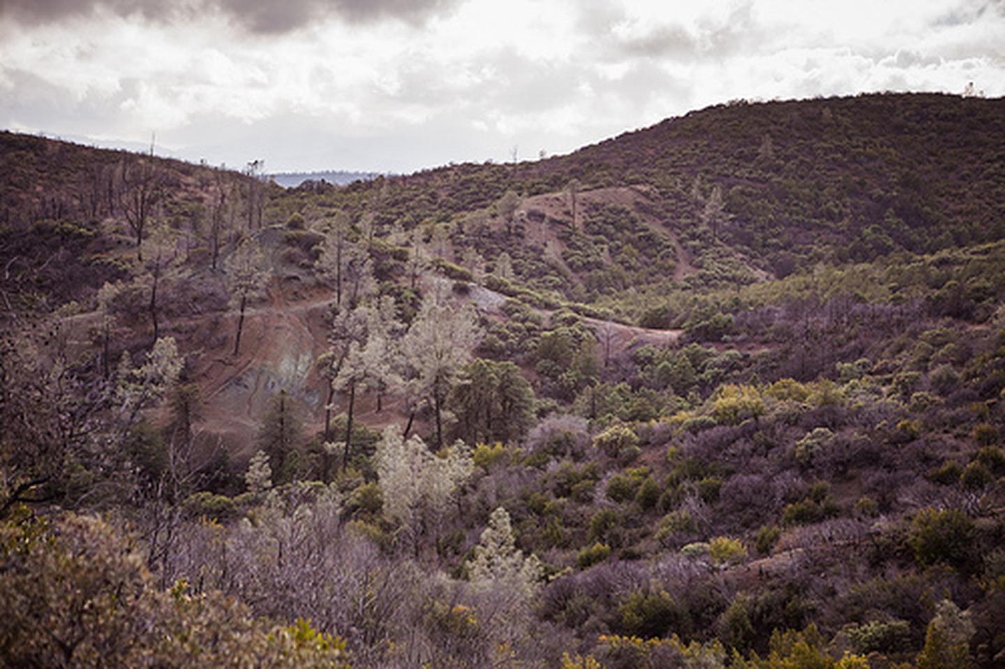
Due to its close proximity to the Sacramento and San Francisco Bay Area regions, and because of its varied terrain, Knoxville's 17,700 acres attract many off-highway vehicle (OHV) enthusiasts each year. The landscape is characterized by steep and rolling hills with the vegetation varying from scattered hardwoods and grasses to dense chaparral brush. California gray pine and Macnab cypress are also dispersed throughout the area. Of particular note, are unusual plant communities unique to the area's serpentine barrens, which are closed to vehicles to protect the delicate vegetation.
Other popular activities in the area include hunting, mountain bicycling, camping, and nature study. There is one developed campground, and an OHV staging area. Target shooting is not allowed at the Knoxville Recreation Area.
Knoxville Recreation Area is part of the Berryessa Snow Mountain Monument administered by BLM's Ukiah Field Office.
Camping
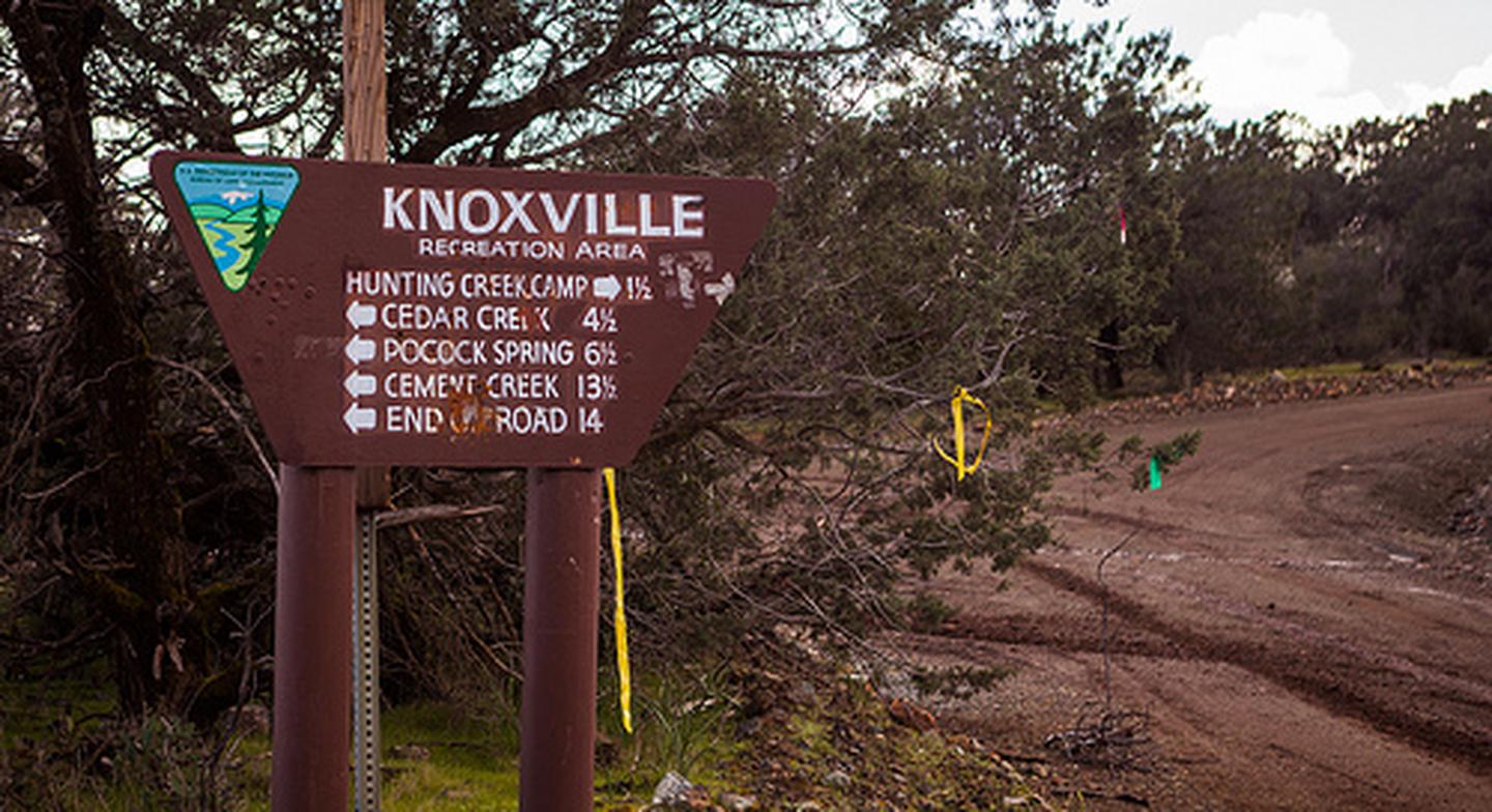
Lower Hunting Creek is located at the intersection of Dunnigan Hill Road and Hunting Creek Road at Hunting Creek, this developed campground has 5 sites with shade structures, vault toilet, trash cans, and 3 overflow campsites. There is no potable water at the site (bring your own drinking water). There are no fees and no reservations. Campsite availability is on a first-come, first-serve basis.
Cedar Creek, Cement Creek, and Pocock Creek are primitive camps with no facilities.
Firewood Gathering: Cutting or removing standing vegetation (live or dead), is strictly prohibited. Use only wood that is both dead AND down for firewood.
Off-Highway Vehicles
North OHV Staging Area: From north entrance take Dunnigan Hill Road approximately 3/4 mile to Round Mountain Road. Proceed west on Round Mountain Road approximately 1/4 mile to the staging area. Site has parking and vault toilet.
- All vehicles must be street licensed or have a current off-highway vehicle registration (green or red sticker)
- All vehicles must be equipped with a properly installed muffler and a U.S. Forest Service approved spark arrester.
- All-Terrain Vehicle (ATV) operators must wear a D.O.T. approved safety helmet. No operator of an all-terrain vehicle may carry a passenger when operating on public lands. However, the operator of an all-terrain vehicle, that is designed for operation off of the highway by an operator with no more than one passenger, may carry a passenger when operating on public lands. (CVC 38506).
- Please respect our neighbors and stay out of private land.
- All roads and trails in the area have two-way traffic. Be alert and always stay to the right-hand side.
- Please stay on designated trails. Avoid cutting switchbacks or driving through stream bottoms and wet meadows. Devilheads Road is a county road, therefore only street licensed vehicles are permitted.
- This area is open to hunting year round. Be extremely cautious when riding during peak hunting seasons.
Photos


Contact Us

Activities


Addresses
Directions
From the town of Lower Lake go east on Morgan Valley Road 13 miles to the north entrance to Knoxville at Dunnigan Hill Road (this access not recommended for two-wheel drive vehicles beyond Round Mountain Road). Continue three miles further on Morgan Valley Road for the south entrance to Knoxville at the intersection with Devilhead Road (southeast of the McLaughlin Mine crushing plant). There are BLM signs at both entrances. OR - From Napa, take the Lake Berryessa Road (hugs the west side of the lake). After crossing Putah Creek, it is approximately 17 miles to the Devilhead Road entrance, and 20 miles to the Dunnigan Hill Road entrance. OR - From St. Helena, take Pope Valley Road to Pope Creek Road. Take a left at the Lake Berryessa-Knoxville Road. It is approximately 17 miles to the Devilhead Road entrance, and 20 miles to the Dunnigan Hill Road entrance. CAUTION: There are 4-5 lower water crossings located on the Lake Berryessa-Knoxville Road north of Lake Berryessa that may restrict access to the Knoxville entrances from the south.
Fees
No Fees