
Monument map earns ‘finalist’ honors in global GIS awards
Happy GIS Day!
GIS (Geospatial Information System) maps are some of the most-appreciated tools in the Bureau of Land Management, especially when there’s one handy while traveling to unfamiliar, remote areas.
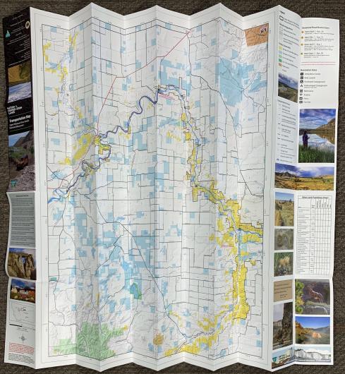
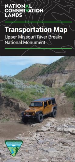
One such map featuring some of the most remote and rugged public lands in Montana – the BLM’s Upper Missouri River Breaks National Monument Transportation Map – earned high honors at the 2025 Esri User Conference.
Esri is the global market leader in geographic information system (GIS) software, location intelligence, and mapping. About 30,000 GIS professionals from around the world attended the July 2025 conference in San Diego, California (15K+ in-person; 14K+ virtually). More than 500 GIS products were submitted in 15 award categories and evaluated by top industry judges.
The UMRBNM Transportation Map was recognized as a finalist in the Reference Map category.
Abby Kirkaldie, a BLM North Central Montana District GIS specialist, created the map, a data-intensive project designed to be a 2-sided, printed visitor information product, which took about a year to complete.
“Competition for the Esri awards is steep, so being recognized as a finalist is a pretty big deal,” said Zane Fulbright, NCMD manager. “We’re fortunate to have Abby providing GIS services for our district. She has very high professional standards, and it shows in everything she produces.”
Kirkaldie shares credit for the Esri recognition with Larry Shoemaker, a 2020 GIS intern, who provided substantial data research contributing to the map project. She also worked closely with monument staff to include helpful tips, seasonal advisories and rules for visitors.
“Traveling in remote areas of the monument can be a challenge,” Fulbright added. “This map provides essential travel information for visitors that they wouldn’t be able to get from a typical highway map, like the primitive routes, remote recreation sites, national historic trails, and little-known airstrips, as well as the Missouri Breaks Back Country Byway.”
Printed copies of the Upper Missouri River Breaks National Monument Transportation Map are available for $10 each at North Central Montana District offices in Lewistown, Fort Benton, Havre, Malta and Glasgow.
Related Stories
- Preserving a Legacy in Stone: The Race to Save Pompeys Pillar
- BLM Billings Field Office Completes Dilworth Creek Riparian Restoration Project
- Boating Paradise: GAOA Funding Enhances Popular Recreation Site Along Montana’s Yellowstone River
- Commemorating 150 Years: The St. Patrick’s Day Fight Along the Powder River
- Snapped enamel and crushed bone: A Moment Frozen in Time