
Arches National Park
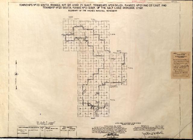
Hello and welcome to the Record of the Week! This week, the team travels to Arches National Park in Utah. The park, shaped by proclamations and laws signed by six presidents, became a national monument on April 12, 1929. It now spans more than 76,000 acres and features over 2000 natural arches, the highest density of natural arches in the world. Read more in ArcGIS Story Maps.
The GLO website provides live access to Federal land conveyance records for the Public Land States, including image access to more than 12 million federal land title records issued between 1788 and the present.
The site also hosts images of survey plats and field notes, land status records, and control document index records, and is one of the most visited websites in the Department of the Interior. Visit glorecords.blm.gov for more information.
Related Stories
- Freedom and Liberty Bring the Spirit of the West to Northern Virginia
- BLM Launches a Modernized General Land Office Records System
- Framed for Freedom: Bureau of Land Management Eastern States and the Legacy of National Historic Trails
- Safety Week 2026: Building Skills, Confidence, and a Stronger Safety Culture
- Strengthening Partnerships: BLM Connects with Industry at Key Oil and Gas Meetings in Ohio and Pennsylvania
Office
5275 Leesburg Pike
Falls Church, VA 22041
United States