
Anchorage Field Office installs permafrost monitoring stations along Iditarod National Historic Trail
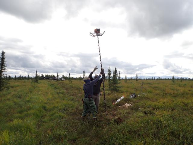
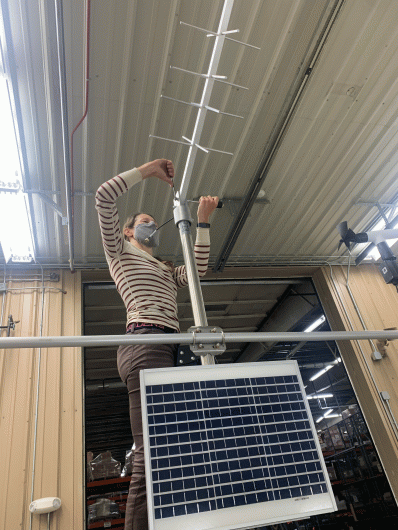
BLM Anchorage Field Office staff, assisted by Geo-watersheds Scientific, recently installed two new soil temperature monitoring stations along the Iditarod National Historic Trail (INHT). The stations are located in a part of the state that previously had poor coverage from the existing permafrost and climate monitoring networks. Data from the new stations will help the Bureau understand conditions of the trail and how the trail is affecting underlying permafrost.
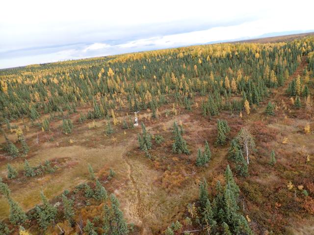
The INHT is a 2,400-mile winter‐use only gold rush era trail established in the early 20th century that connects Seward and Nome via remote interior Alaska. Much of the trail travels through regions that are underlain by permafrost, often over wetlands impassable in summer conditions. Permafrost is ground that remains at or below 0° C (32° F) for at least two consecutive years and is found beneath nearly 85 percent of Alaska. Global warming has resulted in rising permafrost temperature and areas of thaw. Thawing of permafrost destabilizes the ground above it, causing soil slumping and mass wasting events. Each station measures soil temperature to approximately 3 meters below ground surface at 13 different depths. They take these 13 measurements in both the trail treadway and an adjacent undisturbed location. Additionally, they collect all climate parameters standard for a Remote Area Weather Station.
BLM National Historic Trail Administrator, Kevin Keeler, has observed over the past decade that even though trail use is limited to wintertime travel, significant soil slumping and compaction is present, and vegetation is noticeably altered within the treadway. “These conditions may be due to permafrost degradation, loss of insulating vegetation, or other altered soil temperature regimes in the treadway of the trail,” said Keeler.
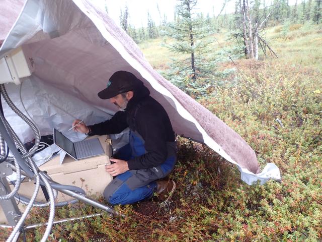
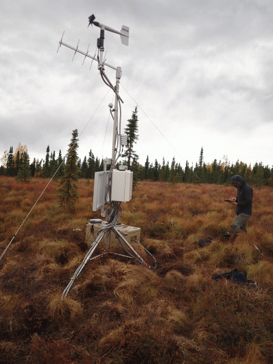
Data from each station are transmitted hourly via satellite telemetry and will soon be accessible on a public website, making it available to answer the questions of a wide group of researchers across Alaska and the global permafrost research community. Station data can be included in future state and global permafrost modeling updates and model validation conducted by research institutions such as the University of Alaska Fairbanks Geophysical Institute.
Related Stories
- Birding Aravaipa Canyon: A morning of songs, color, and creekside adventure
- BLM, Partners Enhance Public Access at Popular Recreation Area
- BLM Celebrates America’s 250th Anniversary in Oregon
- Framed for Freedom: Bureau of Land Management Eastern States and the Legacy of National Historic Trails
- Reel Partners: BLM and Wyoming Game and Fish Cast a Line for Kemmerer’s Next Generation
Office
222 W 7th Avenue #13
Anchorage, AK 99513
United States