
Manassas Battlefield National Park
This week the GLO team visits Manassas Battlefield National Park located in Prince William County, Virginia. Join us as we digitally explore this historic national park and physically embark on a quest to find public land survey monuments located at the battlefield.
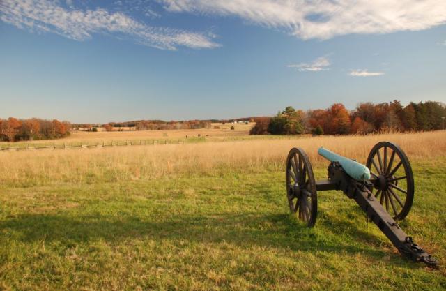
Manassas Battlefield National Park is located in Northern Virginia and consists of approximately 5,000 acres of land, trails, creeks, buildings, and historic markers. The location proved pivotal during the Civil War with two key battles taking place there, the First Battle of Manassas, or First Bull Run, and the Second Battle of Manassas, or Second Bull Run. The battlefield became a national park in 1940 and was listed on the National Register of Historic Places in 1966. The park is free to the public and provides a wealth of opportunities for visitors looking to explore history and enjoy nature. Read more on ArcGIS Story Maps.
The GLO web site provides live access to Federal land conveyance records for the Public Land States, including image access to more than 12 million Federal land title records issued between 1788 and the present.
The site also hosts images of survey plats and field notes, land status records, and control document index records, and is the most visited website in the Department of the Interior. Visit glorecords.blm.gov for more information.
Related Stories
- Strengthening Partnerships: BLM Connects with Industry at Key Oil and Gas Meetings in Ohio and Pennsylvania
- Successful Wild Horse & Burro Placement Event Draws National Interest in Liberty, Kentucky
- Great American Clean Up Brings Accessibility, Stewardship, and Community Together at the Jupiter Inlet Lighthouse ONA
- Where Art Meets Conservation: Students Shine in 2026-2027 Junior Duck Stamp Competition
- Placing Wild Horses and Burros East of the Mississippi, Supporting Healthy Herds and Public Lands in the West
Office
5275 Leesburg Pike
Falls Church, VA 22041
United States