
BLM-ES GLO team joins Esri FedGIS Conference
The BLM-Eastern States General Land Office (GLO) team members exhibited at the Esri Federal Geographic Information Systems (GIS) Conference at Walter E. Washington Convention Center in Washington, D.C., February 11-12, 2020. The purpose of the conference was to share the use of GIS in the Federal Government.

The Esri FedGIS Conference Hall
The conference was attended by more than 5,000 Federal Government employees; residents of the Washington, D.C., Metropolitan Area; and attendees from different states. Key speakers included: Jack Dangermond, Esri Founder; Dr. Healy Hamilton, Chief Scientist of “NatureServe;” Vice Admiral Robert D. Sharp, Director of the National Geospatial-Intelligence Agency; and featured speakers from the U.S. Department of Agriculture (USDA), U.S. Environmental Protection Agency, U.S. Census Bureau, and YMCA. Each key speaker explained the benefits of GIS to their organization, as well as Esri’s commitment to providing government agencies with guiding-edge tools to support the U.S. economy.
GLO Team Members: Daniel Fleming, Branch Chief of GLO Records Automation; Kelsey Combs, Legal Instruments Examiner; Joe Cullinan, GIS Specialist; Chad Ennis, GIS Specialist; Ryan Tietjen, GIS Manager; Andrea Israel, Cadastral Survey Clerk; and Kenneth Roy, Land Surveyor, interacted with conference attendees, sharing information with visitors on the GLO Story Map “Record of the Week” and the GLO website where the public can look up sought-after land records.
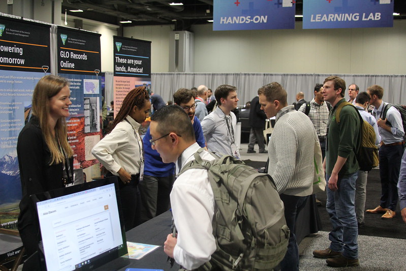
Kelsey Combs, Andrea Israel, Daniel Sharareh, and Chad Ennis informing attendees of GLO's services.
The conference was followed by an ArcGIS Story Map presentation that included speakers: Daniel Fleming, Kelsey Combs, and Ryan Tietjen; GLO Team Members Allen Carroll and Michelle Thomas; Esri Representatives; and Elizabeth Creech, Public Affairs Specialist for the U.S. Department of Agriculture Farm Production and Conservation Business Center. Allen Carroll and Michelle Thomas lead the presentation by sharing a detailed description of a story map, it’s benefits, how to create a story map, and where the public can view a story map. “If I can create a story map project, you can too,” Michelle said.
The presentation was then followed by the GLO Team Members who presented their “Record of the Week” story map that features unique records from the General Land Office. They each shared information on the process of creating a “Record of the Week” story map project, getting it reviewed by the BLM-Eastern States External Affairs Division, and sending it to the National Operations Center for public distribution. Elizabeth Creech concluded the presentation by sharing her USDA story map project “Farming for the Future,” which features the greatest challenges in farming and planning for the future of farming.
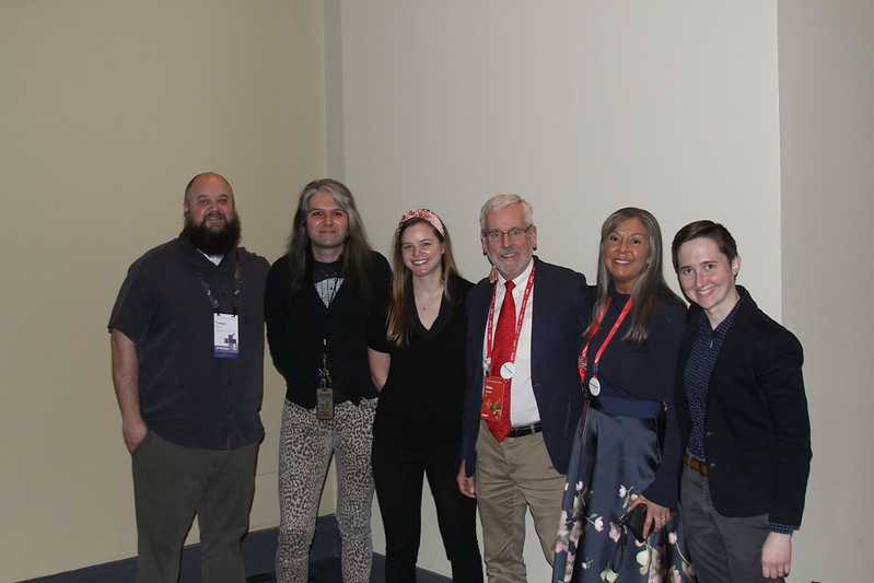
BLM Eastern States, USDA, and Esri speakers from left to right: Ryan Tietjen , GIS Manager of BLM-ES; Daniel Fleming, Branch Chief of GLO Records Automation; Kelsey Combs, Legal Instruments Examiner; Allen Carroll, Esri Representative; Michelle Thomas, Lead Web Producer of Esri; and Elizabeth Creech, Public Affairs Specialist of USDA's Farm, Production, and Conservation Business Center.
Throughout the conference, the audience was very engaged with the topics covered from each speaker and the GLO exhibit booth. Public Affairs Specialist of the BLM-Eastern States External Affairs Division, Tatiana “Ashley” Muriel Luna was very satisfied with the event as well. "The interaction between all of the EsriFedGIS users creates a modern and resilient environment. The way we now use data and navigation in technology is really uplifting and develops an outstanding analytical future," Ashley said.
See all of GLO Branch “Record of the Week” here and view pictures of the Esri FedGIS Conference on BLM-ES Flickr album
Related Stories
- BLM Launches a Modernized General Land Office Records System
- Framed for Freedom: Bureau of Land Management Eastern States and the Legacy of National Historic Trails
- Safety Week 2026: Building Skills, Confidence, and a Stronger Safety Culture
- Strengthening Partnerships: BLM Connects with Industry at Key Oil and Gas Meetings in Ohio and Pennsylvania
- Successful Wild Horse & Burro Placement Event Draws National Interest in Liberty, Kentucky
Office
5275 Leesburg Pike
Falls Church, VA 22041
United States