
Good Information, Good Decisions
Partnership collects and refines data for plant communities and Rangeland Health attributes
Story by Josh Sorlie, Soil Scientist, Malta Field Office
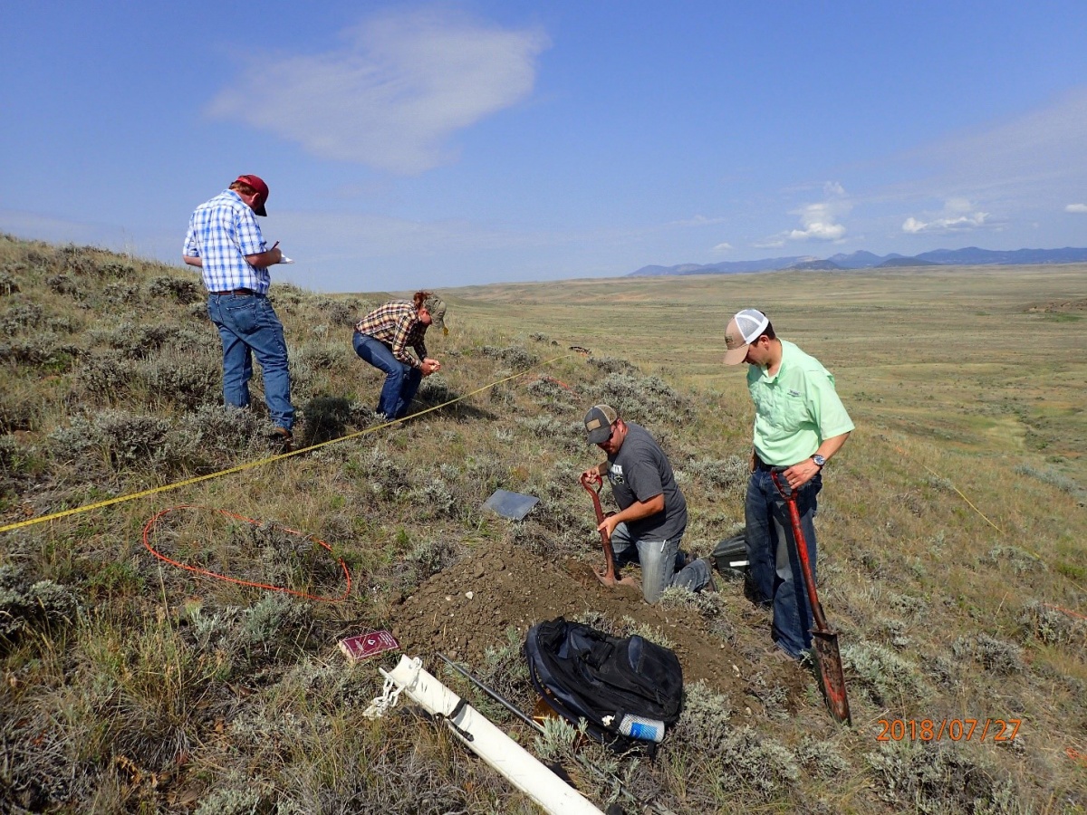
Pictured from left to right: Mathew Stanfield Mandy
Holmes, Josh Sorlie - BLM, Luis Alvarez - NRCS.
Photo taken by: Jeremy McKeller - BLM.
Managing complex resources across thousands of acres is no small task. The sheer number of variables are challenging enough, but what if the underlying data is unreliable?
The BLM North Central Montana District and USDA Natural Resources Conservation Service (NRCS) have partnered to collect and refine data for plant communities and Rangeland Health Attributes within the 52XC – Central Glaciated Plains Major Land Resources Area (MLRA) in central Montana. That information will be used to revise Ecological Site Descriptions (ESDs) and Rangeland Health Reference Sheets (RHRSs) which are the underlying standard for Rangeland Health, Greater Sage-grouse Habitat Assessments and Restoration, Burned Area Rehabilitation, and Reclamation.
BLM first approached NRCS in 2009 after having strong concerns with the expected plant communities described in some ESDs and associated RHRSs.
NRCS agreed to take a hard look into BLM concerns, which resulted in the creation of a technical team consisting of specialists from BLM, NRCS and the Montana Natural Heritage Program. Funding was provided by BLM through an Interagency Agreement.

Photo by NRCS
Intense soil and vegetation data collection was conducted during the summers of 2012-2014. The BLM also provided field data that has been collected over the past several decades. Through the process of data collection/assemblage and collective expert knowledge, 64 Provisional ESDs were completed by NRCS and reviewed by BLM in 2018. Also, an MLRA 52 specific Ecological Site Key was developed, which guides a user in identifying Ecological Sites, the basic component of a land-type classification system.
The focus of this past summer’s field season was sampling and collecting data for revising 10 RHRSs at 30 different sites. Soil and vegetation data was collected for the 17 Indicators of Rangeland Health. Soil profiles were described and each soil horizon was sampled for lab analysis. All together 119 horizons were described and sampled. Vegetation data collection methodologies included: Line-point intercept, and herbaceous and shrub production plots.
BLM plans to continue the partnership with NRCS to revise/improve ESDs and RHRSs into the future.
Thank you goes out to Mike Philbin, Alden Shallcross, and Floyd Thompson (BLM - Montana/Dakotas State Office) for their continued support and funding of this project. Also, the BLM would like to recognize Scott Brady and Stuart Veith (NRCS - Havre MLRA Soil Survey Office) for their efforts of going above and beyond.
Related Stories
- Preserving a Legacy in Stone: The Race to Save Pompeys Pillar
- BLM Billings Field Office Completes Dilworth Creek Riparian Restoration Project
- Boating Paradise: GAOA Funding Enhances Popular Recreation Site Along Montana’s Yellowstone River
- BLM California uses targeted grazing to manage invasive weeds in the Sacramento River Bend area
- Commemorating 150 Years: The St. Patrick’s Day Fight Along the Powder River