
Where's the Water?
Alden Shallcross, Program lead for Soil, Water, Air and Riparian, Montana/Dakotas State Office
One of the BLM’s responsibilities is to ensure that sufficient water is both available and clean enough to meet the bureau’s multiple use mandates.
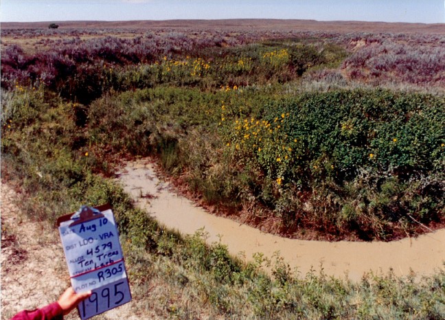
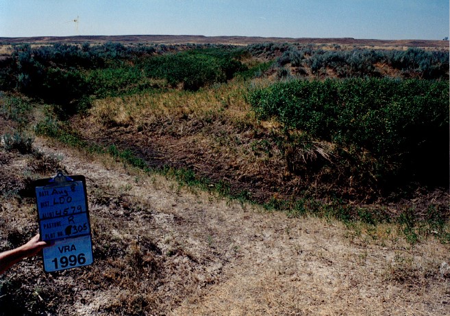
Since many resource allocation and management decisions rely on water (i.e. livestock grazing, fish/aquatic habitat management, water rights management, etc.), accurate estimates of flow permanence (when, where, and for how long water flows) are needed to optimize the corresponding management alternatives. Unfortunately, the most complete flow permanence data set currently available is static, sometimes outdated, and has misclassification rates as high as 50 percent.
This information gap limits the BLM’s ability to incorporate such data into resource management decisions (i.e. establish grazing rotations for wet/dry years; prioritize locations and dates for water augmentation projects; improve alignment between water rights and physical water availability, evaluate the applicability of oil & gas stipulations for streams within a lease parcel, etc.).
Consequently, there is a need for up-to-date flow permanence classifications that reflect both average conditions as well as the year-to-year changes across larger extents and at multiple scales.
In response, BLM Montana/Dakotas Soil, Water, Air, and Riparian Program Lead Alden Shallcross has partnered with researchers at the U.S. Geological Survey’s Water Science Center to estimate flow permanence for all streams in watersheds managed by the Montana/Dakotas field offices via the recently developed PRObability of Streamflow PERmanence (PROSPER) model.
This project will use geospatial data, satellite measurements, field observations and robust statistical analysis to update predictions of annual flow permanence. Model outputs will include sub-reach (30m) scale predictions of the annual probability of flow permanence for every stream segment in the study area, as well as estimates for the timing and duration of flow/no flow conditions (i.e. hydroperiod). These efforts will be completed in three stages.
Phase 1: Expand the PROSPER model to streams in and around surface estate managed by the BLM’s Montana/Dakotas Field Offices.
Streamflow permanence observations from multiple agencies within the study area will be aggregated into a single dataset and used to calibrate the streamflow permanence model.
Data sources will include habitat surveys, riparian assessments, aquatic sampling efforts, stream temperature monitoring efforts, and other projects that have a record of wet and dry stream status. Phase one also will involve investigating and determining important causal mechanisms that drive flow permanence in the study area, and representing those mechanisms with geospatial data that will be used as explanatory variables in the expanded model.
During this phase, the modeled probabilities of streamflow permanence will be appended to the National Hydrography Dataset to help improve the classification of perennial, intermittent, and ephemeral streams
.
This information will help resource specialists with assessments, monitoring, projects, and planning. For example, how stable are perennial or non-perennial streams from year to year in a given watershed OR how are climatic trends likely to affect fish habitat in an area of interest?
Phase 2: Estimate hydroperiod of streams (i.e. if a stream is not perennial, when is it expected to be wet or dry?)
The objective of phase two is to identify, at a sub-reach scale, a general window of time (e.g. months) during the year when stream reaches would be expected to be dry or wet.
Since this methodology is new, pilot basins will be selected based on A) the availability of hydrologic model data and streamflow permanence observations, B) representation of major hydrologic conditions in the study area, and C) the amount of BLM-managed surface estate.
Phase 3: Develop a computing platform for making semi-annual predictions of streamflow permanence, based on current and antecedent hydroclimatic conditions (i.e. when, where, and for how long will water be in our streams during the current year).
These tools will enable BLM’s resource managers to make adaptive management decisions for an upcoming year, based on projected probabilities of flow permanence and hydroperiod. The tools will be run through a cloud-based environment that will update the remote sensing and geospatial data inputs, re-run the corresponding model, and output the predictions for use by the BLM and our partners. These predictions will be especially helpful for drought management.
Related Stories
- Meet Dashiell Gould Lagoyda, fisheries biologist intern at the Safford Field Office
- Celebrating Endangered Species Day: Restoring the Rare MacFarlane’s Four O’Clock
- Growing Resilience from the Ground Up at the Jupiter Inlet Lighthouse ONA
- Commemorating 150 Years: The St. Patrick’s Day Fight Along the Powder River
- BLM Colorado water rights specialist wins Riparian Hero Award