Dingell Act Priority Access Biennial Report
2022 Summary of BLM Priority Access List Parcels and Acreages by BLM State Office
State Office | Total # Parcels on Priority Access List | # BLM Nominated Parcels | # Public Nominated Parcels | # Legally Inaccessible Acres | # Significantly Restricted Acres | |
|---|---|---|---|---|---|---|
AZ | 72 | 23 | 49 | 136,634 | 335,660 | |
CA | 7 | 6 | 1 | 7,888 | 26,870 | |
CO | 137 | 127 | 10 | 88,571 | 886,309 | |
ID | 167 | 135 | 32 | 350,237 | 422,472 | |
MT/DK | 117 | 59 | 58 | 492,178 | 156,033 | |
NM | 26 | 8 | 18 | 34,616 | 63,669 | |
NV | 8 | 1 | 7 | 77,155 | 27,449 | |
OR/WA | 67 | 26 | 41 | 93,059 | 107,695 | |
UT | 18 | 14 | 4 | 84,060 | 14,247 | |
WY | 202 | 54 | 148 | 411,793 | 400,595 | |
Totals | 821 | 453 | 368 | 1,776,191 | 2,440,999 | |
Public Engagement and Priority Access Parcel Nomination Process and Requirements
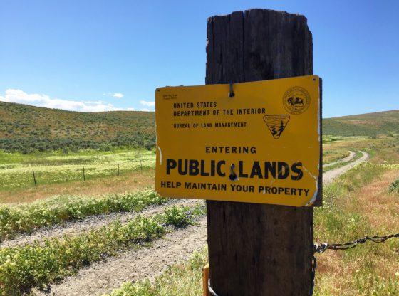
: The BLM held a 30-day comment period from Aug. 1-30, 2024, for the third round of public nominations to identify public lands of at least 640 contiguous acres, where legal public access is either non-existent (legally inaccessible) or significantly restricted for recreational purposes such as hunting and fishing (press release). Nominated lands must be open for recreation consistent with existing land use and travel management plans. A total of 502 new nominations were received in 2024 and are being evaluated for the public access list.
All lands nominated for inclusion on the BLM’s priority access list must be managed by the BLM, encompass at least 640 contiguous acres, and have significantly restricted or no public access. BLM must also consider the likelihood of resolving identified access issues when determining whether to include parcels on the list. Valid nominations must include the location of the nominated land or parcel, total acreage affected (if known), a description or narrative describing the lack of access, and any additional information the BLM should consider when determining if the land should be on BLM’s priority access list. The BLM will not include any personal identifying information concerning owners or ownership of any parcels in preparing the priority list or related congressional reports.
This effort advances a primary goal of the Dingell Act (S. 47), which was signed into law in March 2019. Section 4105 of the Act directs the BLM to develop a priority access list. Implementing the Dingell Act will continue the BLM’s mission to support multiple uses for public land, and to strike a balance for land and resources management, increase access for hunting, fishing, and recreation, and create economic prosperity while protecting and preserving America’s treasures.
How the Priority Access List Data Will be Used
Improving access to public lands requires effective collaboration with tribal governments, state and federal agencies, outdoor recreation stakeholders, conservation partners, and private landowners. Close coordination and dedicated resources across multiple BLM programs are also required to identify opportunities and facilitate execution of administrative priorities. BLM headquarters directorates are working collaboratively to improve national datasets and develop a national public lands access database to assist with identifying existing legal public access to BLM-managed public lands. The Dingell Act provides welcome emphasis to this ongoing effort. In accordance with the Act, the BLM will update the priority access list biennially and each time, will provide opportunities for the public to nominate parcels for the list.
The priority access list and maps will be used to help inform resource program planning and future land use decisions. The state offices were asked to rank the parcels on the list as either high, medium, or low priority to further describe the Bureau’s analysis of the parcels and the access requirements. The information will also be used to guide and to inform proposed acquisitions under the Land and Water Conservation Fund program, as funding becomes available. The BLM will continue to work collaboratively with partners, state and federal agencies, tribal governments, conservation organizations, recreation organizations, land trusts, industry, and willing landowners to acquire new or improved legal public access to the Nation’s public lands.
Example Priority Access Parcels
- Arizona
Telegraph Pass (Yuma Field Office)
740 acres legally inaccessible – In fiscal year 2020, the Telegraph Pass hiking trail saw 65,484 visits and 27,285 visitor days from hikers and local military base personnel that use the trail for squadron physical training endurance drills. Trail users must cross private lands to obtain access to the trailhead on BLM lands. Currently, the Marine Corps Air Station (MCAS) have a Special Recreation Permit for their annual event named “MCAS Yuma Annual Telegraph Pass Challenge.” Residential development is expanding eastward toward this area and may further restrict access to the popular hiking trail and public lands. Providing legal public access would require acquisition of an easement or fee title from a willing private landowner.
Northwest Aravaipa (Safford Field Office)
25,213 acres legally inaccessible – Private lands provide the only access to a significant portion of BLM lands that lie to the north of the Aravaipa Canyon Wilderness, as well as the western portion of the U.S. Forest Service (USFS) managed Santa Teresa Wilderness Area. The area is popular for a wide range of recreational activities, including hunting, fishing, hiking, camping, equestrian, and biking. BLM and USFS lands in the rugged and isolated Santa Teresa Mountains provide habitat for a wide variety of big game species and other native wildlife, including mule deer, mountain lions, black bear, and javelinas with vegetation ranging from lowland chaparral to Madrean pine-oak woodland, to ponderosa pine and Douglas fir at higher elevations. The area includes the Stowe Gulch drainage, an important riparian area in the arid desert and tributary of Aravaipa Creek, which is well-recognized as one of the best native fisheries in the Southwest. The creek sustains numerous threatened and endangered aquatic and terrestrial species. Improving public access would require acquisition of a new Federal right-of-way, or an easement or fee title from a willing private landowner.
Waterman Mountains (Ironwood Forest National Monument)
12,091 acres legally inaccessible – Priority access parcel includes Ironwood Forest National Monument lands intermingled with private property and Arizona State Trust lands. The Waterman Mountains provide outstanding backcountry recreation opportunities, including hunting, sightseeing, wildlife viewing, off highway vehicle (OHV) driving, mountain biking, and undeveloped camping. Waterman Peak is part of a scenic sky island mountain range with a unique assemblage of geologic formations and vegetation. A hiking trail provides access to Waterman Peak and panoramic views of the surrounding Sonoran Desert landscape. The area has no legal public access, which also constrains road maintenance. The area includes the Titan Missile Interpretive Site, developed cooperatively by the Davis Monthan Air Force Base and the BLM with an educational/interpretive path and signs about the area’s Cold War heritage at a decommissioned missile silo site. A demonstration revegetation/restoration site at a former quarry and airstrip showcases different restoration techniques and special designated management areas protect a listed cactus species, a relic population of desert big horn sheep, and Sonoran Desert Tortoise (sensitive species). Cave formations throughout the region also provide suitable habitats for bats. Providing legal public access would require acquisition of an easement, right-of-way, or fee title from either State or Tribal governments or a willing private landowner.
Peloncillo Mountains Wilderness (Safford Field Office)
44,567 acres significantly restricted – The Peloncillo Mountains Wilderness and adjacent BLM-managed lands are in southeast Arizona. Legal access to these public lands is currently restricted by private lands at the southeastern wilderness boundary near Little Doubtful Canyon and the western wilderness boundary near Indian Springs Canyon. Improved access to BLM lands would increase recreational opportunities in the wilderness area for hunting, backpacking, backcountry camping, equestrian use, and sightseeing. The area is comprised of a mix of BLM-managed and privately-owned lands, with Arizona State Trust Lands located to the north, between the wilderness and US Highway 70. Lands in the Peloncillo Mountains Wilderness feature steep mountains, cliffs, and numerous oak-lined canyons that provide habitat for diverse wildlife, including cottontail rabbit, blacktailed jackrabbit, bobcat, coyote, quail, dove, amphibians, and reptiles. Big game species include mule deer, mountain lion, desert bighorn sheep, and javelina. The area includes suitable habitat for several BLM sensitive species including the lesser long-nosed bat, California leaf-nosed bat, Mexican long-tongued bat, peregrine falcon, ferruginous hawk, Loggerhead shrike, and Texas horned lizard. The area also provides migration corridor connectivity for federally listed threatened and endangered species, such as the jaguar and Mexican gray wolf. The Peloncillo Mountains also provide some of the last suitable habitat for the endangered New Mexico ridge-nosed rattlesnake. The area is rich in archeological resources, including the historic Butterfield Stage Route. Prehistoric remains include permanent habitation sites, cliff dwellings, food storage features, rock art sites, and single isolated artifacts. Contemporary use of the area has been identified by the San Carlos Apache Tribe, including the collection of medicinal plants and acorns, which are a traditional food item. Improving public access would require acquisition of a State or Federal right-of-way, or an easement or fee title from a willing private landowner.
- California
Elkhorn Ridge Wilderness Area (Arcata Field Office)
11,000 acres significantly restricted – Elkhorn Ridge Wilderness Area, designated in 2006 through the Northern California Coastal Wild Heritage Wilderness Act, borders Highway 101 approximately 10 miles northeast of Laytonville, California. This 11,000-acre area was protected for its late-successional old-growth stands of Douglas-fir and 8-mile-long federally designated Wild and Scenic segment of the South Fork Eel River, which supports spawning, rearing, and migration for Chinook salmon, Coho salmon, and steelhead. This area has great potential for hunting and backpacking. Currently the sole public access point is an unpaved road that was acquired for timber hauling. It remains difficult to locate, approximately 30 miles to the east of the Laytonville population center, at the southern edge of the Wilderness Area. This access point leaves visitors two miles from any established trails and there is a 2,000-ft. elevation change between the access point and the Wild and Scenic River. An optional access located at the north end of the Wilderness Area lies adjacent to Highway 101 near the confluence of Rattlesnake Creek and the South Fork Eel River where there is only currently administrative access. This potential access would connect to a well-maintained trail system providing connectivity to the entire Wilderness Area and Wild and Scenic River corridor. Improving public access would require acquisition of an easement or fee title from a willing private landowner.
Dry Lakes Plateau (Bishop Field Office)
9,000 acres significantly restricted – The Dry Lakes Plateau is in the Bodie Hills within eastern Mono County, California. The area is predominantly public lands, interspersed with private lands that provide the main access to the area. Located within the Bodie Wilderness Study Area, the area provides outstanding opportunities for primitive, unconfined dispersed recreation including camping, hiking, backpacking, hunting, wildlife and wildflower viewing, and OHV touring. The Plateau is characterized by sagebrush steppe with seasonally flooded lakes and provides important habitat for an abundance of wildlife including Bi-State sage-grouse, migratory mule deer and pronghorn antelope, and a variety of migratory waterfowl, shorebirds, and neotropical birds. The Plateau is located within California’s prized X-12 deer hunting zone that provides a key access point to a self-sustaining wild trout fishery in Rough Creek. The area is rich in cultural resources and was listed on the National Register of Historic Places as an archaeological district for its vital role in Native lifeways. The area continues to be used for traditional religious practice by the Bridgeport Paiute Tribe who consider the area sacred. Evidence of the historic use of the Plateau by Basque sheepherders is present in the form of inscriptions in stone, arbor-glyphs, and drawings on historic water tanks. Cattle grazing continues to be an important use in the area. Improving public access would require acquisition of an easement or fee title from a willing private landowner.
Ivanpah Dry Lake East (Needles Field Office)
4,200 acres significantly restricted – Ivanpah Windsailing Special Recreation Management Area (SRMA) is a non-motorized recreational area used for all types of land sailors, from blow carts to experimental high-speed land yachts. The lakebed is also used for small hobby rockets (non-FAA required), disc throwing competitions, remote control airplanes, long-distance archery, photography, picnicking, human-powered aircraft, and an environmental education site. The dry lakebed is in California adjacent to the Nevada state line and consists of two Recreation Management Zones (RMZ) bisected by Interstate 15. Visitors access the area through Primm, Nevada. The smaller West Lake RMZ is used primarily by beginners and small family groups, while the larger East Lake RMZ is used for advanced windsailing events and large group sites. The world wind speed record has repeatedly been set at this location. The Ivanpah Dry Lake East is considered important, not just for its outstanding recreational opportunities, but also for the unique biological, cultural, and paleontological resources hidden beneath the hardened bajada surface. During flood season local wildlife gain access to much needed water. To protect the overall surface of the lakebed from heavy impact, motorized vehicle use is only approved along a delineated corridor on the outer shorelines of each lake. This area is within the Desert Renewable Energy Conservation Plan (DRECP)--a landscape-level plan that streamlines renewable energy development while conserving unique and valuable desert ecosystems and providing outdoor recreation opportunities. A management goal of the DRECP is to develop staging areas, restrooms, ramadas, picnic tables, and an all-weather access route adjacent to the lakebed playa. These current facilities and those yet to be developed will be installed to provide further protection of the lakebed, including custom gates to provide legal access to the area and minimize motor vehicle access across the lakebed to reduce illegal mudbogging activities. Improving public access would require acquisition of an easement or fee title from a willing private landowner.
Temblors Recreation Area (Bakersfield Field Office)
25,850 acres significantly restricted – The Temblors Recreation Area lies on the inland edge of the California Coast Ranges in eastern Kern County at the southern end of the Central Valley. Bordering the Carrizo Plain National Monument, the 50-mile-long, 3,700-foot-high ridgeline provides spectacular views of the Central Valley and Carrizo Plain. Spectacular wildflower blooms are often seen in the spring. The area has very diverse recreational opportunities, but very limited year-round accessibility. The area is accessible by rough single track and 4-wheel drive routes with limited parking. The Temblor Recreation Area contains over 200 miles of OHV trails, recreational shooting, hunting, wildlife viewing, mountain biking, and other dispersed forms of recreation. The area has also long been important for the livestock, oil and gas, and other industries. It serves as important habitat for a variety of species endemic to the San Joaquin Valley listed as threatened or endangered under the Endangered Species Act and is considered a habitat corridor within BLM’s Conserved Lands Area of Ecological Importance. Improving public access would require acquisition of an easement or fee title from a willing private landowner.
Berryessa Peak (Ukiah Field Office)
9,100 acres significantly restricted – Berryessa Peak is a prominent topographic feature and hiking destination within the Berryessa Snow Mountain National Monument. Public access is only available through cooperation with state and non-profit partners. The allowable uses within the Berryessa Peak project area include non-motorized use and mechanized use. Per the Ukiah Field Office Resource Management Plan (2006), no new recreational facilities can be developed on Berryessa Peak unless public access is available to the area. The BLM consults and works with 15 Native American tribes to provide responsible management of these lands. The Hill Patwin and nearby Lake Miwok inhabited seasonal camps and practiced traditional burning to promote a healthy landscape. Chaparral communities, oak woodlands, and riparian forests support blacktail deer, coyote, mountain lion, bobcat, and black bears. Migratory birds and the Townsend’s big-eared bat use the area for roosting and as a migratory corridor. The steep topography also provides excellent nesting habitat for raptors. Improving public access would require acquisition of an easement or fee title from a willing private landowner.
- Colorado
Danforth Hills (Little Snake Field Office/White River Field Office)
17,650 acres legally inaccessible – The Danforth Hills area north of Meeker, Colorado, is home to several historical sites associated with 19th century struggles between the Native American tribes and early American pioneers. The Meeker Historical Society has documented the area and period to include one of the most historical battles of that time period—the Battle of Milk Creek. The Hills are rolling sagebrush covered with scrub oak on the ravine hillsides, transitioning into steeper mountains with aspen stands on the north facing slopes. The area is well known as one of the best places in Colorado for big game hunting (elk and mule deer), contributing significant economic benefits to the local communities and rural businesses. Improving public access would require acquisition of rights-of-way from federal or local governments and/or easements or fee title from willing private landowners.
Menefee Mountain Wilderness Study Area (Tres Rios Field Office)
8,801 acres significantly restricted – The Menefee Mountain Wilderness Study Area (WSA) contains scenic rugged terrain consisting of steep-sided canyons, cliff-rimmed mesas, and overhanging cliffs. Steep canyons radiate out from the mountain’s six mile-long ridge. Exposed, layered rock of the Cretaceous Mancos Shale, Point Lookout, and Cliff House Sandstone are formed into vertical cliffs and overhangs in the canyons and slopes of the mountain. Vegetation in the area includes pinyon-juniper, oak brush, ponderosa pine, serviceberry, cottonwood, sagebrush, mountain mahogany, Douglas fir, spruce, Mesa Verde cactus, Knowlton miniature cactus, and Mancos milkvetch. The area’s wildlife habitat supports deer, elk, black bear, bobcat, mountain lion, and bald and golden eagles. The area includes archaeological sites related to the Anasazi culture—communities of prehistoric farmers who lived six to 20 centuries ago in earthen and stone structures. These sites are considered sacred by the neighboring Ute and Navajo Tribes, who are strong partners with the BLM and the adjacent Mesa Verde National Park. The WSA provides outstanding recreation opportunities for the hiker, hunter, backpacker, rock climber, and photographer. The area is a popular travel and outdoor recreation destination and attracts visitors from the local, regional, national, and international tourist sectors. Improving public access would require acquisition of an easement or fee title from a willing private landowner.
Bangs Canyon – East Creek (Grand Junction Field Office)
6,268 acres significantly restricted – The Bangs Canyon Special Recreation Management Area encompasses a stunning landscape of high desert canyons and plateaus overlooking the Grand Valley and Grand Mesa, as well as the regional city of Grand Junction. There are opportunities to hike, bike, horseback ride, or use an OHV. The area is being advertised as a recreation destination by members of the public. Improving public access would require acquisition of an easement or fee title from a willing private landowner.
Eastern Half – Little Yampa Canyon SRMA (Little Snake Field Office)
65,446 acres significantly restricted – The Little Yampa Canyon (LYC) Special Recreation Management Area (SRMA) has become a destination in Northwest Colorado, providing opportunities for off-highway vehicle riding, big game hunting, mountain biking, dispersed camping, solitude, and hiking. Improved legal public access to the LYC SRMA closer to the City of Craig, Colorado is highly desired by local residents, businesses, and tourists and would allow the BLM to explore the development of recreational amenities, such as a trailhead for the Yampa Valley Trail, a river launch site, campground, informational kiosk, and an access route into the LYC SRMA. There is potential to connect the City of Craig to the LYC with a bike trail or bike lane. Access discussions and development of recreational opportunities led to the formation of a working group, the Northwest Colorado Outdoor Coalition, to focus on outdoor recreation planning in Moffat County. The outdoor recreation planning efforts are centered on providing connectivity to public lands, healthy living, and economic relief through recreation. Improving public access would require acquisition of an easement or fee title from a willing private landowner.
- Idaho
Bruneau River Access (Bruneau Field Office/Jarbidge Field Office)
4,636 acres legally inaccessible – In a remote area of southwestern Idaho, hidden within a vast high desert plateau, are deep canyons carved by the Owyhee, Bruneau, and Jarbidge rivers. Most of the Bruneau and Jarbidge Rivers are designated as Wild and Scenic Rivers. Volcanic caves, canyons, and spire-like hoodoos tower hundreds of feet above whitewater rafters in this remote environment of unsurpassed solitude and unique beauty. The surrounding canyonlands and river systems have provided essential resources, shelter, and life for the Shoshone and Paiute people for countless generations. Inventories in the Bruneau and Jarbidge River canyons have revealed the presence of archaeological sites on almost all river terraces suitable for camping. The Bruneau River provides habitat for golden eagles and the Bruneau River prickly phlox—an endemic sensitive plant—as well as designated critical habitat for the threatened bull trout. The Bruneau River Put-In (also referred to Indian Hot Springs) and the Bruneau River Take-Out areas are popular and critical facilities for the public to access the river resources. The Put-In is utilized by the public for launching rafts and kayaks on the Bruneau River, as well as for taking out of the Jarbidge River. Except for the Jarbidge River Put-In and the Bruneau River Take-Out, the Bruneau Put-In is the only other access point along the 70 miles of Bruneau and Jarbidge Rivers accessible by vehicle. Both sites provide plenty of space for parking, loading/unloading equipment, and safe, established river access. Four permitted river outfitters operate on the Bruneau River and reliable access to the Bruneau River Put-In and Take-Out are necessary for their commercial operations. According to traffic counter data, the Bruneau River Put-In receives approximately 1,000 visitors per year, with roughly a third of that visitation being river users in the spring months. The Put-In parcel is an 80-acre private inholding within the Bruneau-Jarbidge Rivers Wilderness and is accessible via two cherry-stem roads. The Take-Out parcel is approximately 50 acres of private land. Improving permanent legal public access would require acquisition of easements and/or fee title from a willing private landowner.
Allison Creek (Challis Field Office)
1,267 acres significantly restricted – Allison Creek is an area between Challis and Salmon, Idaho, just east of Highway 93. A road leads from Highway 93 through private land to the BLM-managed area and then continues into the mountains onto USFS lands. There is a large system of open roads on the USFS lands. This area contains high resource values for hunting, fishing, hiking, visual resources, and wildlife/scenic viewing—including many riparian areas with springs and streams leading down to the Salmon River. The streams contain several listed threatened and endangered fish species. Gaining access to this parcel would require an easement or fee title from a private landowner. Improving public access in this area would be a multi-agency benefit, as this could enhance access to the Forest Service parcel.
- Montana
Bullwhacker/Lions Coulee (Havre Field Office & Upper Missouri Breaks National Monument)
88,000 acres legally inaccessible – Improving legal public access in this area would provide much-needed new recreational opportunities from the north and west into the northern half of the Upper Missouri River Breaks National Monument. Currently, primary access is by watercraft from the Missouri River. The proposed new access points would provide motorized and mechanized access to the bulk of Monument acres in Blaine County. Lions Coulee would also provide recreational access into the upper portion of the Ervin Ridge Wilderness Study Area to provide new outdoor recreational opportunities, such as hiking, camping, mountain biking, hunting, and wildlife viewing. The Bullwhacker area is recognized in the 2001 Monument Proclamation as containing “some of the wildest country on all the Great Plains, as well as important wildlife habitat.” As such, sportsmen and women value it for rich mule deer, elk, and bighorn sheep hunting opportunities. Improving public access to the Monument would also support economic benefits to the surrounding local rural communities. Improving permanent legal public access would require acquisition of easements and/or fee title from willing private landowners.
Bitter Creek Wilderness Study Area (Glasgow Field Office)
40,000 acres legally inaccessible; 10,000 acres significantly restricted – Bitter Creek Wilderness Study Area is comprised of nearly 70,000 acres of extremely important mule deer and pronghorn winter range, wintering between 1,000-3,000 mule deer. It also provides crucial nesting habitat for a variety of special status grassland birds and sage grouse. The habitat varies from silver sagebrush grasslands to juniper-laden badlands. Accessible areas are heavily utilized by the public for hunting, hiking, and bird watching. Bitter Creek also has important cultural and paleontological resources, with a high concentration of Native American cultural sites. Scattered deeded lands control access into most of the area. Access has been limited in the past, but the State of Montana has executed several Public Land Access Agreements to improve legal public access to the WSA. These agreements are not permanent and must be renewed annually. Local support for access is high, and several non-governmental organizations have strong interests in working with the BLM to improve conservation and outdoor recreation opportunities in this area. Improving permanent legal public access would require acquisition of easements and/or fee title from willing private landowners.
Deep Creek (Glasgow Field office)
10,000 acres legally inaccessible; 15,000 acres significantly restricted – Deep Creek is a nearly 60,000-acre area in northern Valley County, Montana, that is adjacent to the Bitter Creek WSA. This area has scattered privately-owned lands that control public access throughout the area. This area is a heavily utilized public hunting, hiking, and bird watching area. These lands serve as a migratory corridor for mule deer and pronghorn to the Bitter Creek winter range. This area also provides crucial nesting habitat for a variety of special status grassland birds and sage grouse. Deep Creek has important cultural and paleontological resources. There is a high concentration of Native American cultural sites. The habitat varies from silver sagebrush grasslands to juniper-laden badlands. Access has been limited in the past. The BLM initiated an access project into this area with a private landowner beginning in the fall of 2015 during the hunting season. Since 2019, the State of Montana has entered into a hunting access agreement with the same landowner. These agreements are renewed annually. Local support for access is high and several non-governmental organization partners have interest in working with the BLM to improve access in this area. Improving permanent legal public access would require acquisition of easements and/or fee title from willing private landowners.
Terry Badlands Wilderness Study Area (Miles City Field Office)
48,496 acres significantly restricted – The Terry Badlands WSA includes colorful, banded cliffs that overlook rolling prairie. Geologic features include sandstone bridges, spires, tabletops, and buttes divided by many deep gullies all formed by thousands of years of wind and water erosion. Rolling benches are vegetated with grasses, wildflowers, and brush, such as sage, yucca, greasewood, and scattered juniper. One of the most easterly stands of limber pine is in the WSA. The area supports abundant wildlife, including mule deer and whitetail deer, pronghorn, elk, badger, several raptor species, and reptiles such as horned lizards. Petrified logs may be encountered in the WSA. The WSA is high in cultural resources. Historical resources include 1800s-era U.S. Army troops’ graffiti on Sheridan Butte. The WSA is an excellent area for hiking, horseback riding, back country hunting, rock and fossil collecting, and enjoying the spectacular badlands scenery. The WSA is an important economic component to the City of Terry, Montana, and Prairie County. Improving permanent legal public access would require acquisition of easements and/or fee title from willing private landowners.
Arrow Creek Breaks (Lewistown Field Office)
21,000 acres significantly restricted – The publicly nominated Arrow Creek unit is currently managed as the Arrow Creek Backcountry Conservation Area (BCA). The BCA is managed as an intact landscape to provide visitors a primitive recreation experience to benefit hunters for big game and upland birds. Additionally, the BCA designation serves to protect, conserve, and enhance large areas of intact and undeveloped BLM land that contain functional, unfragmented habitats and migration corridors for recreationally important activities, such as hunting, fishing, trapping, and wildlife watching. The Arrow Creek nomination is best described as native grassland environment, punctuated by steep ravines. The diverse landscape provides secure habitat for wildlife, particularly mule deer winter range, that is often vulnerable to ever changing land use patterns. Motorized public access to the BLM land is very limited, confining recreational use to limited portions of the greater, geographic area. Private landowner enrollment in the Montana’s Block Management Area (BMA) program provides supplemental public access during the fall hunting seasons; however, landowner enrollment in the BMA program is uncertain from year to year. A recent land use plan decision limits motorized, mechanized, and snowmobile travel to designated routes for the enhancement of wildlife habitat. Future management will also strive to restore upland, riparian, and stream functions within the Arrow Creek BCA through collaborative, natural resource partnerships. Recreation will be managed as a non-motorized, dispersed backcountry experience with minimal development other than trailhead facilities. Improving permanent legal public access would require acquisition of easements and/or fee title from willing private landowners.
- New Mexico
Cross Bar Special Recreation Management Area, Texas (Oklahoma Field Office)
11,840 acres significantly restricted – The Cross Bar Special Recreation Management Area (Cross Bar) is in Potter County, Texas. The Cross Bar is the only BLM-managed surface area in the entire state of Texas and is surrounded by private lands. The terrain includes transition areas between rolling plains and high plains ecoregions of the Texas Panhandle. The Canadian River serves as the northern boundary of the property and is fed by three main tributaries (Horse Creek, Ranch Creek, and West Amarillo Creek) that provide important runoff water. The juxtaposition of canyon valleys below and rolling plains above provide not only a variety of habitat for the native wildlife, but also fantastic view sheds for outdoor recreation activities. Vegetation on the Cross Bar is healthy and diverse and serves as a historical reference of what an ecological transition in the Texas high plains should look like. Wildlife are bountiful with white-tailed deer, mule deer, pronghorn, elk, coyotes, bobcats, tremendous avian species diversity, small mammals, and reptiles. The parcel is home to the most robust Texas horned lizard population on current Texas Parks and Wildlife Department surveys of the Texas Panhandle. Throughout the parcel, evidence of earlier Native American history has been discovered. The Antelope Creek people utilized the property as their home and farmed West Amarillo Creek. Cross Bar archaeological sites are important study sites for schools, such as Texas State University. These rare sites offer unique opportunities to educate the public about the history of the Texas Panhandle. The Cross Bar also provides outstanding outdoor recreation activities, such as mountain biking, hiking, horseback riding, camping, and hunting. The local rural community, state and federal officials, and the public are strongly interested in improving public access to provide more local recreation opportunities and expand regional tourism. Current access to the property is extremely difficult and requires advanced 4-wheel drive vehicles to traverse the Canadian River to reach the Cross Bar boundary and a very small percentage of the local community has this ability. Improved public access could be accomplished by constructing a new public access route through a privately donated easement.
Thomas Canyon North Parcel A (Farmington Field Office)
4,406 acres legally inaccessible – The Thomas Canyon North Parcel A is heavily forested with piñon and juniper interspersed with small pockets of ponderosa pine and riparian canyon areas containing cottonwood and willows. This parcel is located on the eastern flank of the Barker Dome geological structure and topographic feature. The topography generally slopes from higher elevations in the west to lower elevations in the east with dissecting steep-sided canyons with ephemeral streams, tinajas, and cottonwood trees. The piñon-juniper habitat site supports large herds of interstate migrating and wintering mule deer. Elk are also frequently found within the parcel boundaries. There are a few primitive two-track routes, gas wells, and associated roads and pipelines in the southern part of the parcel. The northern part has no development. Natural values within the area are considered important and somewhat rare in an otherwise extensively developed region. The area lies approximately 14 air miles north of the city of Farmington and is the only relatively undisturbed natural environment of its size within a 30-mile radius of the city. Scenic values are associated with the botanical, wildlife, geological, natural, and cultural features of the area. Notably, the area contains archaeological sites related to the Anasazi culture, including a Chaco Outlier structure, rock art, and several cliff dwellings. The parcel is adjacent to Ute Mountain Ute Lands on the east and north, and is immediately south of the Colorado State line. The area is popular for non-motorized recreation, including big game hunting, shed hunting, mountain biking, and hiking. It is currently managed as a BLM Extensive Recreation Management Area and Wildlife Area closed to OHV. Improving public access would require acquisition of an easement from a willing private landowner and an easement from the State of New Mexico.
Elk Springs Special Management Area/Area of Critical Environmental Concern – (Rio Puerco Field Office)
3,983 acres significantly restricted – The Elk Springs Special Management Area/Area of Critical Environmental Concern (SMA/ACEC) is in Sandoval County approximately 65 miles northwest of Albuquerque, New Mexico. The topography of the ACEC is characterized by mesa tops with steep, rocky sides and rimrock cut by narrow drainages and valleys with a Visual Resource Management (VRM) class II rating. Elevations range up to 8,000 feet. The Elk Springs area was designated by the New Mexico Department of Game and Fish as crucial winter range for the Jemez elk and deer herds in the New Mexico Comprehensive Wildlife Plan and the Rocky Mountain Elk Foundation identified Elk Springs as one of the most significant winter range areas for elk in the entire state. Also, within the ACEC an established Research Natural Area supports protection and study of the San Juan Basin Reference Section for the Juana Lopez Member of the Mancos Formation. The geologic formation is rich in fossil resources and includes ammonites, mollusks, and fish debris of Upper Cretaceous age. Scenic and recreational values are abundant in the area. Recreation opportunities include hiking, camping, horseback riding, sightseeing, photography, and hunting. Improving public and administrative access would require acquisition of a private inholding or easement for a willing seller.
- Nevada
12 Mile Hot Springs (Wells Field Office)
4,983 acres legally inaccessible – Located in Bishop Canyon, this area is an important recreational resource for residents of the City of Wells, surrounding communities, and travelers along Interstate 80. Associated with a historical dam from the 1930s, the spring was originally enhanced as a bath house for the dam workers. The surrounding areas provide additional recreational opportunities, such as Metropolis Ghost Town and Tabor Creek Campground. The area is also associated with a segment along the California National Historic Trail. Permanent legal public access would require a right-of-way from a federal agency, state or local government, or through acquisition of easements and/or fee title from willing private landowners.
Wood Hills Off-Highway Vehicle Recreation Area (Wells Field Office)
808 acres legally inaccessible – This area is currently proposed as a multi-use trail recreation area in partnership with the City of Wells. Creation of new OHV trail opportunities would provide for increased economic growth for the City of Wells and improved BLM recreational options for the public. The plan proposes up to 50 miles of motorized trail, plus other non-motorized trail opportunities that would open other contiguous BLM areas. Improved legal public access would require a right-of-way from a federal agency, state or local government, or acquisition of easements and/or fee title from willing private landowners.
Pinon Range (Tuscarora Field Office)
27,449 acres significantly restricted – The area is popular for a variety of dispersed recreation opportunities and provides connectivity to valleys of contiguous BLM lands. Multiple locations provide quality rock hounding opportunities and access to the area is important to tribal, public, and commercial gatherers of pine nuts. Improving legal public access would require a right-of-way from a federal agency, state or local government, or through acquisition of easements and/or fee title from willing private landowners.
Tuscarora Mountains (Tuscarora Field Office)
48,720 acres legally inaccessible – This area is intensely popular for hunting and wildlife viewing, landscape photography, and other geologic resources. Access to large blocks of contiguous BLM land is currently limited to only a few access points—two of which are controlled by private landowners. Permanent legal public access would require a right-of-way from a federal agency, state or local government, or through acquisition of easements and/or fee title from willing private landowners. Other access alternatives include the possibility of constructing new road or route segments across BLM lands to provide legal public access.
Rough Hills Wilderness Study Area (Tuscarora Field Office)
6,500 acres legally inaccessible – Currently, the Rough Hills Wilderness Study Area has no legal public access. A road across private land leads to the boundary of the WSA. The topography of the area is unique and provides excellent solitude, picturesque vistas, and wildlife viewing. Multiple springs provide important wildlife habitat in arid landscape. Permanent legal public access would require a right-of-way from a federal agency, state or local government, or through acquisition of easements and/or fee title from willing private landowners.
- Oregon
Snow Creek Quartzville Tie – NW OR District
2,560 acres significantly restricted – Improving legal public access to this area in northwest Oregon would increase recreational access to approximately 40,000 acres to hunting, hiking, and other activities—including sightseeing, wildlife viewing, and water features.
The Snow Creek area is popular and well known among north Willamette Valley residents. Earlier in Oregon history these areas were open to public use, but these lands have never had legal public access and are part of the Oregon and California Railroad (O&C Act) lands, with BLM-managed lands checkerboarded with private timberlands. Fire danger can be severe during summer months and public access would likely be managed for seasonal entry to reduce wildfire risk.
Valley of the Giants Outstanding Natural Area – NW OR District
5,898 acres legally inaccessible – At the headwaters on the Siletz River in the Oregon Coast Range, this area contains approximately 5,000 acres of remnant late successional forest and steep terrain, and threatened species such as the marbled murrelet (brachycampus marmoratus).
In Oregon history these areas were open to public use, but these lands have never had legal public access and are part of the Oregon and California Railroad (O&C Act) lands, with BLM-managed lands checkerboarded with private timberlands.
Higgins Reservoir – Vale District (Baker)
2,983 acres significantly restricted – Higgins Reservoir is located approximately 25 miles from Baker City near Hereford, Oregon. Anglers will find a variety of species including rainbow trout. Improving legal public access to this reservoir would increase recreational opportunities on its east side, giving anglers and other recreational users access to approximately 3,000 acres of BLM-managed public land.
Connor Creek (Vale Baker Field Office)
10,835 acres legally inaccessible – This difficult to access complex of BLM lands is located to the northeast of Huntington, Oregon, in Baker County. The area is comprised of BLM land intermixed with multiple private landholdings that provide an array of wildlife, botanical, cultural, and recreational resources on public lands. The areas are well known by locals, Oregonians, and out-of-staters alike for providing quality recreation opportunities for hunting during bear, deer, bighorn sheep, and elk seasons. The Lookout and Little Lookout Mountain area also contains important wintering range for bighorn sheep, mule deer, and elk. Animals are frequently seen coming in for water off Connor Creek Road. The high elevation of this area offers cooler temperatures, attracting hunters, off-highway vehicle riders, sightseers, and campers seeking to escape the summer heat of surrounding lowlands. Several primitive roads and OHV trails offer potential for excellent loop rides and scenic drives, with spectacular views from the high vantage points of the Snake River canyon. Improving legal public access would require acquisition of easements and/or fee title from willing private landowners.
- Utah
Desolation Canyon Peripheral Parcel (Price Field Office)
795 acres significantly restricted – Parcel 20 Carbon PR 66 is in Carbon County and is important for deer and elk hunting. The only access via federal land goes through a WSA; thus, no motorized access is available. There is access via private land but the public must attempt to negotiate access with the landowner, who charges fees. The parcel also borders State Institutional Trust Lands Administration-managed land, which is often utilized by the public for dispersed recreation activities. Desolation Canyon WSA is located near the parcel, which could make this parcel more valuable for future recreational activities. Improving public access would require acquisition of fee title or easement from a willing private seller.
Box Elder Promontory Mountains – (Salt Lake Field Office)
759 acres legally inaccessible – Box Elder is an isolated island of BLM-managed land on the western flank of the southern Promontory Mountains. This parcel is surrounded by private land, with no legal public access. Current use of the parcel is related to maintenance of a communications site on the ridge line and limited public hunting opportunities permitted through the Utah Division of Wildlife Resources as part of a Cooperative Wildlife Management Unit (CWMU) with the BLM. Utah residents can apply for a permit in a public drawing or obtain a voucher from the landowner or operator of the CWMU to hunt in this area. Due to the terrain and isolation from other BLM-managed lands (almost 18 miles), hunting is likely the most feasible use of the parcel. Improving public access to this parcel would require the acquisition of an easement or fee title from a willing landowner.
Wild Mountain (Vernal Field Office)
3,3385 acres significantly restricted – Diamond Breaks Natural Area is a popular destination in southern Daggett County. The area provides opportunities for big game hunting, dispersed camping, backpacking, equestrian riding, solitude, and hiking. Improved legal public access to Diamond Breaks Natural Area is highly desired by residents, businesses, and tourists to the area and would allow the BLM to explore the development of recreational amenities, such as a trailhead for Hoy Mountain, campground, informational kiosk, and an access route into the Big Game special permitted hunting areas. The outdoor recreation planning efforts in the Vernal Field Office are centered on providing connectivity to public lands, healthy living, and economic relief through recreation. Improving public access would require acquisition of an easement or fee title from a willing private landowner.
- Wyoming
SA Road/ SA Hills (Buffalo Field Office)
2,522 acres legally inaccessible – While hunting is the most popular recreational activity in this area, acquiring access to these lands is expected to attract more visitors and other types of recreational activities. This would include opportunities for solitude and self-reliance. Activities for non-motorized recreation such as horseback riding, hiking, and backpacking would be expected to occur in this area. In addition to increased recreational opportunities, this area provides for important habitat for mule deer and the potential for improvement to greater sage-grouse brood rearing habitat.
Sand Hills (Casper Field Office)
17,840 acres legally inaccessible – The Sand Hills Management Area encompasses approximately 17,633 acres in east central Natrona and west central Converse counties. The area features active and inactive sand dunes varying in length from 100 to 500 yards and reaching a height of 300 feet at certain points, and provides habitat for big game and nongame species, with roughly 13 percent of the area being considered crucial wildlife habitat. Many of the dunes in the area include pioneer native grasses. The sand dunes may also meet requirements for Blowout Penstemon, an endangered perennial plant which is adapted to blowout dunes. For these reasons and because of the proximity to the city of Casper, the area is of interest to out-of-state users and the local community for its potential to support a variety of recreational uses such as hunting, hiking, and OHV use. The area also contains a wide variety of cultural resources ranging from prehistoric to historic times, including a segment of the Bozeman Trail which passes through the center of the management area, as well as properties of Native American traditional religious and cultural importance.
Rattlesnake Mountain (Cody Field Office)
18,700 (2,200 State land) acres significantly restricted – The backdrop of Cody, Wyoming, Rattlesnake Mountain contains outstanding recreation and resource values associated with the Greater Yellowstone Ecosystem, including some of the longest migration corridors for elk and mule deer in the Lower 48 and year-round habitat for grizzly bear and wolf. Prior to the mid-1990s, the public traditionally accessed Rattlesnake Mountain through adjacent private land to hike, horseback ride, drive OHVs, camp, and hunt. A new owner of the private land has since severely restricted access to Rattlesnake Mountain. The Cody Field Office proposes gaining access to Rattlesnake Mountain through route and trail construction on public land administered by the BLM and the Bureau of Reclamation. This would increase access to 18,700 acres of BLM-administered public land and an additional 2,200 acres of State of Wyoming trust land. Park County Commissioners, Shoshone Back Country Horsemen of Northwest Wyoming, Park County Pedalers (local mountain bike advocacy group), Northwest Wyoming OHV Club, and local sportsmen and women have demonstrated support for access to Rattlesnake Mountain.
Little Mountain/Moss Ranch (Cody Field Office)
5,666 acres significantly restricted – Little Mountain/Moss Ranch sits on the north end of the Bighorn Mountains in Wyoming and contains outstanding bighorn sheep habitat and crucial winter range and migration corridors for mule deer and elk. Lying immediately south of the Crow Indian Reservation in Montana, Little Mountain/Moss Ranch holds sites of known tribal importance. Recreation opportunities include hiking, camping, mountain biking, off-highway vehicle use, fishing, and hunting. Private land inholdings within Little Mountain/Moss Ranch limit access to adjacent public land managed by the BLM and the U.S. Forest Service, as well as the Crow Indian Reservation land to the north. Access would need to be gained through road/trail easement acquisition from private landowners.
Heart Mountain (Cody Field Office)
5,748 acres significantly restricted – Heart Mountain dominates the horizon between Cody and Powell, Wyoming, and provides habitat for mule deer, elk, pronghorn antelope, and grizzly bear. The Nature Conservancy property on Heart Mountain supports one of the greatest concentrations of rare plants in Wyoming. Named Heart Mountain by the Crow Indians, this area holds sites of known tribal importance. Until recently, the public had customarily accessed Heart Mountain via the Heart Mountain Irrigation District Canal Road to hike, horseback ride, drive off-highway vehicles, and hunt. When the Heart Mountain Irrigation District Canal Road was closed to the public because of safety and private property concerns, access to public land on Heart Mountain became limited. The Cody Field Office proposes to increase access to Heart Mountain by partnering with Park County Commissioners, the Bureau of Reclamation, and The Nature Conservancy on alternative route construction and access agreements.