
Stevens Trail Trailhead |
Remember your OUTDOOR ETHICS when enjoying your public lands. Please RECREATE RESPONSIBLY.
Overview
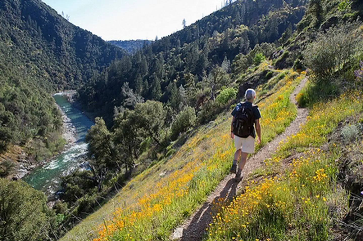
Historically, the Stevens Trail connected the town of Iowa Hill with the city of Colfax, both in Placer County, California. The current trail extends 4.5 miles along the northwestern slope of the North Fork of the American River Canyon. It begins at the trailhead in Colfax and ends at the confluence of Secret Ravine and the North Fork of the American River.
Notice:
Camping is not allowed in the parking lot at Stevens Trail. Vehicles are allowed to park overnight in the parking lot for up to 72 hours for dispersed camping along the Stevens Trail. Vehicles parked longer than 72 hours will be towed. Dispersed camping is allowed on public land for a period not to exceed 14 days.
Trail History
The story of the Stevens Trail begins with the establishment of the Gold Rush mining communities of Illinoistown and Iowa Hill, separated by the steep North Fork American River canyon. The Stevens Trail was originally surveyed under the ownership and direction of John Rutherford, an Iowa Hill miner and tanner. Rutherford soon brought in a partner, Truman A. Stevens, also a miner. Stevens was responsible for the completion and actual use of the trail during its main years of historic use, 1870-1895.
The trail was originally used as a toll path from Colfax down to Secret Ravine along the American River and then traveled up the other side to Iowa Hill which was a major metropolis during the Gold Rush period. Eventually, the use of the trail died down as did gold fever and it was all but forgotten until 1969 when a Sacramento area Boy Scout was credited with rediscovering the trail. Although the bridge connecting the two sides of the river no longer stands, the trail still provides a beautiful hike through an area that was once bustling with miners...all in search of gold! The Stevens Trail is now listed on the National Register of Historic Places.
The Stevens Trail is also the site of Cape Horn Passage (aka Railroad Cut) which is a formidable, steep and rocky outcropping 1300 feet above the North Fork of the American River where the railroad planned to lay tracks. In 1865, Chinese railroad workers began side hill rock cutting, where they were likely lowered by rope to excavate the railroad bed. This was a difficult, time-consuming and dangerous process that was eventually completed in 1866. The route eventually became popular with travelers because of the panoramic views from Cape Horn.
Hunting and Shooting Info - Stevens Trail
- All public lands located in MDM, T. 15 N., R. 9 E., Sec. 26 are CLOSED to target shooting.
- Hunting is allowed, in accordance with State law, unless a specific area is signed CLOSED by the BLM.
NOTE: All California game species are regulated by the California Department of Fish and Wildlife (CDFW).
Rules, regulations, and seasons are controlled by CDFW, and it is the hunter's responsibility to verify and comply with proper species, seasons, zones, regulations, and legal location if hunting on public lands.
FGC 3004 — It is unlawful for any person to hunt or discharge while hunting, any firearm or other deadly weapon within 150 yards of any occupied dwelling house, residence, or other building or any barn or other outbuilding used in connection therewith. The 150 yard area is a "Safety Zone."
Helpful Links:
- Where to Shoot
- California Department of Fish & Wildlife
- Hunting, Fishing and Recreational Shooting on Public Lands, BLM California
- Hiking on Public Lands
Please also visit our webpage for: North Fork American River
Return To: BLM, Mother Lode Field Office
Photos
Contact Us

Activities


Geographic Coordinates
Directions
Follow I-80 East towards the town of Colfax and exit at North Canyon Way. Travel along North Canyon Way for about a mile. Go past the Colfax cemetery to the Stevens Trailhead. Parking will be on your left.
Please Note: Due to increased use of the Stevens Trail, on weekends and in the high use season, parking can be an issue. When parking along North Canon Way, be sure to legally park alongside the road safely out of the traffic. Do not block driveways and please respect private property rights. Vehicles parked illegally on private property or blocking any driveway will be towed at the owners expense.
NOTICE: Camping is not allowed in the parking lot at Stevens Trail. Vehicles are allowed to park overnight in the parking lot for up to 72 hours for dispersed camping along the Stevens Trail. Vehicles parked longer than 72 hours will be towed.