Red Gulch Dinosaur Tracksite

At BLM's Red Gulch Dinosaur Tracksite, you can imagine walking along an ocean shoreline 167 million years ago with dozens of dinosaurs, who were looking to pick up a bite of lunch from what washed up on the last high tide. The sandy ground is soft and your feet sink down in the thick ooze, leaving a clear footprint with every step you take.

The Red Gulch Dinosaur Tracksite is the largest tracksite in Wyoming and one of only a few worldwide from the Middle Jurassic Period (160 million to 180 million years old). Until the tracks were reported in 1997, most scientists thought the entire Bighorn Basin and most of Wyoming was covered by an ancient ocean called the Sundance Sea.

Not only are there hundreds of tracks at the site, but the 40-acre area could contain thousands more. The dinosaur tracks were clearly made just at the shoreline, not in deep ocean water, and there must have been large areas of dry land to support not only dinosaurs but other animals and plants.

The limy mud that the dinosaurs were walking in probably felt similar to cement just starting to harden. The tracks were perfectly preserved when the mud hardened and was covered by more layers of ooze, and then by fine sand, filling the tracks and preserving their shape. Over the years, layer upon layer of sediment filled in over the top. Much later, erosion went to work and removed those layers, exposing the tracks that had been made all those millions of years ago.

The tracks were reported in 1997 by Greybull native Erik Kvale while enjoying the scenery with Allen Archer, Rowena Manuel, Cliff Manuel and Fran Paton on BLM-administered lands. Their discovery altered the views about the Sundance Formation and the paleoenvironment of the Middle Jurassic Period in North America.

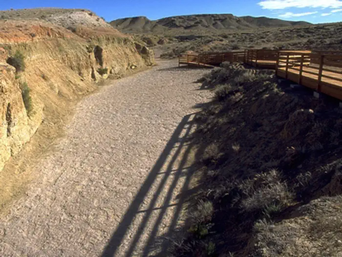
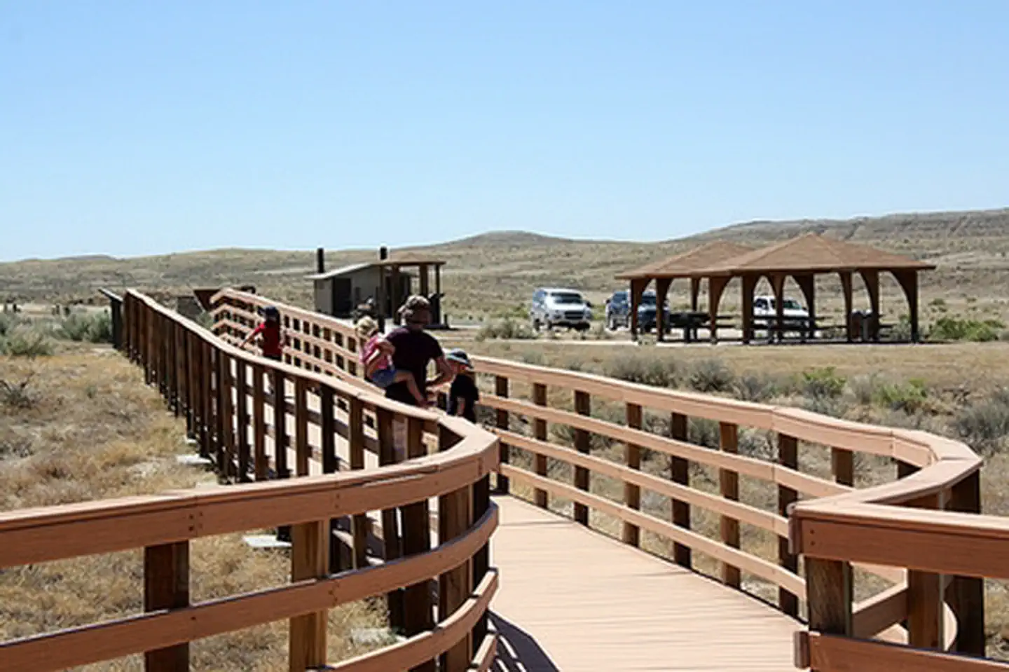
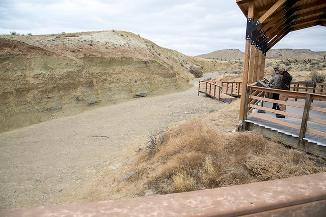
In 2002, the site was renovated with a new boardwalk, interpretive signs, picnic tables, benches, trails, an upgraded access road and graveled parking for up to 15 cars and three buses.

Photos

Dinosaur Track
Dinosaur Track
Red Gulch Dinosaur Tracksite interpretive trail
BLM photo by Bob Wick
Red Gulch Dinosaur Tracksite
BLM Wyoming
Site pavilion
Site pavilion
Dinosaur Track
Dinosaur Track
Red Gulch Dinosaur Tracksite interpretive trail
BLM photo by Bob Wick
Red Gulch Dinosaur Tracksite
BLM Wyoming
Site pavilion
Site pavilion
Dinosaur Track
Dinosaur Track
Red Gulch Dinosaur Tracksite interpretive trail
BLM photo by Bob Wick
Red Gulch Dinosaur Tracksite
BLM Wyoming
Site pavilion
Site pavilion
Dinosaur Track
Dinosaur Track
Red Gulch Dinosaur Tracksite interpretive trail
BLM photo by Bob Wick
Red Gulch Dinosaur Tracksite
BLM Wyoming
Site pavilion
Site pavilion

Accessibility Description (ABA/ADA)

The walkway and pavillion are accessible.

Adventure is at Your Fingertips

Red Gulch Dinosaur Tracksite Photos

Red Gulch Dinosaur Tracksite

Red Gulch Q&As

What is a Tracksite? A tracksite is an area where footprints and other trace fossils are preserved. Tracksites may cover only a few square yards or they may extend for miles. They tell stories about extinct animals that can't be read from body fossils such as teeth and bones.

Tracks, trackways, and tracksites - what are they? A track is a single footprint. A trackway is a row of two or more tracks made by a single animal walking across a surface. A Tracksite is an area where many tracks or trackways are preserved.

Why are the tracks important? Scientists are excited about this site for several reasons. First, this is the largest tracksite in Wyoming, and one of only a few worldwide from the Middle Jurassic Period (160 million to 180 million years old). For part of the Middle Jurassic, Wyoming was covered periodically the the Sundance Sea. Until the tracks were found, it seemed that only sea-dwelling creatures could have lived in the area, and there shouldn't be any footprints here at all!

But there's more to the mystery. What kinds of animals were making these tracks? Middle Jurassic dinosaur skeletons are extremely rare in North America, and there are only a few areas with similar tracks. With few fossils for comparison, the identity of the Red Gulch track-makers have not been identified. Scientists think that the footprints were made by small to medium sized bipedal dinosaurs (walked on their hind legs).

The site is interesting because it is so extensive and unusual in its age and geographic occurrence. Its location makes it easily accessible for scientific research. Even the geologic history of the area, once thought to be well understood, needs to be rewritten because of the tracks' discovery.

When was the Red Gulch Dinosaur Tracksite found? The Tracksite was reported during the summer of 1997.

How old is it? The Tracksite is approximately 167 million years old. The rock layer that preserves the Tracksite was horizontal when the tracks were made. All sediments, such as sandstone, clay, limestone, or silt, are deposited as horizontal layers. Faulting and uplift may later bend, break, and tilt these layers.

Why is the rock layer tilted? The rock layer that preserves the Tracksite was horizontal when the tracks were made. All sediments, such as sandstone, clay, limestone, or silt, are deposited as horizontal layers. Faulting and uplift may later bend, break, and tilt these layers.

What kind of rock is this? The rock is limestone.

What did it look like when dinosaurs were walking here? The dinosaurs were walking across a flat, ripple-marked coastline much like those found in the Bahamas today.

What was the environment like then? Could dinosaurs live in Wyoming's winters? The environment was probably much warmer than present day Wyoming because North America was much farther south 167 million years ago. It was about as close to the equator as Florida is today.

How big were the dinosaurs? The hip-height of some dinosaurs can be estimated by multiplying the length of the footprint by 4 or 5. We think the theropods walked with the body leaning forward from the hips, and the heavy tail extended almost straight backward.

Were the dinosaurs running? Most of the dinosaurs appear to have been walking, not running.

How do we know that? The speed of a small dinosaur can be estimated by comparing its hip-height to its stride length (the distance between two consecutive footprints made by the same foot.) If the stride length is more than three times the hip-height the animal was probably running.

How old are some other fossils found in this area? The Allosaurus "Big Al" found north of Shell, Wyo. in 1991, is about 15 million years younger than the Tracksite. The plant fossils at Big Cedar Ridge, near Ten Sleep, Wyo. are about half as old as the Tracksite.

What are the oval shaped holes in the Tracksite surface? The oval shaped holes in the Tracksite may have been made by ancient shrimp, clams, or lugworms. One kind made vertical burrows and another made horizontal holes. Understanding this will help reconstruct the environment around the time the tracks were made.

How do scientists investigate the site? Science is a process that follows a few simple rules. Seen as a whole, science may look complicated and difficult, but the individual steps in the scientific method are very clear. Taken one at a time, in sequence, the steps can lead to an objective and defensible conclusion. The first step is observation.

Observation: Scientists who study the earth must learn from observation. Earth history can't be duplicated in an experiment, so geologists and paleontologists must look closely at rocks and fossils to gather information about them. The present is the key to the past. Geologists learn from studying modern systems, the way ancient systems worked.

Analysis: Information from observations is analyzed to learn whether it is meaningful to the study. Irrelevant information may be put aside. Analysis also shows if more information, or a different kind of information, must be gathered before going further.

Hypothesis: Scientists rely on their education and training to form ideas about what their observations have revealed. An idea that might explain their observations is called a hypothesis. Often more than one hypothesis is proposed, because there might be several possible explanations.

Testing: A hypothesis isn't an answer. Each must be tested to see if it explains what was observed. A hypothesis that doesn't provide a complete, objective explanation is rejected, and another must be chosen and tested.

Conclusion: The hypothesis that offers the best explanation of all the information observed and analyzed can become a conclusion. Often an early hypothesis must be modified to fully explain all the observations.

Science is an endless process. Conclusions reached in one study are not necessarily "the truth." They're just the best answer we can reach with the information at hand, and are often the basis for another study.

BLM Wyoming Know Before You Go

The BLM welcomes you to explore, enjoy, and make positive memories from your outdoor experiences on America's public lands and waters. Please remember these are wide-open spaces and wildlands. Plan ahead and be aware of potential hazards. It is everyone's responsibility to take the necessary steps to minimize chances of becoming lost or injured on public lands.

When visiting public lands, please also practice Leave No Trace and Tread Lightly principles.

For other key advice on various recreation activities, please see the BLM's trip-planning tips. These helpful tips can help you make the most of your recreation experience. However, for more information about local conditions, regulations and recreation resources, there is no substitute for visiting the closest BLM office.


Paleontology in the Bighorn Basin

The 260-plus million acres administered by the BLM are rich in fossils. Most public lands are simply those rejected by homesteaders as too steep, too dry, and too barren to support a family. What is unsuitable for agriculture is perfect for fossil discoveries.

Paleontologists have been collecting fossils in the Bighorn Basin since before 1880. Rocks in the Basin and along the flanks of the Bighorns and Absarokas range from about 600 million years to about three million years old, and all but one geologic period is represented.

The Bighorn Basin, and Wyoming in general, has yielded many kinds of fossils. The region is arid, so little soil or vegetation forms to obscure the exposures of bare rock. Also, when rain falls, it often does so violently and quickly erodes the surface, exposing more and more fossils.

May I Collect Fossils? Certain restrictions apply to collecting fossils on public lands. Except in areas with special management designations, no permit is required to collect small amounts of invertebrate fossils or plant fossils other than petrified wood.

Special restrictions apply to collecting petrified wood and vertebrate fossils, in addition to any area-specific special management restrictions. It is always best to visit the closest BLM office to check for area-specific restrictions, land status, fire danger and road closures before collecting.

Vertebrates - Vertebrate fossils may only be collected with a permit because of their relative rarity and scientific importance. They include not only bones and teeth, but also footprints, burrows and other traces of activity.

Vertebrate fossils are fragile and complex and permit applicants must be able to show a sufficient level of training and experience in order to collect them. In addition, all vertebrate fossils collected under a permit must be held in an approved repository.

Invertebrates - no permit is required to collect reasonable amounts of invertebrate fossils such as:

  • Trilobits
  • Brachipods
  • Ammonites

The invertebrate fossils you collect are for your personal use and enjoyment, and may not be bartered or sold. Please remember to leave some for the next collector, too.

Petrified Wood - you may collect:

  • Up to 25 pounds of petrified wood, plus one piece, each day.
  • No more than 250 pounds in any calendar year without a permit.

You may not combine your allowance with another collector's allowance to obtain larger pieces of petrified wood. And you can't sell it without a special permit.

Other Plant Fossils - No permit is required to collect reasonable amounts of plant fossils such as leaves. They are for your personal use and may not be bartered or sold.

Red Gulch Science & Discovery

Scientists Come to Study

In 1998, a year after its discovery, paleontologists and geologists from around the country descended on the Tracksite to study this intriguing site. The scientists, from the University of Wyoming, Dartmouth College, Department of Geological Sciences - Indiana University, Kansas State University, BLM National Science & Technology Center, South Dakota School of Mines and Technology and the Smithsonian Institution, formed the Red Gulch Dinosaur Tracksite Science Team, working at the Tracksite under a BLM Paleontology permit.

Members of the team mapped, measured and compared the rocks and fossils at this site with other previously studied tracksites. Through this reseach, they broke new ground in the study of the Middle Jurassic in central North America.

What We Know

Since then, scientist have continuted to work to unlock the Red Gulch Dinosaur Tracksite (RGDT) puzzle. They had many questions, now they have some of the answers.

What dinosaur made the tracks? All the tracks identified so far were formed by two-legged (bipedal) dinosaurs. Some, and perhaps all, of the tracks appear to have been made by meat-eating dinosaurs (theropods). They weighed between 15-400 pounds. Because Middle Jurassic dinosaurs are so rare, it is very difficult to match the tracks to any particular dinosaur.

Typically, a well-preserved theropod dinosaur track is three-toed and nearly symmetrical, exhibits tapering toes and preserves a slightly "S" shaped impression of the middle toe. Identifiable theropod trackways preserve prints that are slightly "pigeon-toed" having an inward rotation of the feet.

However, many other tracks and trackways do not exhibit such features. Although clearly made by two-legged dinosaurs, these less well-defined prints may have been made by a different type of dinosaur such as a plant-eating ornithopod. In many cases, it is impossible to identify the trackmaker as to ornithopod or theropod.

How many tracks are there? 1,000 tracks have been located, 600 of them are in the Ballroom. Nearly 600 dinosaur tracks have been located by surveying instruments. A network of one-meter-square grids has been surveyed in the "Ballroom and Discovery" area. Scientists estimate there are at least 1000 tracks in the "Ballroom" area of the Tracksite.

How big are the tracks? The tracks are 8-28 cm long, have three distinct toes, and may also show the heel and claws.

Where were the dinosaurs going? Most of the hundreds of identifiable trackways go in the same south-southwesterly direction. The orientations of most of the tracks indicate that the dinosaurs were moving to the south-southwest.

This could indicate herding or migratory animal behavior. Or it could indicate the presence of a physically constrained pathway (such as a tidal flat or beach next to an open body of water).

A logical interpretation would be that the dinosaurs may have been moving parallel to the shoreline. However, the shapes of the ripples associated with the RGDT surface shows this was not the case. The presence and orientation of the ripples indicate that relatively deeper water conditions existed to the southwest. Since the dinosaurs were moving in a southwesterly direction, it appears the dinosaurs were moving perpendicular to the shoreline and not parallel. The ripples reveal the dinosaurs may have been moving toward the water.

What do the ripples tell us? The Tracksite exhibits a well-developed rippled surface. Ripples can be used to determine the direction of current movements. The coated-grain limestone consists of tiny sand-sized spheres of calcium carbonate and fossil shell fragments cemented together. The ripple surface formed before the grains were cemented together. The ripples are very similar in shape to those formed by relatively gentle waves in very shallow water. The dinosaur trackways appear to have formed shortly after the formation of the ripples.

Some tracks have been cross-sectioned or "sliced" to find out what the rock looks like within the footprint. The geologists are studying how the soft, limy mud was deformed as the weight of the dinosaur pushed it down.

What was the geography and climate like? During the time in which the RGDT tracks were preserved, large portions of the western interior of North America were inundated by a shallow sea. To the west, a volcanic arch extended north from Mexico to southwestern Canada. To the east, the sea was bounded by very shallow water, low-lying coastline conditions that extended from central Wyoming into the present day Dakotas.

The climate during this time was extremely arid, at least seasonally.

The geology team has traveled to Florida, Texas, New England and elsewhere to visit other ancient environments. The ichnology team has visited sites throughout Colorado and Utah. Track expert Beth Southwell, UW, has been to Dinosaur State Park in Connecticut and even to China!

How old is the Tracksite? The Red Gulch Dinosaur Tracksite surface dates to approximately 167 million years old. This puts it in the mid-Bathonian Stage.

How do we know this? Scientists used several factors to determine the date:

  • The occurrence of the oyster Gryphea nebrascensis, just above the track bed;

  • The occurrence of a complete specimen of the ammonite Cadoceras muelleri just above the track layer;

  • Two microfossils of marine planktonic protozoans called "Dinoflagellates."

The ages of these fossils have been well established in many places around the world. By finding these fossils here in the RGDT area, scientists can deduce the age of the surrounding area including the Tracksite.

The Tracksite preserves an ancient tidal environment. Scientists have traveled around the world to get clues to the Tracksite puzzle. Even though the daily rise and fall of the tide is small, because the tidal flat slopes at a very low angle towards the sea, a very broad expanse (several kilometer wide) is exposed at low tide. This is similar to the type of tidal flat preserved in the Tracksite area.

Why were the footprints preserved? Team members are studying modern environments where footprints may be preserved and trying to find out why such delicate structures were not immediately washed away but instead preserved and turned to rock.

What is a trace fossil? A fossil is any physical evidence of ancient life. A body fossil would include bone material or shell. A trace fossil, however, is evidence of the activity of ancient animals or plants. The physical evidence in the rock record of burrowing, crawling, walking, etc., constitutes a trace fossil. Therefore, the footprints at the Tracksite are vertebrate trace fossils.

What other kinds of trace fossils were found at the Tracksite? The older trace fossils on the Tracksite are classified as belonging to a Skolithos burrow type. The primary example are round, vertical tubes approximately 0.5 cm in diameter, similar to those made by modern annelid worms. These were probably made at the same time the dinosaurs were making their tracks.

The second, younger generation of invertebrate faunal traces is also present. These were made after the dinosaur tracks had been buried by sediment. The younger traces consist of U-shaped burrows ranging from 5 cm to greater than 12 cm in width and 2 cm to 3 cm in diameter. These may have been made infaunal crustaceans, bivalves such as clams or lugworms.

What are ABs? Shallow, irregularly shaped depressions are also present on the Tracksite. They have been nicknamed "AB's" for "amorphous blob."

The Tracksite AB's appear to have formed through a combination of both biological and physical erosional processes. The depressions are very similar to features observed on modern intertidal flats.

What else has been found? Samples of pollens, collected by scientists during the summer of 1998 have been processed in the laboratory. So far, it appears that there are pollens of cycads and several different conifers, fern spores and a variety of one-celled organisms in the layers directly overlying the Tracksite. The pollen is the only remains we have of these plants and could have been blown or washed in from vegetated areas tens to hundred of miles away.

Phone

Activities

Iconography of a capital V
INTERPRETIVE PROGRAMS
Iconograph of two people wearing backpacks and using walking sticks
HIKING
Iconograph of binoculars
WILDLIFE VIEWING
Iconograph of binoculars, a magnifying glass, and a maple leaf
ENVIRONMENTAL EDUCATION
Iconograph of a camera
PHOTOGRAPHY

Addresses

Worland Field Office
101 South 23rd
Worland
Wyoming
82401

Geographic Coordinates

44.46243348, -107.8156396

Directions

Travel approximately eight miles east of Greybull WY (or four miles west of Shell) on US Highway 14 to the Red Gulch/Alkali National Back Country Byway turnoff. Head south on the Byway approximately five miles.