
Point Arena-Stornetta Unit | California
Effective Friday, June 5, 2026, the BLM Ukiah Field Office issued an updated Fire Prevention Order due to increased wildland fire danger. For specific questions, please contact the Ukiah Field Office at (707) 468-4000. Fire Prevention Order
For a full list of restrictions, please visit the BLM California fire restrictions page.
State of California campfire permits are available for free at all BLM, USFS and CAL FIRE offices or at https://www.readyforwildfire.org/prevent-wildfire/campfire-safety/
Overview
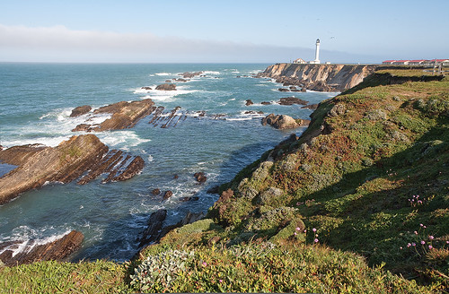
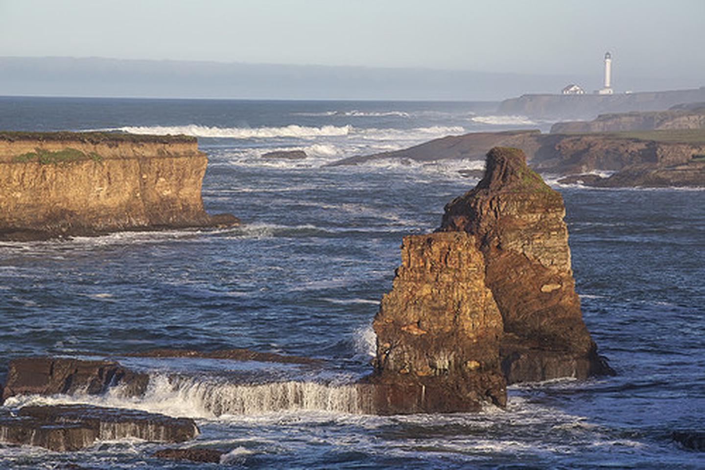
Situated along the rugged Mendocino County coastline adjacent to the town of Point Arena, the Point Arena-Stornetta unit offers spectacular views of coastal bluffs, sea arches, the estuary of the Garcia River and sandy beaches and dunes with eight miles of marked paths.
Download a map and guide for your visit
Hiking
Trail Alert: The coastal trail is subject to erosion and may not be passable. Please watch for caution signs and call or email the Ukiah Field Office for current trail conditions.
Open for day use only; no motorized vehicles or hang gliding; dogs must be on leash.
Point Arena -Stornetta Unit is administered by BLM's Ukiah Field Office and is part of the California Coastal National Monument which provides unique coastal habitat for marine-dependent wildlife and vegetation on more than 20,000 rocks, islands, exposed reefs and pinnacles along the California coastline, as well as 7,924 acres of public land in six onshore locations.
Wildlife
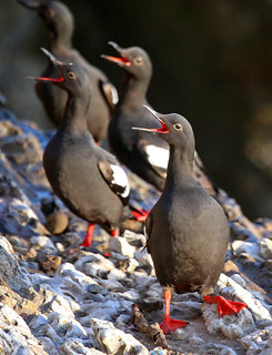
The Unit is home to nine special status species, including plants, mammals, birds, amphibians, fish and insects. Commonly seen marine animals include harbor seals seen loafing on the rocks and migrating gray whales.
Photos
Contact Us

Activities


Addresses
Directions
From San Francisco
Follow US-101 to W Railroad Ave in Sonoma County. Take exit 479 from US-101(42.9 mi). Take Roblar Rd and Valley Ford Rd to CA-1 N (14.1 mi). Valley Ford Rd turns slightly left and becomes CA-1 N (70.1 mi). Turn left onto Light House Rd.
External Map
Fees
No Fees