
Johnny Behind the Rocks | Wyoming
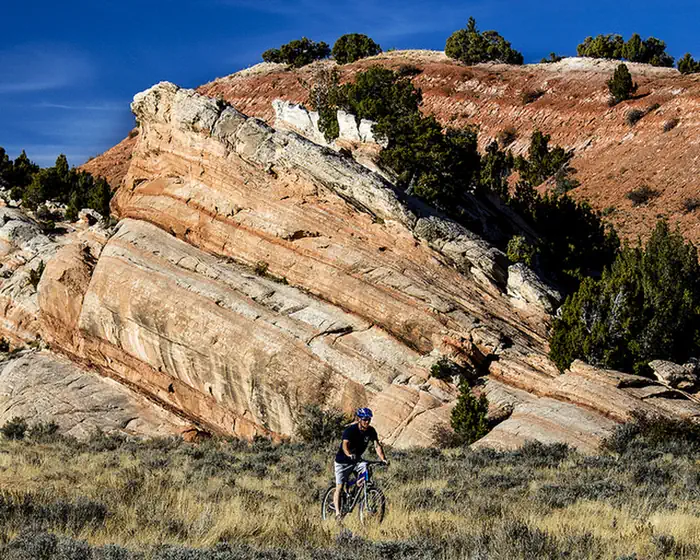
The Johnny Behind the Rocks Trail System provides mountain bikers with a high desert experiences in a compact area. The trails within this network are flowing in nature with a hard-packed surface and fine grain soils. Most of the system is located on routes that climb to and traverse long and scenic ridgelines. The Wind River mountain range is visible on the western side of the system.
The trails meander through typical Wyoming Basin terrain that ranges from clusters of juniper woodlands and open sagebrush meadows. Although open year-round, visitors wishing to ride on dirt rather than snow are usually restricted from mid-March to the end of November.
Trails are often effectively closed during the spring thaw in early March due to extremely muddy conditions on some portions of the trail with high clay content.
Learn more at the Johnny Behind the Rocks mountain biking information page.
Photos
Interactive Trail Map
Flickr Album

Contact Us

Activities


Addresses
Geographic Coordinates
Directions
Directions: Drive South on State Highway 287. Turn left at the junction continuing eastward on Hwy 287. Cross Little Popo Agie River and Twin Creek. Upon crossing Twin Creek you will pass a red cliff band on the left as well as a red stone barn on the right. Turn left into the white gravel parking area marked by a green gate.
Fees
None
Need To Know
Plan Your Visit
- Season Dates: January 1 - December 31
- Fee: None
- Size: 12 miles
- Elevation Gain/Loss: 1,000+ feet
- Difficulty: Trails range from beginner to intermediate
Directions
- Drive South on State Highway 287. Turn left at the junction continuing eastward on Hwy 287. Cross Little Popo Agie River and Twin Creek. Upon crossing Twin Creek you will pass a red cliff band on the left as well as a red stone barn on the right. Turn left into the white gravel parking area marked by a green gate.
Quick Links
Contact Information
Lander Field Office
1335 Main Street
Lander, Wyoming 82520
307-332-8400