
Chimney Rock Campground | Oregon
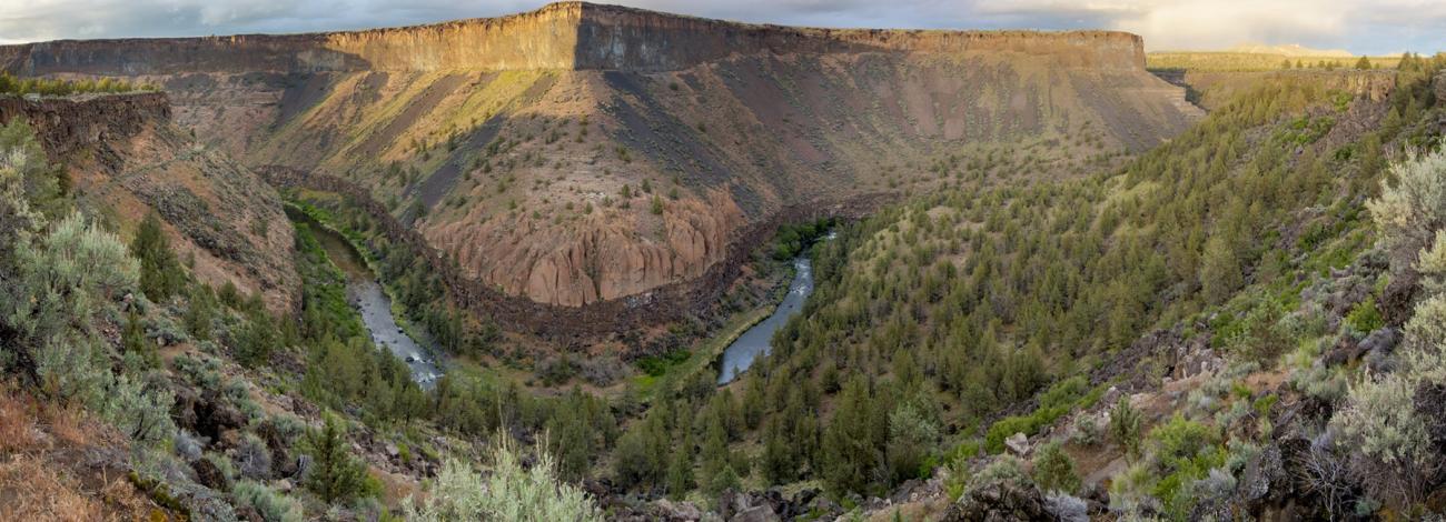
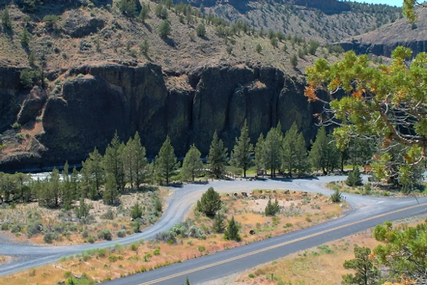
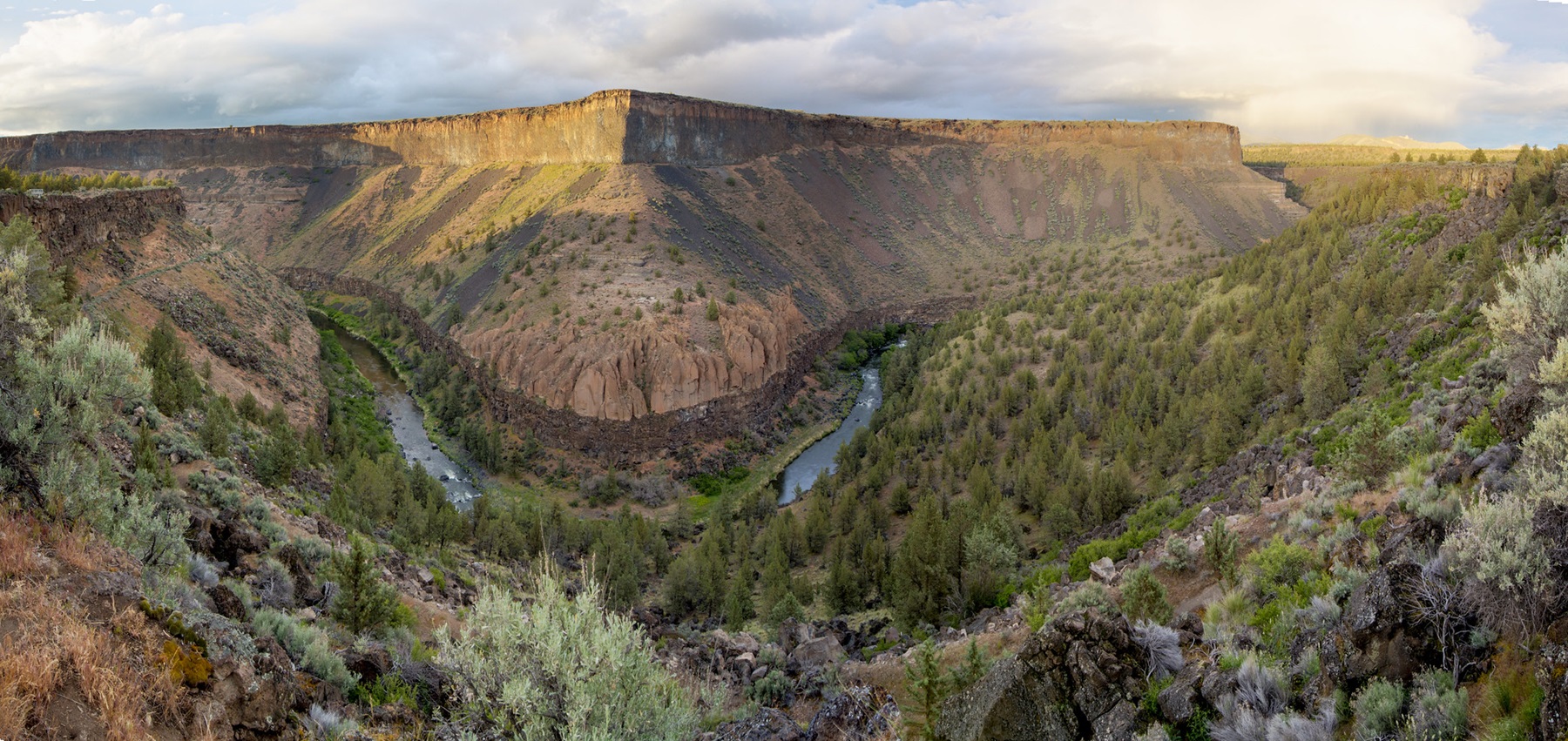
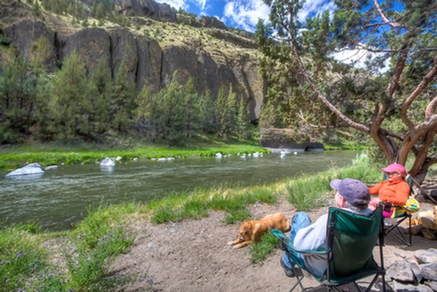
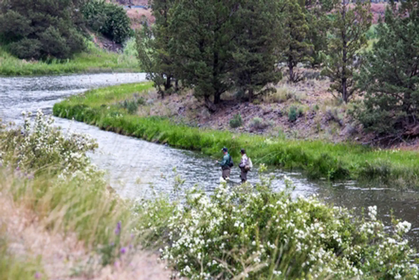
Along the Chimney Rock segment of Central Oregon's Crooked Wild and Scenic River, Chimney Rock campground offers a relaxing woodland setting amongst Western Juniper trees and beneath massive Columbia River rock formations. Fly-fishing and hiking on the nearby Chimney Rock trail offer day-long recreational fun. Enjoy plenty of easy river access along the adjacent Crooked River Back Country Byway, State Highway 27.
Know Before You Go
- Chimney Rock Campground is open year-round and is equipped with 16 campsites and vault toilets. No reservations are accepted; site is first-come, first-served only.
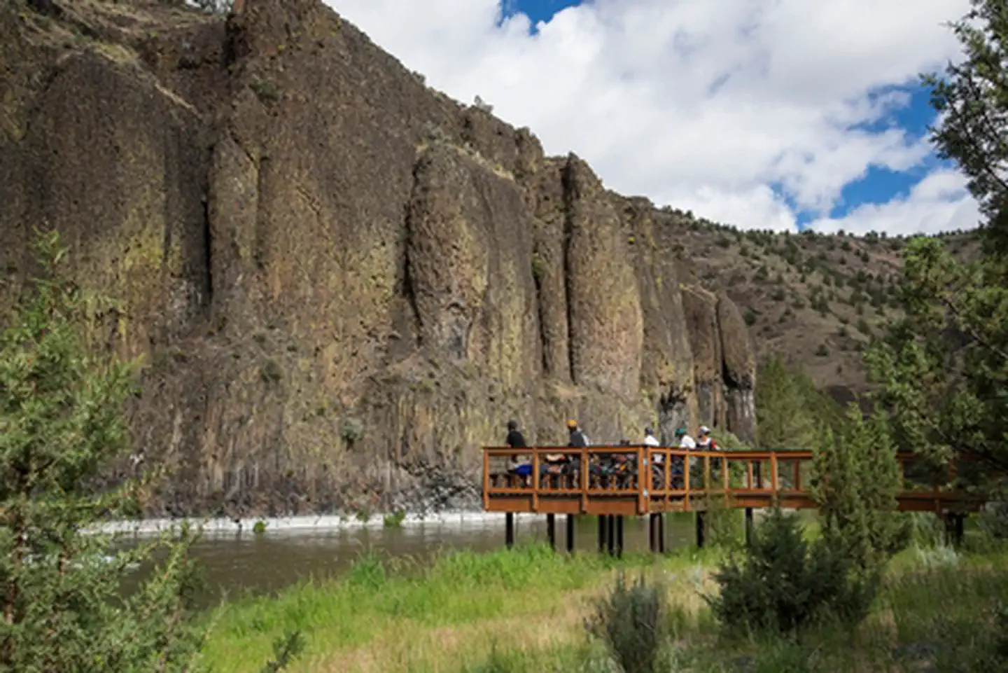
- Water is available in the campground and an accessible fishing platform is located near the campground entrance.
- When recreating on public lands, practice Leave-No-Trace Principles.
- Don't Move Firewood: Please protect Pacific Northwest forests by preventing the spread of invasive species. Firewood can carry insects and diseases that can threaten the health of our western forests. You can make a difference by obtaining and burning your firewood near your camping destination.
Point of Interest
Check out the campground's namesake butte located prominently above highway 27 opposite the campground. Access to the trailhead is across the highway at the Chimney Rock Trailhead.
For a different view, visitors can ride the 18-mile Crooked River Canyon Scenic Bikeway from Prineville to Big Bend Campground. Designated in 2018, this moderate route takes riders from picturesque farms to towering cliffs.
Photos
Accessibility Description (ABA/ADA)
There is no cell phone reception at this site.
The campground’s 2 chip-sealed parking areas have room for 20-30 vehicles. Dispersed across the 2 parking areas are 4 spaces designated as accessible: 2 are wide spaces and 2 have access aisles for vans.
In the parking area just to the north of the trailhead for the Chimney Rock Trail, there is a partially shaded kiosk with site and safety information, a pay station, and angled interpretive panels with details about local flora and fauna and the history and geology of the area.
An accessible single vault toilet is located south of this parking area, with an even transition from the asphalt path to the concrete pad at the toilet entrance. A garbage can with a lid that should be reachable from a sitting position is on pavement next to the toilet.
A second accessible toilet, also with an even transition from asphalt to concrete at the entrance, is near the parking area farther south, next to the trailhead and the camp host’s site.
Paved walkways 3-4 feet wide connect the parking areas to the water spigot near the camp host’s site, the accessible fishing platform, individual and group campsites, and the group picnic area near the Crooked River.
The water spigot sits on a concrete pad and is operated with a pump mechanism. The handle of the pump may be high for visitors using mobility devices.
A wide elevated boardwalk with protective railings leads to a large fishing platform with views of the river. The platform also has a picnic table with recessed legs to accommodate wheelchair users.
The campground has 8 campsites, including 3 accessible group sites and 3 accessible individual sites. Both the individual and group campsites have paved surfaces supporting picnic tables with recessed legs and elevated fire rings with grill attachments.
The group picnic area is along the paved walkway next to the Crooked River. It sits on a large asphalt pad and has 4 tables with recessed legs, 4 pedestal grills, and an elevated metal fire ring.
Descriptions and photos uploaded June 2026. Please note that actual on-the-ground conditions may vary due to natural events (e.g., weather, wildfires, erosion), normal wear and tear, or site improvements.
Contact Us

Activities


Addresses
Geographic Coordinates
Directions
From Prineville, Oregon: Drive 16.4 miles south on State Highway 27; the campground will be on your right.
Fees
$8 per single campsite per night;
$16 per each group site;
$2 per each extra vehicle (tow vehicles excluded) with a maximum of two vehicles allowed per site.