
WAH WAH MOUNTAINS WILDERNESS STUDY AREA
Values
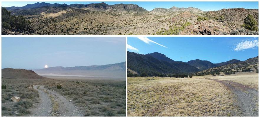
The WSA encloses a narrow, flat-topped mountain range with steep and rugged topography and elevations ranging from 5,600 to 8,980 feet. Vegetation consists primarily of pinyon-juniper woodlands with mixed stands of Ponderosa pine, white fir, and mountain mahogany. Bristlecone pine grows on approximately 190 acres in the higher elevations of the WSA. Bristlecones are rare in this area and those in the WSA are exceptionally large, reaching heights of 50 feet or more. Bristlecone pines are among the oldest living trees. The area is also teeming with wildlife as cougar, antelope, deer, chukar partridge, and various birds of prey all reside within the unit. The area also provides unique geological and archaeological characteristics, particularly around the area of Crystal Peak.
Visitation Information
The Wah Wahs are generally best approached from Milford, Utah or the unincorporated community of Black Rock, Utah. The access points vary from the northern portion of the WSA (Crystal Peak area) and the southern portion (Wah Wah Summit area). To access the northern portion of the WSA from the I-15 corridor, travel west from Cove Fort, Utah on Black Rock Road. Black Rock Road crosses Hwy 257 to become Crystal Peak Road, Travel ~35 miles west of Highway 257 on the Crystal Peak Road to reach the north end of the WSA. Black Rock and Crystal Peak roads are graveled and maintained. To access the southern portion of the WSA, travel west from Milford on State Route 21 for 32 miles. The access route for the Wah Wah Summit monitoring area is located just beyond mile marker 45, near a sign for the Wah Wah summit.
Visitor Advisory
In the southern end, once visitors turn off the paved state route, routes are dirt tracks that typically require 4WD and high clearance. Please obey any posted closures.