Science & Research
What's new?
- Science Plan Update
Grand Staircase-Escalante National Monument (GSENM) has recently produced a Science Plan that encourages, supports and guides researchers and land managers in conducting and utilizing scientific research in GSENM. This Science Plan is in complete accordance with the recent (January 2025) Resource Management Plan (RMP) for GSENM.
The plan also complies with direction that National Conservation Lands like GSENM establish Science Plans. This document provides:
- Summaries and links to past research;
- Ideas and needs for future research;
- Steps to obtain approval to do scientific research in GSENM; and
- Strategies for sharing and utilizing scientific findings in support of GSENM objectives.
The RMP provides clear direction on how GSENM is to be managed, and this Science Plan supports the RMP, and in no way changes or conflicts with management direction in the RMP. This Science Plan will be a living document that can be updated as needs and objectives change in coming years.
GSENM Science Plan 2025 | Bureau of Land Management
Science Lecture Series
The Grand Staircase-Escalante National Monument science program hosts a lecture series at the Kanab Library at 374 N Main St, Kanab, UT 84741. Times are 6pm unless noted otherwise, and the public is invited to attend these free events. If you have ideas for topics or speakers, contact Marc Coles-Ritchie at [email protected]. See below for additional information about future and past presentations.
- Upcoming Lectures
August 12, 2026: The Geology of the Colorado Plateau & Formation of the Colorado River System (Lance Weaver)
September 9, 2026: To be announced
October 14, 2026: How to photograph in the desert responsibly (Andrew Napier)
November 18, 2026: Paleontology (Katja Knoll)
December 9, 2026: Mule deer populations and habitat connectivity (Kasey Lindstrom)
January 13, 2027: To be announced
February 10, 2027: To be announced
March 10, 2027: Bighorn Sheep and other Wildlife (Joel Berger)
April 14, 2027: Micro-plastics in Soils of Grand Staircase-Escalante (Christina Pondrell)
May: No BLM talk; Amazing Earthfest has many good talks
- Past Presentations
Did you miss a science presentation of ours or just wanted the slides from one? No problem! You can find them below.
- Plants
Tree rings and Climate Change on the Colorado Plateau June 2026
Drew Peltier, Assistant Professor, University of Nevada, Las VegasNative buckwheat of Grand Staircase-Escalante Dec. 2025
Marc Coles-Ritchie, BLM Ecologist and Web Staley, BLM Range Technician at Grand Staircase-Escalante National MonumentTrees of Grand Staircase-Escalante, Nov. 2025
Marc Coles-Ritchie, BLM Ecologist at Grand Staircase-Escalante National MonumentCactus of Grand Staircase-Escalante
Marc Coles-Ritchie, BLM Ecologist at Grand Staircase-Escalante National Monument
Jared Higgs, botany consultant and cactus expert based out of Price, UTWildflowers of Grand Staircase-Escalante National Monument
Marc Coles-Ritchie, BLM Ecologist at Grand Staircase-Escalante National MonumentGrasses of Grand Staircase-Escalante National Monument
Marc Coles-Ritchie, BLM Ecologist at Grand Staircase-Escalante National MonumentShrubs of Grand Staircase-Escalante National Monument
Marc Coles-Ritchie, BLM Ecologist at Grand Staircase-Escalante National MonumentLandscaping with Native Plants in Southern Utah
Marc Coles-Ritchie, BLM Ecologist at Grand Staircase-Escalante National Monument
Tim Clarke, landscape designerRiparian and Wetland Plants of Grand Staircase-Escalante National Monument
Marc Coles-Ritchie, BLM Ecologist at Grand Staircase-Escalante National Monument
- Animals
Aquatic Invertebrate and Bats
Geoff Smith, Utah Tech University
Wildlife BiologistPrairie Dogs of Utah
Barbara Sugarman, UT DNR
Utah Prairie Dog Recovery BiologistUtah's Amazing Bees and How We Can Help Them
Amy Dolan, Xerces Society
Conservation Biologist Mountain States BBA CoordinatorWildlife in a challenged world
Joel BergerBats of GSENM
Jackie Grant
- Archaeology & History
Utah Cultural Site Stewardship
Lexi Little, Operations Coordinator for the Utah Cultural Site Stewardship Program
Caitlyn McAllister Grand Staircase-Escalante National Monument ArchaeologistEnigmatic Traces of Sacred Water: Cup and Channel Petroglyphs of the Far West
Michael L. Terlep, Archaeologist, North Kaibab Ranger District, Kaibab National Forest
- Soils, Biocrust & Lichens
What Lichens Can Tell Us About Inter-ness
Steve Leavitt, BYU Department of Plant and Wildlife Sciences
- Geology and Paleontology
Maps and Geographic Information Systems Mar. 2026
Jason Stewart, BLM GIS SpecialistGeology of Cottonwood Road Jan. 2026
Janice Gillespie, U.S. Geological Survey Senior Research Scientist
Get to know a Monument 'ologist
Prepare to embark on a journey inside Grand Staircase-Escalante National Monument, where we continue to explore the world of scientists dedicated to unraveling its mysteries. Discover the latest installment here and browse through the archives listed below.
- Paleontology
Meet Madi, a young paleontologist with a cool story to tell 💪🌍 Did you know she discovered her first dinosaur at age 14? In celebration of #InternationalDayOfWomenAndGirlsInScience, we share Madi's journey from taking her childhood passion for paleontology and turning it into a career 🦖🌄 Learn more about Madi’s inspiring story at https://storymaps.arcgis.com/stories/3c35a86220d34d39b9b2cfc1e12c00cd/ 👩🔬 🔬
Color Country Podcast Episode #12: #12 - Unearthing the past: How this Southern Utah student is making her mark in paleontology (Updated Mar. 4, 2025)- Water Quality
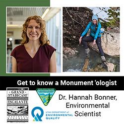
Meet Dr. Hannah Bonner! Hannah is an environmental scientist for the Utah Department of Environmental Quality. Hannah works with Grand Staircase-Escalante National Monument Soil Scientist Raven Chavez in monitoring recreational water at Calf Creek Falls in Escalante, Utah.
Hannah is a Utah native who started her career as scientist in 2016, and together she and her team are dedicated to safeguarding public health in Utah's renowned lakes, reservoirs, and rivers.
Her Story: BLM Blog | Facebook Feature | Instagram Feature
- Wildlife
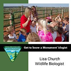
Lisa helps monitor and document the potential impacts of proposed projects on wildlife and its habitat. As a subject matter expert in fauna for the Kanab Field Office and Grand Staircase-Escalante National Monument, Lisa’s main responsibility is to serve as a part of the interdisciplinary team that monitors and documents the potential impacts of proposed projects on a species and its habitat.
Her Story: Facebook Feature | Instagram Feature
- Soils
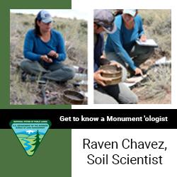
Raven started her soils journey in December 2012 at the Oregon State College of Forestry and worked for a few federal agencies before starting her career with the Bureau of Land Management. In addition to her primary duties, Raven can also be found bringing soil science to the classroom, speaking about her work with students, conducting worm races, and stressing the importance of an education in science, technology, engineering, and mathematics, more commonly known as STEM. To learn more about some of Raven’s work as a Grand Staircase-Escalante National Monument Soil Scientist, visit: Scientists take AIM at natural resources on BLM land.
Her Story: Facebook Feature
- Paleontology
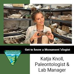
Katja Knoll, Paleontologist and Lab Manager for Grand Staircase-Escalante National Monument, is a film student- turned-paleontologist. After pursuing an education for documentary filmmaking and rediscovering a passion for science, Katja’s career path and education took an unexpected detour. Katja moved to Kanab, Utah, and began working as a paleontology intern for Dr. Alan Titus at Grand Staircase-Escalante National Monument during the summer of 2014. Shortly after, Katja was hired full-time as the paleontology lab manager for the Monument and graduated with a Master of Science in Geology. Katja also helped Dr. Alan Titus expand the Monument’s paleontology volunteer program and continues to manage it today, which she says brings a myriad of diversity and perspective to the program.
Her Story: Facebook Feature
Research Stories
- News Releases
• Monument continues to demonstrate scientific significance: Research published on tiny dinosaur eggs found in Kaiparowits
• 94-million-year-old fossil provides clues to ancient reptile evolution
• Monument nets important dinosaur discovery
• Dinosaur exhibits now on display
• Scientists take AIM at natural resources on BLM land
• Helping hands work together to restore historic cabin
• Dino dentistry extracts paleo story from public land
• Evidence indicates tyrannosaurs may not have been a solitary species after all- Interviews with Scientists
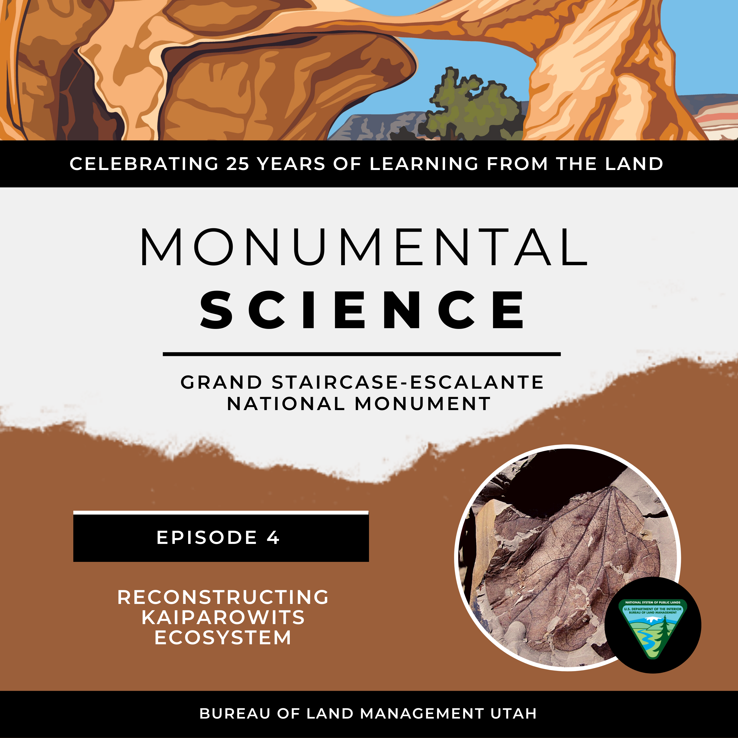
"Reconstructing Kaiparowits Ecosystems" - Guest Speaker: Sarah Augusta “Gussie” MacCracken
"Reconstructing Kaiparowits Ecosystems"
Dr. Sarah Augusta “Gussie” MacCracken, paleobotanist and National Science Foundation postdoctoral fellow, Department of Earth Sciences at the Denver Museum of Nature and Science, chats with Grand Staircase-Escalante National Monument Paleontologist Dr. Alan Titus about reconstructing Kaiparowits ecosystems from the bottom up and how scars on fossil leaves illuminate the diversity of ancient plants and insects on the Monument.
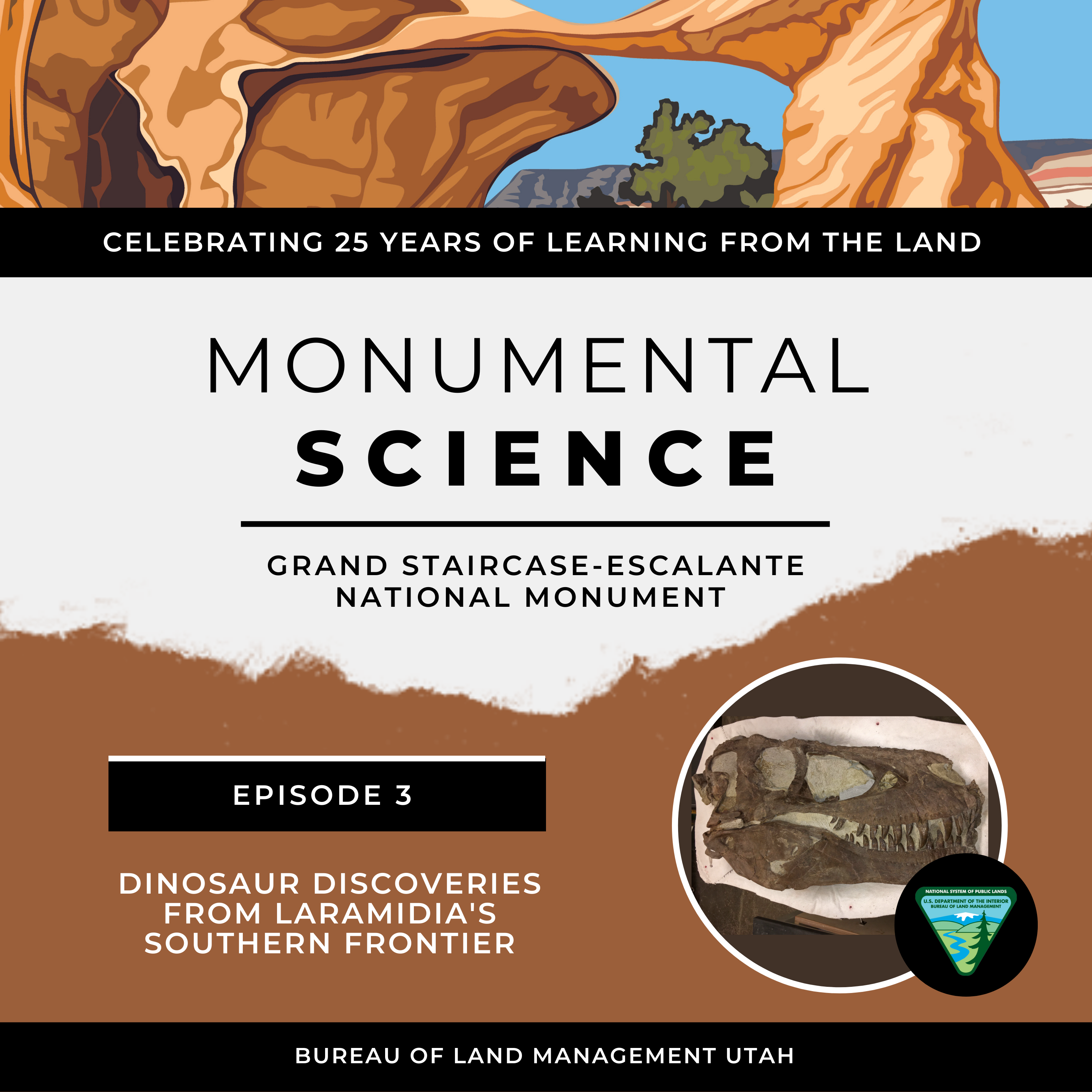
"Dinosaur Discoveries from Laramidia's Southern Frontier" - Guest Speaker: Dr. Joseph Sertich
"Dinosaur Discoveries from Laramidia's Southern Frontier"
Dr. Joseph (Joe) Sertich, Curator of Dinosaurs at the Denver Museum of Nature & Science, and Grand Staircase-Escalante National Monument Paleontologist Dr. Alan Titus discuss research through 10 years of collaborative exploration of the monument and new dinosaur discoveries from Laramidia's southern Frontier.
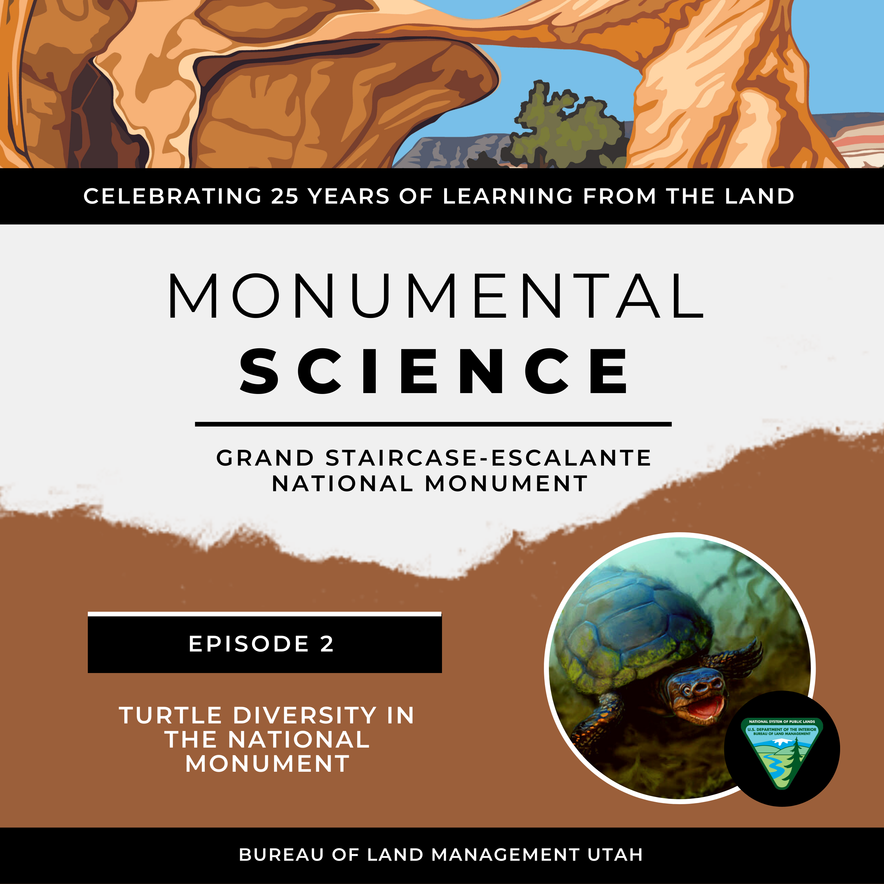 "Turtle Diversity at the National Monument" - Guest Speaker: Dr. Joshua Lively
 "Turtle Diversity at the National Monument"
Dr. Joshua Lively, curator of paleontology at Utah State University Eastern Prehistoric Museum, talks with Grand Staircase-Escalante National Monument Paleontologist Dr. Alan Titus about his research on a new freshwater sea turtle from Grand Staircase-Escalante National Monument and reviews turtle diversity in the Cretaceous Kaiparowits Formation.
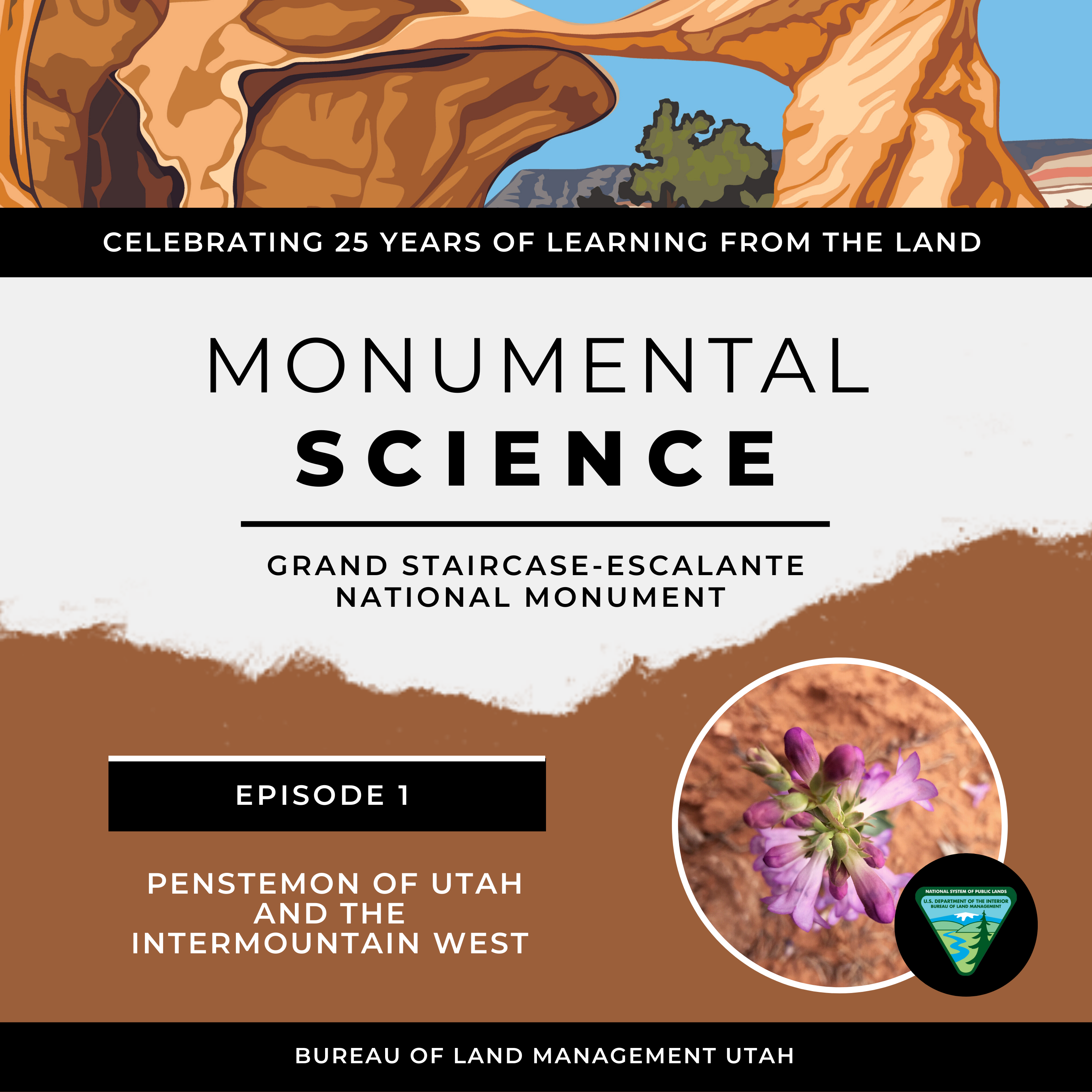
"Penstemon of Utah and the Intermountain West" - Guest Speaker: Dr. Mikel Stevens
"Penstemon of Utah and the Intermountain West"
Dr. Mikel Stevens, Emeritus Professor of Plant Genetics and Plant Breeding at Brigham Young University, chats with Grand Staircase-Escalante National Monument Paleontologist Dr. Alan Titus about his penstemon research on the Monument.
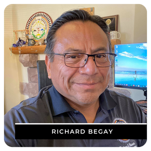
Navajo Cultural Connections to the Southern Utah Landscape
Richard Begay - Tribal Historic Preservation Officer, Navajo Nation
Richard Begay worked on the Navajo Indian Reservation in Arizona, New Mexico, and Utah as a field archaeologist and later as an ethnologist for various projects, including the Bureau of Reclamation’s Glen Canyon Environmental Studies efforts to document Navajo history of the Grand Canyon region.
Disclaimer: The views and opinions expressed in this audio message are those of the author and do not necessarily reflect the official policy or position of the Bureau of Land Management.
- Presentations
• Penstemon of Utah, Dr. Mikel Stevens
• Enigmatic Traces of Sacred Water, Michael Terlep
• Bees: Jewels of the desert, Dr. Olivia Carril
• Utah's Hidden Ecosystems, Dr. Randall Irmis
• Breaking down the Navajo Sandstone, Dr. David Loope
• Freshwater sea turtle, Dr. Joshua Lively- Videos
 **Under construction**
Water & Weather Data
Streamflow data from USGS at https://waterdata.usgs.gov/ut/nwis/rt which reports daily flow data across Utah including a few in Grand Staircase-Escalante.
Water quality data, including harmful algal blooms at Calf Creek, from Utah Department of Environmental Quality: https://deq.utah.gov/water-quality/recreational-water-quality-home.
- MesoWest Utah Weather Stations at https://mesowest.utah.edu/ reports real-time weather data from stations across the US including a few in Grand Staircase-Escalante.