BUTLER WASH WILDERNESS STUDY AREA
Values
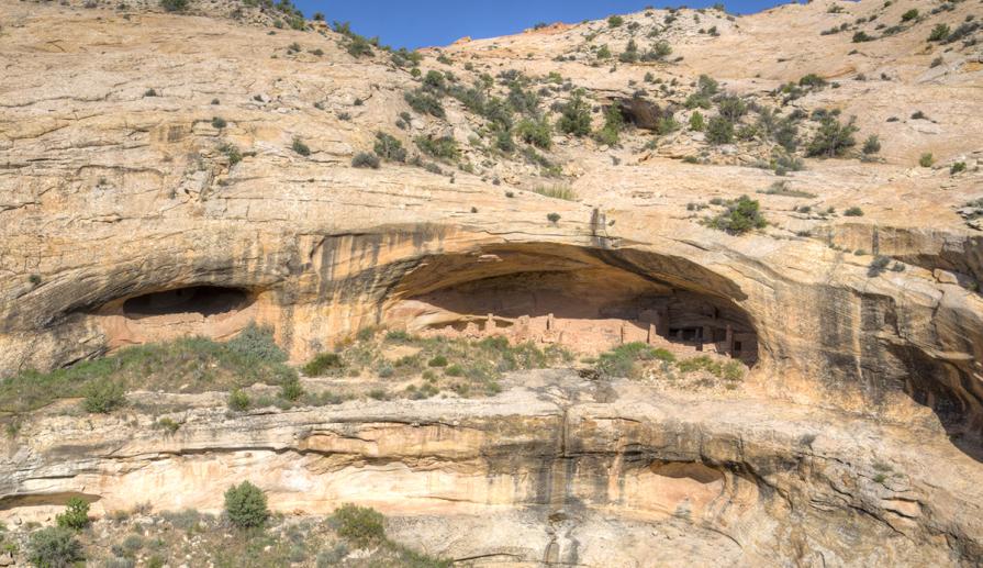
The WSA is in the Canyonlands Section of the Colorado Plateau Physiographic Province. The terrain consists of northward draining shallow canyons of varying widths and low, parklike mesas, with scattered buttes, knobs, and spires. The WSA has outstanding scenic quality. Red and buff sandstone spires, knobs, and buttes contrast with the green vegetation and the blue sky. In the southeast, the heads of Salt Creek (most of which is in Canyonlands National Park) cut a myriad of shapes in the colorful sandstone. Other special features include historic evidence of early century cowboy use, and an array of wildlife including cougars, mule deer, and peregrine falcon.
Visitation Information
Located in northwestern San Juan County, about 32 miles northwest of Monticello, UT. The Salt Creek Trailhead, House Park and Bobby's Hole provide access to the WSA. From Monticello, drive north on Highway 191 for 14.4 miles. Turn left (west) onto UT-211 and travel approximately 20.2 miles. At the Cottonwood Creek Recreation site, turn left (south) onto Beef Basin Road (B107). Continue approximately 17 miles to the Salt Creek Trailhead. To reach the western portion of Butler Wash WSA, continue another 7.8 miles past the Salt Creek Trailhead on the Elk Ridge Road Scenic Byway and then turn right (north) onto FR 0093/B119 toward House Park/Bobby's Hole.
Visitor Advisory
Visitors should come prepared for backcountry conditions and adequately prepare for their trip. Knowledge of weather, terrain, and physical conditions can help ensure safety.
Flickr Album