
Idaho Advisories and Closures
On this page, you may find the following information (when in effect) for BLM regions listed below:
- Seasonal Closures: BLM Idaho winter closures implements seasonal closures across the state to reduce disturbance to wintering wildlife during the most stressful time of year. Closing areas to human activity is important to allow deer and elk to conserve energy and survive the winter. When animals flee due to disturbances caused by people, they use calories that are needed to survive through the rest of the winter. Pregnant deer and elk are particularly sensitive to disturbances, and stand a better chance of survival when the habitat is free of interactions with humans and pets.
- Recreation Closures: Travel, recreation site closures
- Fire-Related Closures: Closures as result of wildfire
- Upcoming Events on Public Lands for Awareness
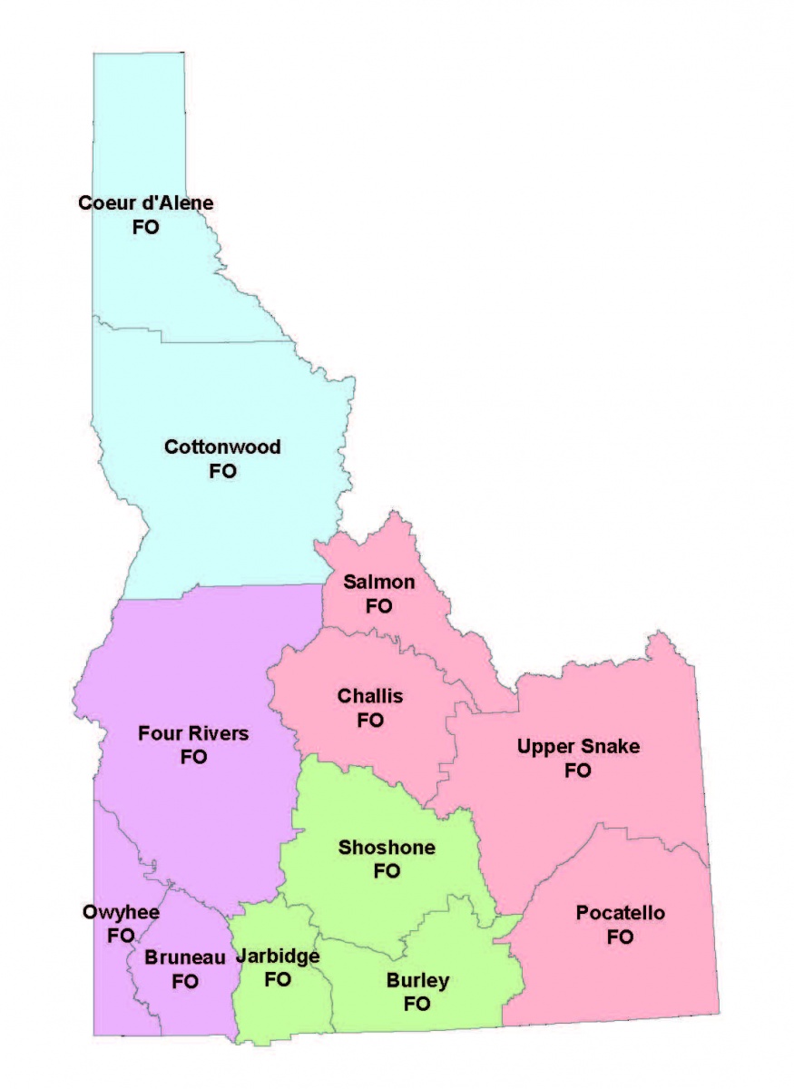
Open tabs below for more information about advisories/closures in a region near you:
- Southwestern Idaho (Boise District)
- Northern Idaho (Coeur d'Alene District)
- March 10, 2026 Section of Tiger Gulch Road temporarily closed due to storm damage in north Idaho | Bureau of Land Management
The Bureau of Land Management has temporarily closed a portion of the Tiger Gulch Road due which is impassable due to a washout of the roadway caused by recent winter storms.
The route closure is located in Township 49 North, Range 5 East, Section 6, approximately .1 mile south of the Kings Pass Road junction, on the edge of town of Murray. The closure is necessary to protect public safety and prevent further natural resource damage. Substantial effort to reconstruct the road segment will be required to return the route to a passable condition. The road segment will be closed until design and funding for repairs are acquired. Link to PDF map here. Temporary closure order here.
The Bureau of Land Management Cottonwood Field Office will replace the sewage lift station at Pink House Recreation Site, located near Orofino in Clearwater County. These renovations are necessary to ensure the long-term functionality and safety of the site and will temporarily affect some amenities.
The project involves a complete overhaul of the sewage lift station which will require a temporary closure of the sewer dump station and the flush toilets, starting March 16, 2026, and lasting several months. These amenities are expected to be available and fully functioning before summer 2026. The site will remain open during this time, with campgrounds on first-come first-served basis, although the flush toilets and RV dump station will be out of service and electrical access may be intermittent due to construction activities.
- Annual Seasonal Closure: October-May Blackwell Island Recreation Site. Reopens May 21, 2026.
Please call the Coeur d'Alene District for updates on closures at 208-769-5000.
- Eastern Idaho (Idaho Falls District)
UPPER SNAKE FIELD OFFICE- Stinking Springs and Egin-Hamer winter closures
Dec. 15 - May 1: Stinking Springs, Egin-Hamer Areas - link to press release dated Dec. 8, 2023.
The Upper Snake Field Office, in collaboration with the Idaho Department of Fish and Game, temporarily closes the Stinking Springs area every winter near the South Fork of the Snake River to all motorized vehicles and human entry to support mule deer and other wildlife survival rates in the area. This closure begins Dec. 15 and ends at sunrise May 1, but the opening day could change depending on weather conditions.
The Egin-Hamer area closure closes BLM-managed public lands to human entry every year to protect wintering deer, elk and moose. Restrictions begin Jan 1, and end at sunrise April 1 SOUTH of the Egin-Hamer Road, and at sunrise May 1 NORTH of the Egin-Hamer Road.
For more information, please view the Stinking Springs ATV and Mountain Biking Trail, the Egin-Hamer Closure map, or contact the Upper Snake Field Office at 208-524-7500.
CHALLIS FIELD OFFICE- Multiple Area winter closures
Motorized use is prohibited from Dec. 16 – April 30:
- Birch Creek Area of Critical Environmental Concern Seasonal Closure Area
- Carlson Hills Seasonal Closure Area
- Donkey Hills Area of Critical Environmental Concern Seasonal Closure Area
- Old Stage Road Seasonal Closure and Second Spring Seasonal Closure Area
- Willow Creek Summit Seasonal Closure Area
These annual seasonal closures are necessary for the protection of wildlife values and crucial elk winter range. The closure helps to protect wildlife during the difficult winter months, when mortality rates can increase. Non-motorized use is allowed year-round.
Motorized use is prohibited from October 1 – December 31:
- • Goldburg WSA
- • Burnt Creek WSA
- • East Fork to Hwy 93 seasonal closure area
These annual seasonal closures improve non-motorized big game hunting opportunities and reduce unauthorized off-road use within wilderness study areas and other important habitat areas.
A free georeferenced travel map may be downloaded onto your mobile device using Avenza Maps. For additional information, contact the Challis Field Office at (208) 879-6200, or in Challis, Idaho 83226.
SALMON FIELD OFFICE- Agency Creek winter closure
All primitive roads in the Agency Creek area are closed to motorized travel, including snowmobiles and other tracked vehicles, between 12/16 and 4/30 to provide protection to crucial big game winter range. The Lewis and Clark Scenic Byway is exempt from this closure. Please consult the Agency Creek area travel map or call the Salmon Field Office at 208-756-5400.
SALMON FIELD OFFICE- Hayden Basin spring closure
All roads in the Hayden Basin area are closed to motorized travel, including snowmobiles and other tracked vehicles, between 3/1 and 6/1 to provide protection to crucial big game winter range. The Hayden Creek Road, Colson Cutoff, and Basin Creek Road are exempt from this closure. Please consult the Hayden Basin area travel map or call the Salmon Field Office at 208-756-5400.
POCATELLO FIELD OFFICE- Chinese Peak-Blackrock Canyon Trail System winter closure
The Chinese Peak-Blackrock Canyon Trail System includes the AMI Trail Head (route 352), Barton Road Trail Head (route 301), Box Canyon (route 3110), Blackrock Canyon (route 302), and Caddy Canyon (route 324). These trails are seasonally closed to motorized and mechanized vehicles from Nov. 16 to April 14 each year, to prevent damage from use when the soil is wet and easily rutted, in order to minimize erosion and maintenance costs. This closure may be extended if wet winter conditions persist later than April 15. Tracked Over-Snow Vehicles (i.e., snowmobiles) are not allowed within the Chinese Peak-Blackrock Canyon Trail System travel management plan area.
A free georeferenced travel map of the Chinese Peak-Blackrock Canyon Trail System may be downloaded onto your mobile device using Avenza Maps. For additional information, please contact the Pocatello Field Office at 208-478-6340.
POCATELLO FIELD OFFICE- Soda Hills winter closure
Ninety Percent Canyon (route 10), Idaho Ranch Canyon (route 11), and Swenson Valley (route 12) all have upper and lower gates. Upper Gates are closed to all motorized vehicles from Nov. 16 to May 14 each year. Lower gates are closed to all motorized vehicles from Jan. 5 to May 14 each year. The closure is in place to protect wildlife during the winter months and to prevent damage from motorized vehicle use when the soil is wet and easily rutted, which minimizes erosion and maintenance costs. Tracked Over-Snow Vehicles (i.e., snowmobiles) are not allowed within the Soda Hills travel management plan area.
A free georeferenced travel map of the Soda Hills area may be downloaded onto your mobile device using Avenza Maps. For additional information, please contact the Pocatello Field Office at 208-478-6340.
POCATELLO FIELD OFFICE- Curlew/Deep Creek winter closure
Bannock Range/Goodenough Creek Campground - Walker Creek Trail (route 152) and Mormon Canyon (route 195) are designated as 50 inches or less in width. These Routes are seasonally closed to wheeled motorized vehicles from Nov. 16 to May 14 each year. The closure is in place to protect wildlife during the winter months and to prevent damage from motorized vehicle use when the soil is wet and easily rutted, which minimizes erosion and maintenance costs. These routes remain open for Tracked Over-Snow Vehicles (i.e., snowmobiles).
Deep Creek Mountains - Sand Hollow (route 956), Green Canyon (routes 903/956), Right Fork Knox Canyon (route 903), Yates Canyon (route 145B), and Bear Hollow (routes 145A/146/963/964/966) are all designated as 50 inches or less in width. These routes are closed to wheeled motorized vehicles from Oct. 1 to May 31 each year. The closure is in place to protect wildlife during the winter months and to prevent damage from motorized vehicle use when the soil is wet and easily rutted, which minimizes erosion and maintenance costs. These routes remain open for Tracked Over-Snow Vehicles (i.e., snowmobiles).
A free georeferenced travel map of the Curlew/Deep Creek area may be downloaded onto your mobile device using Avenza Maps. For additional information, please contact the Pocatello Field Office at 208-478-6340.
POCATELLO FIELD OFFICE- Pocatello West Bench winter closure
The Bannock Range/Pocatello West Bench - Trail Creek Road West Gate and Sandy Lane Gate are seasonally closed to all motorized vehicles from Nov. 15 to May 15 each year. The closure is in place to protect the Portneuf watershed, to protect wildlife during the winter months and to prevent damage from motorized vehicle use when the soil is wet and easily rutted, which minimizes erosion and maintenance costs. For additional information, please contact the Pocatello Field Office at 208-478-6340.
POCATELLO FIELD OFFICE- Bear Lake winter closure
Bear Lake County/East Side of Bear Lake - Merkley Mountain (route 07), Dry Canyon (routes 50/110), Pine Spring (routes 112/113), Cooley Canyon (routes 48/96/97), and Mud Canyon (route 90) are closed to all motorized vehicles and Tracked Over Snow Vehicles (i.e., snowmobiles) from Nov. 16 to May 15 each year. The closure is in place to protect wildlife during the winter months and to prevent damage from motorized vehicle use when the soil is wet and easily rutted, which minimizes erosion and maintenance costs.
A free georeferenced travel map of the Bear Lake area may be downloaded onto your mobile device using Avenza Maps. For additional information, please contact the Pocatello Field Office at 208-478-6340.
- South-Central Idaho (Twin Falls District)
Jan. 1 - April 30 Wood River Valley OHV Restrictions
The Bureau of Land Management Shoshone Field Office is implementing off-highway vehicle and conditional seasonal restrictions in the Wood River Valley to reduce impacts to wintering herds of deer and elk. No OHVs will be allowed in the identified areas from Jan. 1–April 30, 2026.
A map of the restricted areas is available online and will be posted at the informal snowmobile trailheads. The Wood River Valley Recreation and Access Environmental Assessment and associated Decision Record authorized these restrictions.
Recreationists, motorized and non-motorized alike, should consider their potential impacts to deer and elk in the area this winter and adjust their actions accordingly to minimize disturbance.
The following areas, except for motorized corridors, are closed to OHV use, including snowmobiles, from Jan. 1–April 30, 2026.
- All BLM-managed public land north of East Fork and Greenhorn
- South aspects of Ohio Gulch
- Quigley to Muldoon
- Bell Mountain to Picabo
- Croy Creek to south of Townsend Gulch and US Hwy 20
- Big and Little Beaver Drainages
- Camp Creek and Poison Creek areas
- Elk Mountain area.
Corridors open to motorized use include groomed snowmobile trails and ungroomed motorized corridors. The following are groomed by Blaine County for snowmobile use when there is sufficient snow: Quigley to Cove Creek, Muldoon, Sharps, Croy Creek to Camp Creek, and Rock and West Glendale.
Ungroomed corridors include Ohio Gulch, Indian Creek, Slaughterhouse and Bell Mountain to Picabo. All motorized vehicles and snowmobiles are limited to the road corridor in these locations/areas.
Jan 16 - March 15 South Hills Seasonal Motorized and Mechanized Travel Restrictions
The Bureau of Land Management (BLM) Burley Field Office management will implement an annual seasonal motorized travel closure in the South Hills area, south of Twin Falls, Jan. 16 to March 15, 2026. The closure is intended to prevent resource damage and protect crucial mule deer winter range and sage-grouse habitat. The area remains open to the public for non-motorized use.
A map is available online, and signs are posted in the area to notify the public of the temporary closure to the following roads, as well as any two-tracks or trails tied to these roads:
Indian Springs (closure begins 1.5 miles south of Foothills Road)
North Cottonwood Creek
Dry Creek
Dry Gulch
Cherry SpringThe seasonal closure applies to all motorized vehicles (including E-bikes), except those specifically authorized to access the area. Motorized travel authorization is provided for search and rescue operations, emergency medical services and law enforcement personnel, and administratively approved actions such as livestock grazing, access to private lands and resource monitoring or research studies.
For more information regarding this road closure, or nearby areas available for motorized travel throughout the winter, please contact Taylor Baxter or Heidi Barker, BLM Burley Field Office recreation planners, at (208) 677-6600.
BLM-Idaho Regions
- Eastern (Idaho Falls District)
- Southwestern (Boise District)
- Central (Twin Falls District)
- Northern (Coeur d' Alene District)