
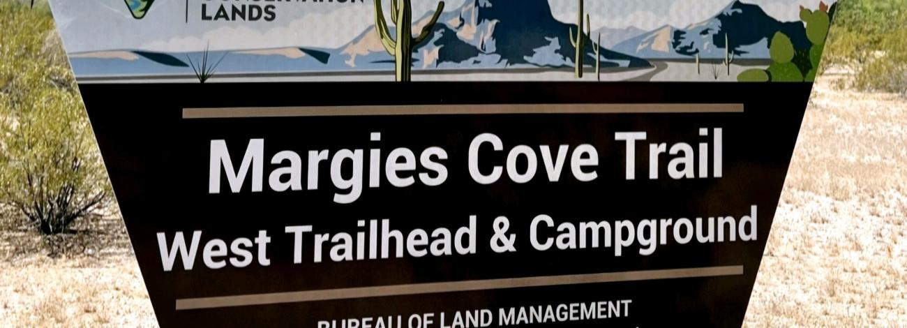
Margies Cove West Trailhead | Arizona
Margies Cove Trail is a near level, 9-mile route through the heart of the 63,200-acre North Maricopa Mountains Wilderness in the Sonoran Desert National Monument. Margies Cove Trail follows a combination of former vehicle tracks and wide, unmarked desert washes. The trail ends at the Margies Cove East Trailhead.
Margies Cove West Trailhead includes day-use parking for ten vehicles, a campground featuring three campsites with picnic tables and steel fire rings, a vault toilet, and informational signage.
No trail signage or directional markers are available along the route, so this trail is recommended only for experienced hikers skilled in reading topographic maps. Use the USGS 7.5 minute “Butterfield Pass, Ariz.” and “Cotton Center SE, Ariz.” topo maps.
Margies Cove Trail intersects the northern terminus of the Brittlebush Trail in the interior of the North Maricopa Mountains Wilderness. Only hiking and equestrian use is allowed in wilderness under the Wilderness Act of 1964. Motorized vehicles and mountain bikes are prohibited in wilderness.
The North Maricopa Mountains are a jumble of long ridges and isolated peaks separated by extensive, saguaro-studded bajadas and wide desert washes. Cholla, ocotillo, prickly pear, paloverde, ironwood, and Mexican jumping bean complement thick stands of saguaro to form classic Sonoran Desert vistas. Commonly seen wildlife includes desert mule deer, javelina, desert bighorn sheep, coyote, desert tortoise, and numerous varieties of lizards and birds.
Hours and Seasons
Trail can be used year-round; however, it is recommended for use from November through April. At other times of the year, the trail is seldom used due to high temperatures.
Summer temperatures may often reach 115 degrees. Wear a hat, long sleeve shirt, sunglasses, and sunscreen. Drink plenty of water!
Features and Services
- Drinking Water: There is no drinking water available. Bring plenty of water.
- Toilets: Accessible vault toilet onsite.
- Pets: Service dogs are legally permitted anywhere that visitors can go. Pack out all waste.
Your Safety
This is a remote area and access roads are not maintained. Cell phones do not work in many areas of the monument.
Heat and Sun
The monument's elevation ranges from 1,000 to 4,400 feet, so summer is rough on visitors. It's best to enjoy the monument from late October to mid-April. If you are visiting in summer, take extra precautions to drink plenty of water, as temperatures may exceed 110°F. We recommend sunscreen, sunglasses and a hat. Weather forecast
Water
Bring all the water you will need. There is no drinking water available on the monument. Plan on drinking one gallon (4 liters) per person per day—more if you're engaged in strenuous activities.
Your vehicle
Make sure your gasoline tank is full, carry additional water and full-size spare tires in your vehicle, and make sure your vehicle is in good working condition. Winter is the most popular time to visit.
Wildlife
The desert sun stirs up rattlesnakes and other reptiles as early as February.
Flash floods
Flash floods caused by sudden storms can be dangerous in washes, so it is best to have a survival plan to prevent emergency situations. Have good maps with you and know how to use them.
Border Concerns
The southern part of the monument is a corridor for drug and human smugglers. Be alert for illegal activities and law enforcement operations.
Respect and Protect
The area is home to many species of wildlife. Please remember to practice outdoor ethics and recreate responsibly. Help us protect this unique environment by leaving no trace during your visit.
Check for fire restrictions before your visit. Using exploding targets, fireworks, sky lanterns, tracer ammunition and other incendiary devices is prohibited on BLM-managed public land in Arizona.
Report resource crimes including vandalism, dumping and suspicious activity at 1-800-637-9152.
Accessibility Description (ABA/ADA)
The parking area consists of hard-packed ground with non-striped spaces. Although none of the spaces are designated as accessible, the entire parking area should be suitable for people with mobility devices.
This trail may pose challenges to visitors with mobility impairments.
Contact Us

Activities


Addresses
Geographic Coordinates
Directions
To access Margies Cove West Trailhead, drive Arizona Highway 85 to Woods Road (just south of mile post 134) and turn east. At the cattle guard/dirt road, turn left and follow the brown Margies Cove Trail signs which guide you west then north along the Hwy 85 fence line, then east 3.8 miles to Route 8001E. Turn right onto Route 8001E and drive south 1.2 miles to the trailhead. A high-clearance, two-wheel-drive vehicle is suitable for this road.
External Map
Fees
There are no permits, passes, or fees required to visit this wilderness area. It is free.
However, commercial, competitive, and large organized group events require a special recreation permit. Contact the local managing field office for more information about special recreation permits.
Recreational activities on any nearby state trust land require a permit from the State of Arizona.
Visits to the Sand Tank Mountains, located south of Interstate 8, require a free Barry M. Goldwater Range permit. Permits are only available online and not at the local BLM office.
Stay Limit
Dispersed camping is generally allowed on public land for a period not to exceed 14 days within a 28 consecutive day period.