
Nevada Surface Management Reference Map
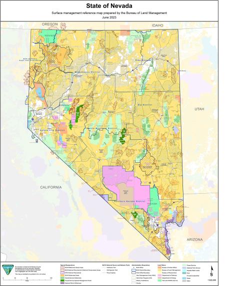
This map was produced by the BLM Nevada State Office in June, 2023. It shows district and field office boundaries, county lines, roads, and special designations such as national conservation areas, herd areas, and herd management areas for wild horses. Click on the link below to download the full-size version. This is a large map meant to be printed on a plotter at a size of 33 inches by 44 inches, so the resolution is too fine to see very much if printed at smaller sizes. The full-size version is best viewed on a device screen where you can zoom in and out to see details.
Download Files
Publication Date
Region
Nevada
Organization
Collection: Public Room, BLM Library
Category: Map
Keywords
Map
Public Room
Surface Management Agency