



A New Chapter on the Missouri: Community Celebrates Expanded Lewis and Clark Paddlers’ Trail
BUTTE, Mont. — On Saturday, July 18, more than forty people gathered at the Lower Toston Dam Campground to celebrate the inaugural float of a newly signed segment of the Lewis and Clark Paddlers’ Trail. Community members joined staff from the Bureau of Land Management, Montana Fish, Wildlife & Parks, and the Broadwater County Trails team to mark this milestone in expanding recreation opportunities along the Missouri River.
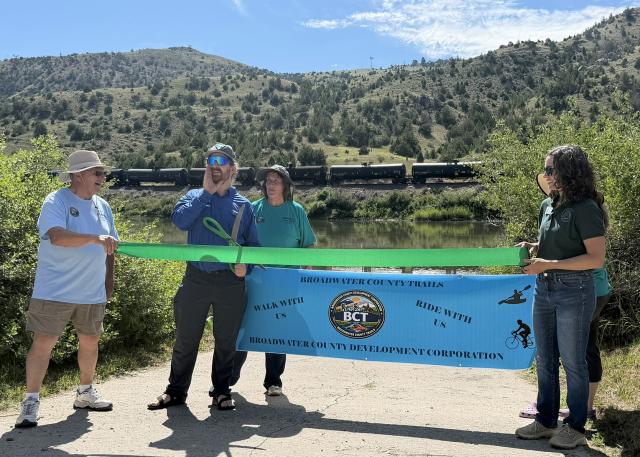
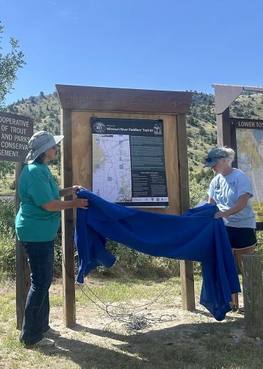
The Lewis and Clark Paddlers’ Trail traces the route of the historic Corps of Discovery, offering boaters a chance to experience both Montana’s landscape and its cultural heritage. Until now, official trail signage guided paddlers from Missouri Headwaters State Park downstream to just above Toston Dam. The new 20‑mile segment extends the route from Lower Toston Dam Campground toward Canyon Ferry. New kiosks like the one unveiled during Saturday’s event are being installed at Montana FWP river access sites to help visitors easily navigate the trail and plan river trips.
Staff from several offices, including those representing federal and state leadership, were present to share letters of support. Afterward, the newly designed kiosk was revealed and a ribbon cutting was held at the boat ramp. Afterward, volunteers and visitors launched their boats and floated downstream to commemorate the opening of the new segment.
“The extended trail improves river access for paddlers of all skill levels, making it easier for families, casual recreators, and experienced boaters to enjoy safe, scenic sections of the Missouri River,” said Henry Atkinson, BLM Butte Field Office Outdoor Recreation Planner.
Clear signage and updated maps help visitors identify put‑ins, take‑outs, hazards, and recommended routes. The new kiosks also highlight historic points of interest along the river corridor, helping connect recreators to the story of the Lewis and Clark Expedition, carried out from 1804 to 1806. Their landmark journey was commissioned to explore the lands of the newly acquired Louisiana Purchase and find a route to the Pacific Ocean. As they traveled up the Missouri River and across the western landscape, the expedition documented wildlife, geography, and Indigenous cultures, creating some of the earliest written accounts of this part of the country. Today, visitors paddling the Missouri River can experience sections of that same route, gaining a deeper appreciation for both the landscape and its place in American history.
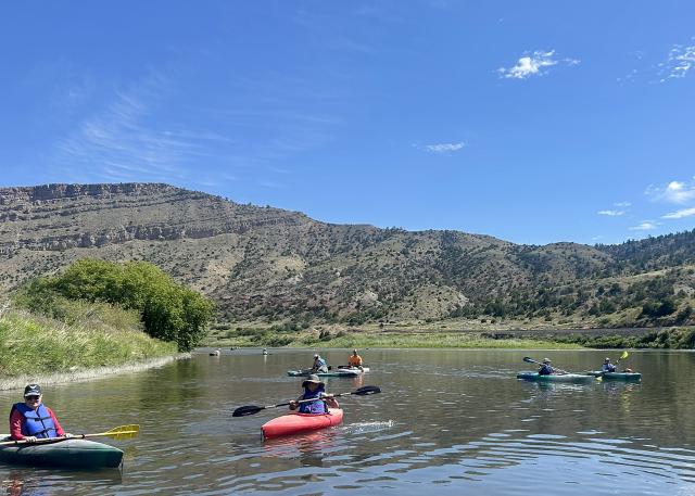
By providing trash bags and encouraging stewardship during the inaugural float, BLM reinforced how responsible recreation can protect wildlife habitat, maintain clean water corridors, and ensure positive experiences for future visitors. The expanded trail creates opportunities for day trips, overnight paddles, fishing access, wildlife viewing, and educational outings, all while supporting local outdoor recreation economies.
“The Butte Field Office recreation team was proud to contribute to expanding access along the Missouri River and supporting opportunities for the public to connect with this iconic landscape,” said Atkinson.
Related Stories
- National Public Lands Day Volunteers Revitalize Dean S. Reservoir in Montana
- National Public Lands Day Paddles, Plants and Caves: BLM Connects Milwaukee Youth with the Outdoors
- K2-Play Completes Final Phase of North Fruita Desert Trails Master Plan
- BLM Fishing Derby brings Americans Outside for recreation and stewardship in Imperial Valley, California
- Fossils, furs and a few sparks at Kemmerer Outdoor Discovery Day