



More time travel for the nation’s 250th: Exploring BLM back country byways in Oregon and California
The previous article discussed how the Bureau of Land Management’s back country byways provide a lens for reading the story of our nation, as the BLM commemorates the 250th anniversary of the country.
We looked at byways that traverse public lands in Colorado, Idaho, and Utah and that reveal important chapters in the nation’s history. Here we explore more of America’s story by tracing other scenic and historic routes, this time in Oregon and California.
BLM back country byways in Oregon
The Cow Creek Back Country Byway provides travelers in southwestern Oregon with an alternative route from Interstate 5. It forms a loop that begins at milepost 80, in Glendale, and ends at milepost 103, in Riddle.
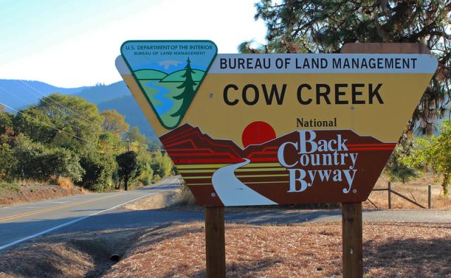
Rich with both historic interest and natural beauty, this 45-mile-long byway is a paved, Type 1 road, suitable for passenger vehicles in most conditions. It winds through coastal mountains, passing forests, farms, orchards, and waterfalls as it follows the Cow Creek River, a tributary of the South Umpqua River. The route also parallels the original Oregon and California Railroad, which began operating south of Portland in 1869 and finally reached the California border in 1887.
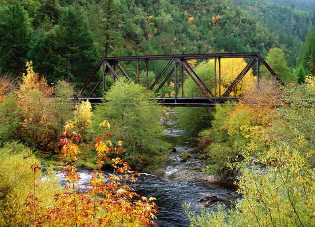
The Byway offers quite a few opportunities for time travel. It skirts two steel-girder railway bridges constructed in 1905; takes visitors near a railroad tunnel built in 1883, now closed; and provides glimpses of the mining and logging heritage of the region. The road passes near the remains of West Fork, where a railroad trestle testifies to the ghost town’s former life as an important stop on the Oregon and California Railroad and a base for gold-mining and logging operations.
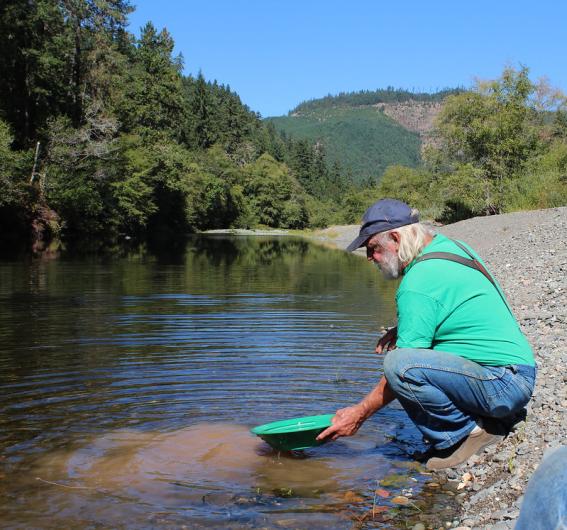
Visitors can still pan for gold in a designated segment of lower Cow Creek, near the Island Creek Day Use Area. Visitors should check with the BLM Roseburg District Office for current recreational gold-panning guidelines and seasonal conditions.
Another road leading to previous centuries, as well as America’s much more distant geologic past, can be found about 350 miles to the northeast, on Oregon’s South Fork John Day River Back Country Byway.
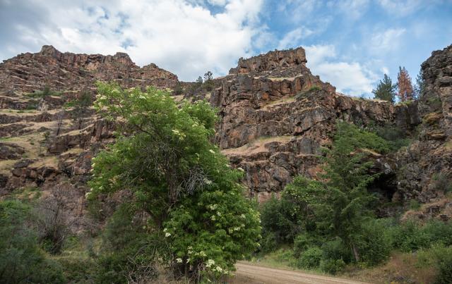
This gravel route, also a Type 1 byway, runs parallel with the South Fork John Day Wild and Scenic River, near the Malheur National Forest, for 50 miles. Much of the route is a two-lane road, though some stretches can accommodate only a single vehicle. The surface is suitable for high-clearance vehicles during dry conditions.
The namesake of both the Byway and the river it follows, John Day, took part in an 1812 overland expedition to the mouth of the Columbia River. That expedition was sponsored by the owner of the Pacific Fur Company, John Jacob Astor, after whom Astoria, Oregon, was named.
Running alongside river rapids and the 56-foot-high Izee Falls, the Byway offers views of old-growth forest and basalt cliffs formed by volcanic activity some 16 million years ago. It also provides access to the Murderer’s Creek Herd Management Area, named after a tributary to the river.
Here wild “timber horses” live among Ponderosa pines and mixed conifers on nearly 150,000 acres and at elevations of up to 6,500 feet. Some of these horses may be descendants of horses once kept at the Rockpile Ranch, established in the late nineteenth century near Dayville.
The town of Izee, named after the IZ Ranch, is about 20 miles farther south. Although the town has experienced population decline and is marked by several abandoned structures, a two-room schoolhouse that was built in 1889 and served students in the area for 100 years remains intact.
Before the arrival of explorers such as Day and the settlers and ranchers who came after him, Columbia Plateau and Northern Paiute Indians, among other Native peoples, used the river corridor for fishing, hunting, and berry picking. Conflicts arising from settlement patterns are reflected in the names of places like Murderer’s Creek, where a group of miners was killed in the 1860s.
BLM back country byways in California
If you head south and drive for about 300 miles, crossing into California, you’ll reach the Surprise Valley Barrel Spring Back Country Byway. This 93-mile loop begins and ends in Cedarville, California, and like other BLM back country byways it transports visitors through both space and time.
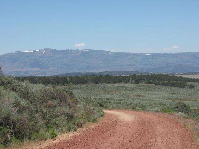
The route runs along the base of the Warner Mountains in northeastern California and encompasses stretches of roadway in Nevada. Portions of the Byway are paved in California, while other parts of the road in both California and Nevada are improved gravel. Still other sections have a dirt surface that will require a vehicle with high ground clearance and possibly four-wheel drive.
The landscapes through which the Byway passes are no less varied than the road’s surfaces, ranging from alpine peaks and pine forests to hills covered in sagebrush to flat valley floors. Wildlife in the area includes bighorn sheep, pronghorn antelope, and mule deer; migrating shorebirds such as willets, which make use of the intermittent lakes that form in the spring and early summer; greater sage-grouse; and large raptors such as golden eagles and prairie falcons.
The BLM’s map of the Byway shows 29 points of historic as well as scenic interest, allowing visitors to plot their course through key episodes of our nation’s story. Here are only a few of the highlights along one of America’s most historically resonant roadways:
a lake near Cedarville where prehistoric villages have been excavated;
wild gardens with edible roots and tubers traditionally harvested by the Northern Paiute;
the Applegate-Lassen trail used by participants in the 1849 California gold rush;
the town of Cedarville itself, founded in 1864 as a stopping place for wagon trains; and
abandoned family homesteads from the early decades of the twentieth century.
Almost 800 miles to the south, near the California-Arizona border, the Bradshaw Trail National Back Country Byway represents about one-third of the stagecoach and wagon road established in 1862 by prospector William D. Bradshaw.
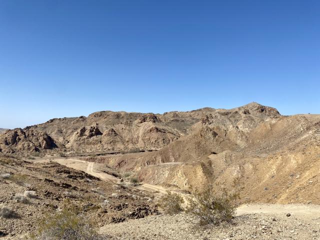
That road was the first overland route to connect populated areas of California’s west coast to the gold fields near the town of La Paz in what was then known as the U.S. New Mexico Territory and later became the Arizona Territory. Several stagecoach lines ran on the route, including the Wells Fargo Express.
A Cahuilla chief and a member of the Maricopa Tribe had told Bradshaw about an ancient trade route through the Colorado Desert, with springs and watering holes, and the prospector drew on this information to build the road. It continued to be used until 1878 and led to a population influx in Southern California’s Colorado Desert region—and beyond.
The 70-mile-long stretch of the road preserved as the Bradshaw Trail National Back Country Byway is a Type 3 route, with areas of soft sand requiring four-wheel drive vehicles. It offers views of the Chuckwalla Bench, a desert forest used for millennia by the ancestors of many Native American Tribes. This woodland, along with more than 50 miles of the Byway, is now part of the Chuckwalla National Monument.
To some extent, the history that unfolded along the route must be imagined. When the gold mines were played out and La Paz became a ghost town, abandoned stage stops on the route began to disappear from view, especially with repeated grading of the dirt road.
Yet as so often happens with BLM back country byways, the historical legacies of this road live on in the names of the places where it goes.
Linda Castro, assistant policy director for Cal Wild, underscores the importance of place-names in her article on the Bradshaw Trail.
“Some historians,” Castro says, “believe that the name ‘Chuckwalla’ came from the Cahuilla word (‘chu qual’) for the lizard we now call Chuckwalla.”
With our BLM byways providing access to places with an enduring but not always obvious heritage, the vehicles used to travel these roads are true vehicles of discovery. They allow visitors to take not just a long drive but a deep dive—into the richly layered histories of our public lands.
As KC Craven, the BLM’s National Program Lead for Recreation and Tourism Benefits, puts it, “These routes don’t just offer scenic drives. They reconnect people to stories and places that have shaped our country.
“As we mark 250 years of American history, these byways help ground that history in real places people can visit today."
Related Stories
- Celebrating 30 Years of California Condor Recovery at Vermilion Cliffs National Monument
- BLM Fishing Derby brings Americans Outside for recreation and stewardship in Imperial Valley, California
- Postcards Become Monthly Creative Tradition at Red Rock Canyon National Conservation Area in Nevada
- BLM Showcases Local Recreation Treasures Ahead of National Hunting and Fishing Day
- Healing Hooves: How a Once‑Wild Burro is Bringing Joy Across Pennsylvania and Competing Nationally