
Hotbeds of history: two BLM Montana national monuments mark 25 years
Two Bureau of Land Management (BLM) Montana national monuments, Pompeys Pillar National Monument and Upper Missouri River Breaks National Monument, celebrated the 25th anniversaries of their designations in January.
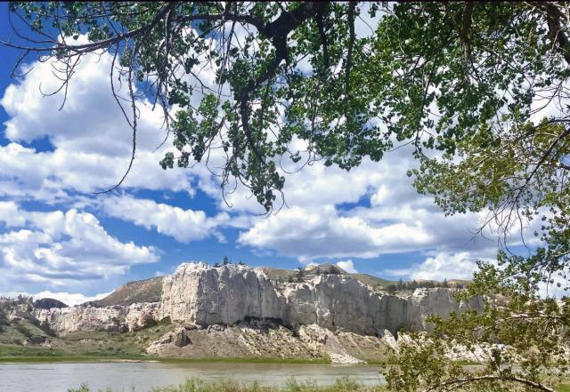
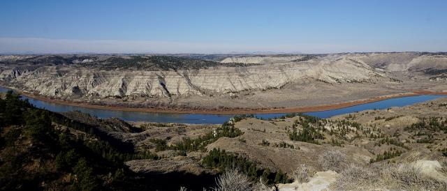
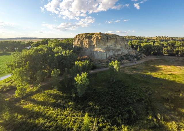
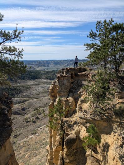
The Upper Missouri River Breaks National Monument, designated on Jan. 17, 2001, includes about 377,000 remote acres in central Montana. The Pompeys Pillar National Monument, also designated Jan. 17, 2001, includes 51 acres on the banks of the Yellowstone River, about 25 miles east of Billings.
What makes these two national monuments so special? One could argue it’s their tie to history, literally etched into the rock.
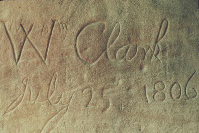
Most people are familiar with the expedition of Captain Meriwether Lewis and Second Lieutenant William Clark, the famous early 1800s explorers of the American West. But did you know that there is an outcrop within the Pompeys Pillar National Monument where you can still see William Clark’s name, along with the date of his 1806 visit to this place, engraved into the rock? This inscription is the only remaining physical evidence of Lewis and Clark’s great American journey.
One fun fact about the “Pillar,” a sandstone outcrop that rises 120 feet towards Montana’s Big Sky, is that Clark named this rock “Pompy’s Tower” in his journal; ‘Pompy’ was his nickname for Sacagawea’s young son, Jean Baptiste Charbonneau.
Beyond the Pillar where Clark inscribed his name, the physical characteristics of the surrounding Montana wilderness, although nameless, also bear witness to history.
For example, much of the Upper Missouri River Breaks National Monument’s biological objects—in addition to landscape features such as open plains, striking cliffs, and river landscapes—have changed little over the intervening years, giving visitors the remarkable opportunity to see the landscape through the eyes of early explorers.
In 1805, Captain Meriwether Lewis described in his journal (which is quoted in the Monument’s Proclamation) his impressions of the landscape within the Upper Missouri River Breaks National Monument’s, which visitors can still witness today:
"... nature presents to the view of the traveler vast ranges of walls of tolerable workmanship, so perfect indeed are those walls that I should have thought that nature had attempted here to rival the human art of masonry..."
In addition to the outstanding scenery, these two national monuments offer many activities that make them well worth the visit for the modern-day explorer.
At the Upper Missouri River Breaks National Monument, visitors can paddle the Upper Missouri National Wild and Scenic River, hike to overlooks, observe wildlife, or visit historic sites, including those tied to Native American history and early homesteaders. Do you want the full experience? Try driving the Missouri Breaks National Back Country Byway for breathtaking landscape vistas.
Over at the other Montana national monument, Pompeys Pillar, the gates and Interpretive Center are currently closed until May 2026; however, visitors can still trek the ¾-mile to the site during daylight hours even though the gates are closed. Climb the boardwalk to the top of the Pillar and see for yourself why William Clark called this a “remarkable rock” in his journal.
As we celebrate the birthdays of these two Montana national monuments, remember to take time to reflect on the enduring beauty of our public lands—a beauty that continues to amaze the modern-day explorer.
Resources
Upper Missouri River Breaks National Monument webpage
Pompeys Pillar National Monument webpage
Pompeys Pillar National Monument Proclamation
Upper Missouri River Breaks National Monument Proclamation
https://www.blm.gov/sites/default/files/docs/2024-02/ppnm-brochure.pdf
Related Stories
- Birding Aravaipa Canyon: A morning of songs, color, and creekside adventure
- Preserving a Legacy in Stone: The Race to Save Pompeys Pillar
- BLM Billings Field Office Completes Dilworth Creek Riparian Restoration Project
- Boating Paradise: GAOA Funding Enhances Popular Recreation Site Along Montana’s Yellowstone River
- More time travel for the nation’s 250th: Exploring BLM back country byways in Oregon and California
Office
111 Garryowen Road
Miles City, MT 59301
United States