
The BLM encourages visitor safety on public lands during wildflower season in the California desert
PALM SPRINGS, Calif. – After much needed winter rain, the California desert comes alive in the spring. Precious plants invisible under the sand will bloom overnight, adding colorful pink, yellow and white flowers across the landscape.
While enjoying your desert excursions this spring, remember to recreate responsibly. Always plan trips in advance. Tell someone where you’re going and your expected return time. To avoid disturbing plants and wildlife, only travel on designated roads and trails. Capture the beauty of wildflowers through photography and leave them where they bloom. For more safety tips, visit the California State Park’s website.
Here are locations to view wildflowers on BLM-managed public lands in the California desert:
Barstow Field Office:
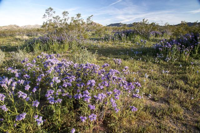
Image: https://flic.kr/p/Scjdfc
The Ord Mountains feature beautiful cactus flowers, specifically in the Kane Wash area. Access requires a four-wheel drive vehicle. Please follow these practices to help protect this special place for future visitors.
The Fremont Peak area, northwest of Barstow, is typically excellent for wildflowers. Open routes off U.S. Route 395 provide access to the area. Drive with caution as dirt roads may be rutted out in spots.
Copper City Road north of Barstow provides access to patches of wildflowers. Vehicles with high clearance are recommended since rocks may be encountered in the road. Many species of wildflowers can be found along Copper City Road including a Joshua tree grove.
El Centro Field Office:
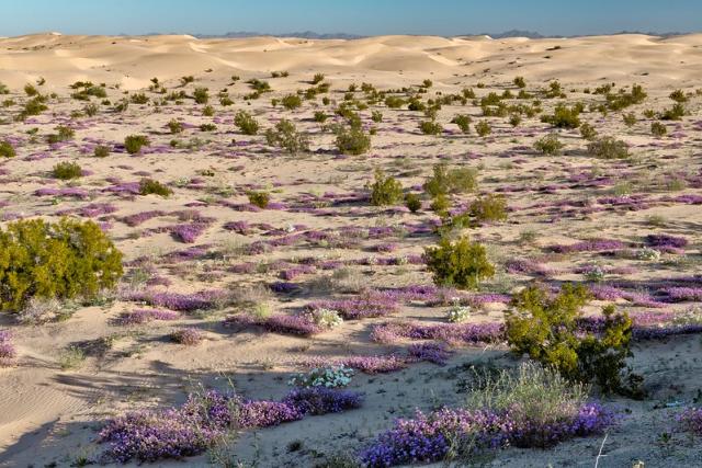
Image: https://flic.kr/p/2pJrABy
Blooms in the North Algodones Dunes Wilderness can be seen from Osborne Overlook in the Imperial Sand Dunes Recreation Area. Permits are required from October 1 through April 15. Permits can be purchased at the Cahuilla Ranger Station, Friday-Sunday for $50 or online for $35.
The Wildlife Viewing Area in Imperial Sand Dunes Recreation Area provides access to the North Algodones Dunes Wilderness. Safely park along Ted Kipf Road before walking into the wilderness area. The gravel road crosses sandy washes, so four-wheel drive is recommended. Geographic coordinates: 33.0207, -115.1075
Sacatone Overlook in McCain Valley offers views of the desert valley below. Four-wheel drive is required.
Carrizo Overlook in McCain Valley offers views of the surrounding area. Roads are passable with a two-wheel drive vehicle. Geographic coordinates: 32.773957, -116.282389
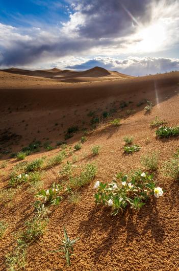
Needles Field Office:
Images: https://flic.kr/p/2pJm5qL, and https://flic.kr/p/2pJfNyp
The Mojave Road, based on the indigenous Mojave trail network, starts at the Colorado River, travels west across Mojave Trails National Monument and passes through Mojave National Preserve, before continuing through Afton Canyon in the Barstow Field Office. The historic route was utilized by many California Tribes and later by pioneers and cavalrymen. This road requires four-wheel drive vehicles with high clearance.
Snaggletooth Primitive Campground, located off U.S. Route 95, is 30 minutes south of Needles and offers spectacular views across the western portion of Mojave Trails National Monument. Two-wheel drive vehicles can access the area.
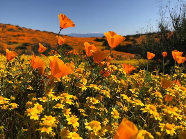
Palm Springs – South Coast Field Office:
Images: https://flic.kr/p/2jr63DA and https://flic.kr/p/2dY4USM
The Santa Rosa and San Jacinto Mountains National Monument Visitor Center, located off California Highway 74 in Palm Desert, has breathtaking views of the Coachella Valley with accessible walking and hiking trails. Park at the visitor center to see wildflowers along the Ed Hastey Garden Trail or hike the Randall Henderson Trail.
Explore Mecca Hills Wilderness to admire wildflowers along the San Andreas Fault Line. Box Canyon Road, which cherrystems the wilderness area, is accessible from Mecca, CA, or Interstate 10 at the south end of Joshua Tree National Park. Safely pull-off at designated or previously disturbed areas to avoid crushing vegetation. Box Canyon Road is accessible in a two-wheel drive vehicle.
Ridgecrest Field Office:
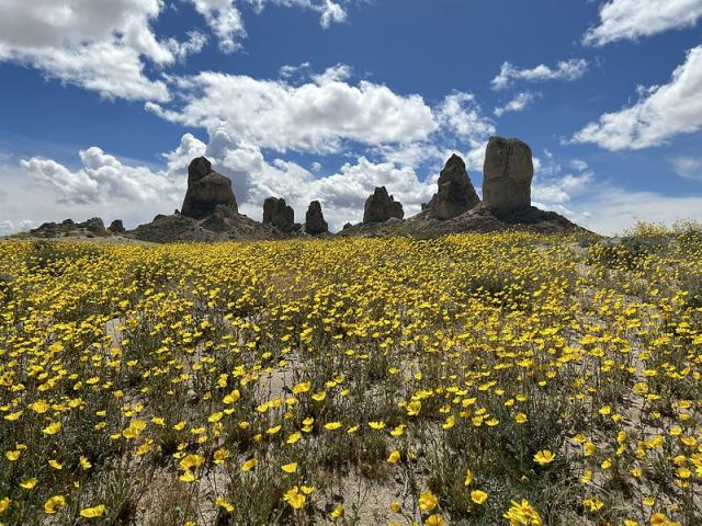
Images: https://flic.kr/p/2pJhSdy, and https://flic.kr/p/2pJsVaR
Short Canyon trail, in Owens Peak Wilderness, is approximately 20 minutes northwest of Ridgecrest and is open to hikers and equestrians.
Directions to Short Canyon: From the intersection of U.S. Highway 395 and State Route 14, travel north for one mile to Leliter Road and turn west to cross U.S. Highway 395. On the west side of the highway, follow the Short Canyon signs and take the graded dirt road to the Power line Road. Then turn south and proceed for half a mile to the intersection with BLM Route SE138. Turn west and follow this dirt road all the way to the parking lot and trailhead. Four-wheel drive vehicles with high clearance are recommended.
The Searles Valley, containing the Trona Pinnacles, a National Natural Landmark, offers views of wildflowers near the southwestern boundary of Death Valley National Park. Drive along Pinnacle Road, a six-mile graded road, to see blooms. For additional questions and information, contact the appropriate field office.
Julia Mogen, Public Affairs Specialist, California Desert District, 760-835-4612, [email protected]
Related Stories
- BLM and Partners Celebrate America's 250th at the King Range National Conservation Area
- Birding Aravaipa Canyon: A morning of songs, color, and creekside adventure
- BLM, Partners Enhance Public Access at Popular Recreation Area
- Volunteers and Partners Retrace 250 Years of History on the Anza Trail
- BLM Celebrates America’s 250th Anniversary in Oregon
Office
1201 Bird Center Drive
Palm Springs, CA 92262
United States