
Repairing the Ikpikpuk River Gage
In February 2023 the Ikpikpuk River gage stopped streaming quality data, indicating an issue with the pressure transducers (i.e., water level sensors). As Bureau of Land Management (BLM) staff considered whether to fix the gage or decommission it, members of the Utqiagvik community contacted the office inquiring about the status of the gage. They told the BLM how valuable the river data was to their community. The gage is monitored by the public to assess the travel conditions along the river and has been a handy tool to watch for potential flooding events that would affect subsistence camps and cabins downstream of the gage site. The data is especially useful during river breakup and freeze up.
The BLM Arctic District Office manages about 187 river miles of the Ikpikpuk River within the National Petroleum Reserve in Alaska (NPR-A). The Ikpikpuk River flows north from its headwaters in the foothills of the Brooks Range to the Beaufort Sea. BLM established a river gage on the Ikpikpuk River below Frye Creek in 2002 that is accessible by helicopter from Umiat or Inigok field stations. The gage is about 70 miles from the Umiat Field Station and 40 miles from Inigok Field Station.
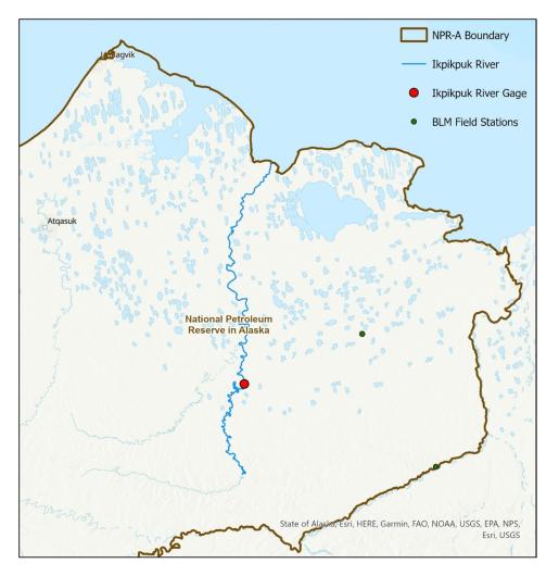
The Ikpikpuk River gage is managed by BLM Arctic District Office in collaboration with the University of Alaska, Fairbanks Water and Environmental Research Center. It’s logistically challenging to manage due to its location, so site visits occur opportunistically between late May and early September when other aquatic monitoring is being done within the NPR-A.
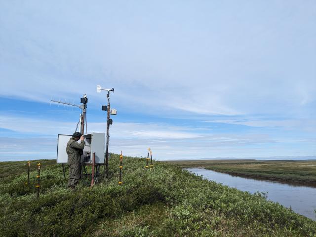
We went to the Ikpikpuk River gage in early June for an initial assessment of the issue with the river gage. While patches of snow lingered on the riverbanks, the river was ice-free and the early flowers of the season, Anemone parviflora, were in bloom. A portion of the bank above the conduit box had slid since last summer, burying the PTs and associated cables with sediment. We took an inventory of things needed to fix the gage and planned our trip back.
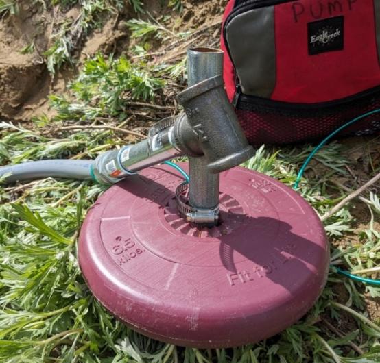
We returned when the riverbank was covered with green foliage and a variety of wildflowers with two new PTs and cable. We deployed the new equipment, protecting the PTs with piping and the cables with conduit and waited to confirm that data was being transmitting correctly. Typically, the PT should be placed low enough in the river that it is able to capture all flow regimes and, if possible, utilize features of the riverbed to stay in place. However, due to high water on the day of our visit, we were not able to situate the PTs in this ideal way and instead positioned them to the best of our ability from the shore.
Unfortunately, after returning from the field and reviewing the data online, we noted that the water level being reported did not correspond with that of the historic record. We could see that the PTs had come out of the water at various times of lower water level. Given that we had one final field visit planned, there was still time to make further adjustments before winter set in.
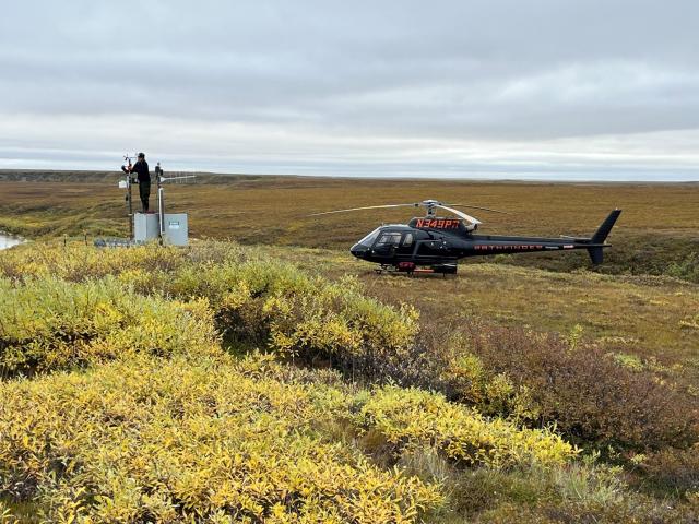
On August 29th, we visited the Ikpikpuk River gage for the last time of the field season. The leaves had already turned towards autumn. The river was even higher than it had been on our last visit. Still, we were able to resituate the PTs a little deeper into the river so that they would be less likely to come out of water. We hand surveyed the water level using previously established elevation benchmarks and applied appropriate offsets to the water level readings from the PTs so that water level reported online is comparable with that of the historical record. Additionally, we installed a new wind sensor.
Once we returned from the field, we sent an update on the gage to members of the Utqiagvik community who had previously expressed interest and concern in its maintenance. We immediately heard back that people had already noticed the updates to the reported data online and had been reviewing the gage data regularly on their hunting trip.
If you’d like to see the data, visit the Fish Creek Watershed Observatory website as well as the National Weather Service website.
Related Stories
- Dino-Mite Story Time in Pinedale
- Reel Partners: BLM and Wyoming Game and Fish Cast a Line for Kemmerer’s Next Generation
- To what degree do livestock stocking rates alter nesting bees and flowers?
- BLM-managed lands support NASA’s autonomous lunar rover testing in Imperial County, California
- Growing Resilience from the Ground Up at the Jupiter Inlet Lighthouse ONA
Office
222 W 7th Avenue #13
Anchorage, AK 99513
United States