
BLM National Scenic and Historic Trails mapping project showcases Indigenous connections to the land
Story by Carin Farley, BLM National Scenic and Historic Trails Program Lead
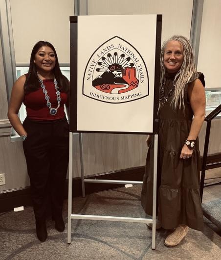
Earlier this month at the annual Partnership for National Trails System (PNTS) Workshop held in Albuquerque, New Mexico, Bureau of Land Management (BLM) National Scenic and Historic Trails (NSHT) Program Lead, Carin Farley, introduced Ancestral Lands AmeriCorps Intern Kiana Etsate-Gashytewa (from the Pueblo of Zuni and Hopi Tribe) to present on the BLM NSHT Program’s Indigenous Mapping and Research Project (IMRP), “Native Lands-National Trails.” The IMRP creates a new interactive GIS map that shows the intersection and relationship between Indigenous lands and the National Trail System. The map and associated toolkit will be available to the public on the PNTS website by the end of this calendar year. The presentation of this project was part of the celebration of Native American Heritage Month (November) and reflects this year’s theme, “Revitalizing Indigenous Connections.” The session showcased the innovative work that has begun on the National Trails System to include a stronger influence from Indigenous communities and their connections to these landscapes.
The idea for this project developed in the fall of 2020, when land acknowledgements were starting to be heard in the United States on calls and during conferences. Acknowledgment without action, authenticity and structural change is an empty gesture. Change requires crucial conversations, and several months were spent thinking of ways to create space to strengthen partnerships in the NSHT program through action and support for Indigenous voices. Native Lands Digital (NLD) was being used frequently as a resource to inform these land acknowledgements and was even used by Interior Secretary Deb Haaland during her travels. NLD is a Canadian Indigenous-led, not-for-profit organization that strives to create and foster conversations about the history of colonialism and Indigenous ways of knowing. They have developed a map where Indigenous communities can represent themselves and their histories on their own terms. BLM reached out to Executive Director of NLD, Christine McRae, and she agreed to partner with the BLM. Through BLM’s long-standing assistance agreement with PNTS, the project was formed.
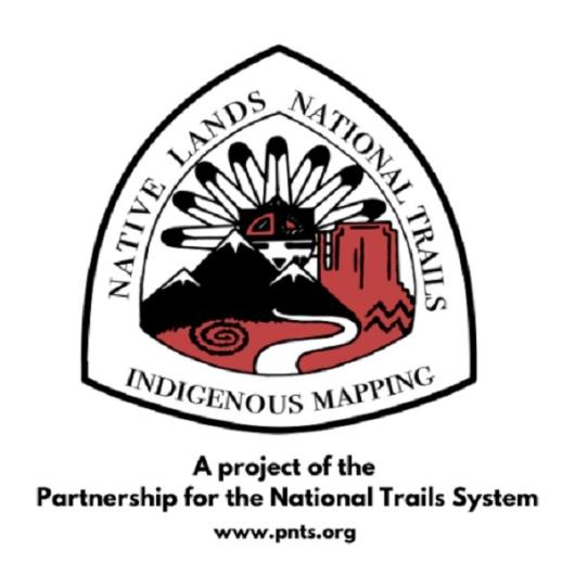
The team wanted an Indigenous youth to steward the project from their perspective and reached out to the Ancestral Lands AmeriCorps program to recruit a candidate. This organization leads underrepresented Indigenous youth and young adults in conservation service programs that reconnect participants to the land, their cultural heritage, and their traditions, hoping to create pathways to education and employment in these fields. Kiana Etsate-Gashytewa joined the project from the Pueblo of Zuni and Hopi with degrees in Political Science (BS) and Applied Indigenous Studies (BS) from Northern Arizona University. Her work overlays data from Native Lands Digital onto the National Trails System in an interactive GIS map. The map will help federal agencies that administer National Trails and their nonprofit trail organization partners to advance National Trails System knowledge of Indigenous ancestral Lands and increase partnerships and collaboration with Indigenous communities along NSHT’s. Autry Lomahongva, an Indigenous youth (from both Hopi and Navajo (Diné)) was selected and paid to design the IMRP logo for PNTS.
Etsate-Gashytewa has taken on this project with passion, reaching out and engaging new partners such as Esri. She has learned a new set of career skills and has proven herself to be a rising leader among her peers.
“It was special to present and work on this project as an Indigenous, Pueblo person from both my homelands in Zuni and on Tiwa territory in Albuquerque, NM. Our relationship to the land and trails coexist with who we are as Pueblo people in deep rooted and rich cultural history. This project aims to bridge connections and give examples of work that has been done in partnership with Indigenous communities and the National Trails System to not only create wider accessibility and collaboration, but overall protection and stewardship of the land. This is not a first step but a continuation of work that has been done for years and continues through this project," Etsate-Gashytewa said.
To learn more, see the PNTS-hosted IMRP webinar recording that was held on Nov. 15th or contact NSHT Program Lead Carin Farley at: [email protected].
Related Stories
- BLM, Partners Enhance Public Access at Popular Recreation Area
- Framed for Freedom: Bureau of Land Management Eastern States and the Legacy of National Historic Trails
- Volunteers and Partners Retrace 250 Years of History on the Anza Trail
- Celebrating 2026 National Trails Day volunteers
- Strengthening Partnerships: BLM Connects with Industry at Key Oil and Gas Meetings in Ohio and Pennsylvania
Office
1849 C Street NW
Washington, DC 20240
United States