
Drawing lightning and inspiration in southeastern Oregon
Story and photos by Derrick Henry, Public Affairs Specialist
Hiram E. Leslie lay suffering in what was then called Dugout Gulch by everyone in southeastern Oregon. Lightning had reached out and touched the accused cattle rustler after he had declared his innocence to friends.
“If I’m guilty of stealing my neighbor’s cattle, may the Lord strike me dead on the spot,” Mr. Leslie fumed in May 1882, part of legend and history recounted in the archives of the Bend Bulletin in 2000 and the Portland Oregonian in 1966. Lightning hit him two days later.
The lightning bolt didn’t kill Mr. Leslie instantly. Instead, the photographer-cattleman from Silver City, in what was then Idaho Territory, would linger with his skull broken wide open. Two other cowboys helping Mr. Leslie had also been struck when the thunderstorm came up suddenly as they were moving cattle to a camp in the gulch. They had minor injuries. Their stock horses were calm now, nipping at vegetation and swishing their tails.
Someone went for a doctor.
The temperatures in southeastern Oregon had been rising and falling all month. Fast-moving storm systems charged the air. Late May blending into summer.
Now, among the volcanic formations millions of years old, Mr. Leslie’s pain fused with the quiet beauty around him. Local historian Omer Stanford told the Bulletin that one of the cowboys, Bill Schnabel, who went to get help, said he could see part of Mr. Leslie’s exposed brain; it pulsed with his heartbeat.
A doctor arrived about 36 hours later and Mr. Leslie was taken to Silver City. There he died on May 31, far from what is now called Leslie Gulch and managed by the Bureau of Land Management.
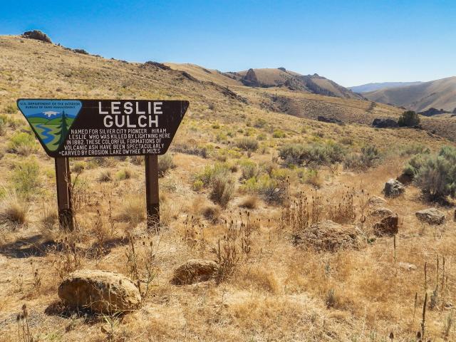
A BLM sign on the way to Leslie Gulch offers this TLDR version:
Named for Silver City pioneer Hiram Leslie who was killed by lightning here in 1882. These colorful formations of volcanic ash have been spectacularly carved by erosion. Lake Owyhee 8 miles.
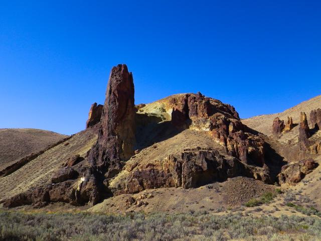
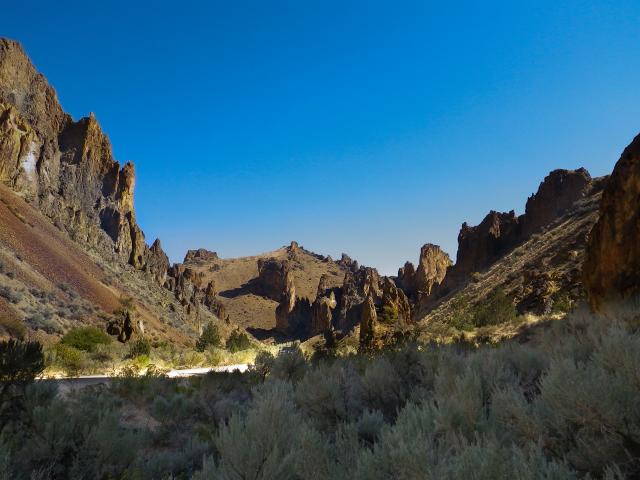
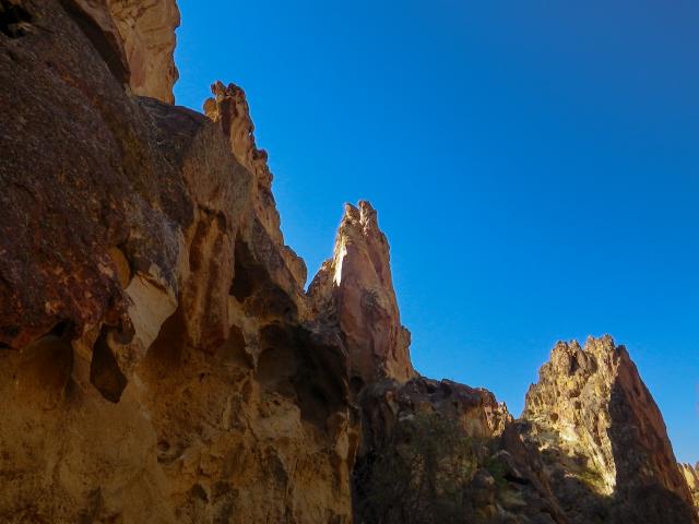
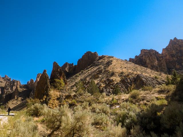
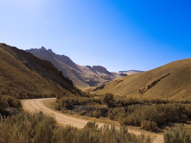
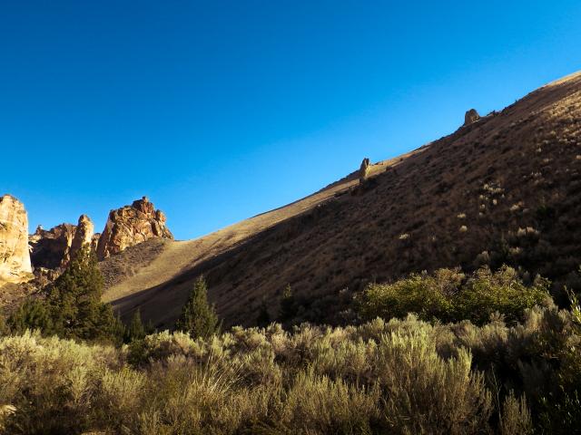
Steep slopes and vertical, honeycombed towers skirt the narrow Leslie Gulch Canyon Road. At the bottom, rock formations knife skyward with brilliant color. Hawks, in search of prey, ride the thermal lifts.
Mr. Leslie’s isn’t the only human story in the gulch. Indigenous peoples fished, hunted, and camped along the Owyhee River in Leslie Gulch 5,000 years before European contact. Later, the original Leslie Gulch Canyon Road served as a wagon and mail route between the towns of Rockville to the east, and Watson to the west on the bank of the Owyhee River. Flooded to make the Owyhee Reservoir during construction of the dam from 1928 – 1932, Watson’s remnants sit at the bottom.
The BLM manages Leslie Gulch, in Malheur County, as an Area of Critical Environmental Concern. The designation authorizes the BLM to protect the outstanding scenery and habitat of California bighorn sheep and several rare plant species. The nearby watersheds of Leslie, Slocum, Juniper, Dago, and Runaway Gulch, all drain into the Owyhee Reservoir. Just before the Owyhee Reservoir stands the 12-site Slocum Creek Campground, prime seating to the more than 11,673 acres covered by this ACEC.
A concrete boat ramp provides Owyhee Reservoir access for small watercraft. Hiking, photography, plant- and wildlife-viewing are all popular activities in Leslie Gulch. Visitors are reminded to exercise caution. This includes being prepared for ticks, rattlesnakes, and extreme weather and road conditions.
Many have noted the contrast between day and night in Leslie Gulch where light, shadow, and stone trigger optical illusions. A homesteader named Ida Dutcher (who moved in March 1917 from the Snake River Valley with their infant daughter and husband Willard) recorded her observations.
“It was beautiful there looking down in Leslie Gulch, with its colorful sandstone walls, many looking like huge animals perched atop the towering pinnacles,” wrote Mrs. Dutcher, who authored Our Homestead in the Canyon, first printed in 1970. “It was especially pretty on moonlit nights.”
The Dutcher family moved into the Gulch for cooler temperatures and better forage for their animals. But living there wasn’t always easy, including rattlesnake attacks on livestock. And the Dutchers often used their horses to help stranded cars on the canyon road. The family left in 1927.
No one lives there anymore but Leslie Gulch remains a popular destination for those who want to experience unforgiving backcountry. Visitors continue to call on their imaginations to describe the wild, irresistible beauty of time-eaten land, just as Ida Dutcher did. Some have even reached back 140 years to take license with the words of Hiram Leslie, the accused cattle rustler who was inducted by lightning into local history, a flash in the landscape’s timeline.
“Truly, truly, this reality is fantasy and this fantasy is real—and if I lie, may lightning strike me as it did Hiram Leslie,” wrote Ralph Friedman about Leslie Gulch in the 1978 book Tracking Down Oregon.
Related Stories
- Sharing the Spirit of America: A Celebration on the Snake River Canyon Rim
- BLM Launches a Modernized General Land Office Records System
- BLM, Partners Enhance Public Access at Popular Recreation Area
- Framed for Freedom: Bureau of Land Management Eastern States and the Legacy of National Historic Trails
- BLM Celebrates America’s 250th Anniversary in Oregon
Office
100 Oregon Street
Vale, OR 97918
United States